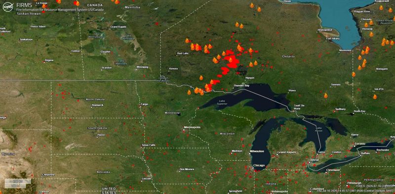
The Wisconsin Department of Natural Resources extended a statewide air quality advisory through noon Friday, July 17, warning that particle pollution from wildfire smoke from Canada and Minnesota could continue to affect communities across Wisconsin. The advisory could be extended again depending on wind patterns and smoke movement.
Here is what to know and how to protect yourself.

Places in the Fox Cities that are closed due to air quality
Where is this smoke coming from and how much longer will it continue to impact me?
Phil Kurimski, senior meteorologist at NWS Green Bay, pointed out the historic levels of poor air quality the region is seeing and the dispersal of the smoke coming from wildfires in the northwest.
“Since 1980, the highest AQI value was 204 on June 25, 2003,” Kurminski said. “So our value of 577 is currently the highest.”
The current advisory is through Friday afternoon, but impacts could still be felt for through the weekend, also bring into question the impact of the smoke on aviators flying into the 2026 Oshkosh Air Venture EAA Week, which is July 20-26.
“During the next few days we expect conditions to improve Friday afternoon,” Kurimski said. “But with the smoke still in the region, it could come back later this weekend depending on upper air patterns. The smoke will linger across the region into next week and could potentially impact EAA at times.”
Safety guidelines for wildfire smoke
According the the Centers for Disease Control and Prevention:
How to check your local air quality in Wisconsin
There are several real-time air quality trackers that report down to the local level available online.
The U.S. Environmental Protection Agency’s tracking map, AirNow.gov, reports AQI on a local level across the United States and southern Canada.
Many of the agency’s sources are Wisconsin Department of Natural Resources monitors, and the DNR has its own live air quality map, too. The DNR map is exclusive to Wisconsin and loses some context about the source of the smoke.
However, as of July 16, the DNR air quality map is “experiencing technical difficulties.”
What does the air quality index (AQI) mean?
Both agencies use the same color mapping to quantify air quality into public health categories. Here’s what each color means:
Caden Perry of the Milwaukee Journal Sentinel contributed to this report.
Emma Johnson is the Appleton Post-Crescent’s summer intern. Reach her at ejohnson@gannett.com.
Kathryn Byrnes is a reporter for the Green Bay Press-Gazette. You can reach her at kbyrnes@gannett.com or 920-431-8526
This article originally appeared on Milwaukee Journal Sentinel: Wisconsin air quality alert shuts down Fox Cities parks
Reporting by Emma Johnson, Appleton Post-Crescent / Milwaukee Journal Sentinel
USA TODAY Network via Reuters Connect
By Emma Johnson, Appleton Post-Crescent | USA TODAY Network