Millions in Central Texas remain under threat of flooding Monday as the region enters a fourth straight day of rain, with forecasts calling for up to 10 inches in isolated areas. Much of the region can expect at least between two to four more inches of rain today.
Among those under flood watch until 7 p.m. are areas already devastated over the Fourth of July weekend; at least 81 people have died in flooding triggered by unrelenting rain Thursday night into Saturday afternoon.

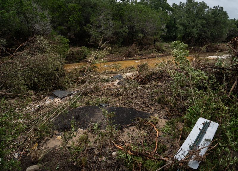
A tragedy that unfolded along the Guadalupe River on Friday battered Kerrville and the all-girls Camp Mystic, which sits on the riverbank, about 65 miles northwest of San Antonio. On Monday, the camp confirmed the deaths of 27 campers and counselors, of which 10 bodies are still not recovered. More than 70 deaths were reported in the region, and more than 850 people were rescued during the Fourth of July flooding.
Another flash flood struck the San Gabriel River and Austin area early Saturday, where at least eight people died and 18 remain missing in Burnet, Williamson and Travis counties.
The ongoing flooding has forced widespread road closures, making travel dangerous or impossible in some areas. Officials urge residents to avoid flooded roads and stay alert to local warnings as search and rescue efforts continue.
Real-time updates are available through local emergency management agencies and the Texas Department of Transportation.
Map: Road closures, driving conditions in Texas
Warning vs watch: What is a flash flood warning?
A flood watch is issued when conditions are favorable for flooding, according to the NWS. It doesn’t guarantee flooding will occur, but it means flooding is possible.
A flash flood warning is issued when a flash flood is imminent or already happening, USA TODAY reported. If you’re in a flood-prone area during a flash flood warning, move to higher ground immediately.
Flash floods can develop within six hours of heavy rain, dam or levee failure. They can uproot trees, destroy buildings and bridges and trigger mudslides — sometimes with water rising over 40 feet as witnessed along the Guadalupe River flooding, which rose by 40 feet in less than two hours.
Flash floods can even occur in areas that aren’t receiving rain, the NWS warns.
Texas weather watches and warnings
This article originally appeared on Austin American-Statesman: Up to 10 more inches of rain possible in Central Texas: See live map of road closures
Reporting by Brandi D. Addison, Austin American-Statesman / Austin American-Statesman
USA TODAY Network via Reuters Connect