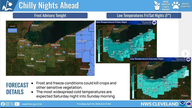
As cooler weather returns with overnight temperatures in the low to mid 30s, there is a potential for patchy frost to develop tonight across Stark County.
The National Weather Service forecast also says that the cold overnight temperatures dipping into the 30s will continue through Saturday night, posing additional risks for patchy frost.

Today’s high temperature is expected to be in the mid 50s, and the nighttime low in the upper 30s.
Friday will bring a high in the lower 50s and a 70% chance of rain. At night, the forecast is for a low in the mid 30s, a 50% chance of rain and areas of frost after midnight.
Saturday will be partly sunny with patchy frost in the morning. Expect a high in the lower 50s during the day and a low in the lower 30s at night.
Warmer air is expected on Sunday, when the high is expected to be in the upper 50s, and the nighttime low in the mid 40s. Highs are expected to be in the mid 60s on Monday, upper 60s on Tuesday and mid 60s on Wednesday.
This article originally appeared on The Repository: Don’t turn the furnace off just yet. Canton forecast calls for 30 degrees at night
Reporting by Canton Repository / The Repository
USA TODAY Network via Reuters Connect