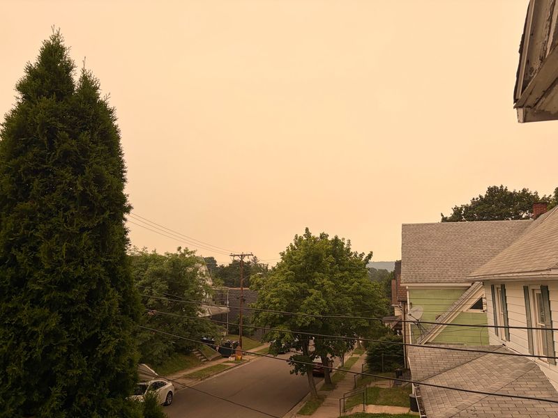
Smoke from wildfires in Canada could continue to impact the Binghamton area throughout the remainder of July and August.
AccuWeather long-range forecaster Paul Pastelok said the smoke trail from the Ontario wildfires is anticipated to continue throughout the last two weeks in July, bringing hazy skies and possibly lower temperatures. These conditions could also remain throughout at least the first few weeks of August, as Pastelok said there is a possibility of more wildfires across the Rocky Mountains.

Here’s what to expect for the rest of the summer season in the Binghamton area.
Canadian wildfires may impact the Binghamton area through August
Pastelok said the Binghamton area is likely to continue to see smoke throughout the remainder of July due to wildfires in Ontario, though it may not be as thick as the smoke the area saw July 15-17.
Despite this, the smoke could cause hazy skies “messing with the sunshine,” Pastelok said, in turn causing the high temperatures to drop five or six degrees if the smoke hits the area during the middle of the day.
As August approaches, Pastelok said the smoky skies could possibly continue in the region as there “could be more fires” across the Rocky Mountains. The flow pattern could be different, he said, meaning the worst of the smoke would stay in southern Canada and further north in New York, but the possibility of some smoke reaching Binghamton can’t be completely ruled out.
Due to the potential fires being in the “northern Rockies,” rather than Ontario in August, the impact locally would be less intense as the flow pattern of the smoke would move more west and southwest, Pastelok said, meaning it probably won’t smell as bad in the area and the air quality see less of an effect.
Other notable weather impacts in the Binghamton area
The remainder of July is likely to continue to be quite wet, Pastelok said, with rain, thunderstorms and severe weather threats in the forecast. Although, this may change in the month of August.
By the second or third week of August, Pastelok said Binghamton will see some “hot and humid days,” with high temperatures being “a couple degrees above normal,” and an overall rise in humidity levels as the month progresses.
Along with this, the chance for severe weather is anticipated to decrease. Though it won’t be “completely dry,” he said there should be a downturn in precipitation and the severity of storms compared to late June and July, and the area could likely dry out even more by the end of August or beginning of September.
Regarding flooding, Pastelok said there is a very low chance for the Binghamton area, though the possibility cannot be completely ruled out.
He explained that current patterns show “a lot of recurving storms” in late August and September, meaning tropical storms will steer toward the coast, not impacting the Northeast. However, if a storm fails to recurve, it will head inland which sometimes causes the bulk of the rain to move all the way up the coast, and that could cause flooding in the Binghamton area.
“We don’t live near the coast,” Pastelok said, “but sometimes the worst of these systems could be farther inland, where the flooding takes place. If it hits North Carolina and just doesn’t make a complete turn, it’s coming right up the gut right here.”
He emphasized that there is a very low probability of this occurring, but the chance is still there, so it is something to keep in mind as we approach the peak of tropical storm season.
This article originally appeared on Binghamton Press & Sun-Bulletin: Canadian wildfire smoke may impact Binghamton into August
Reporting by Sunshyne Lynch, Binghamton Press & Sun Bulletin / Binghamton Press & Sun-Bulletin
USA TODAY Network via Reuters Connect
By Sunshyne Lynch, Binghamton Press & Sun Bulletin | USA TODAY Network