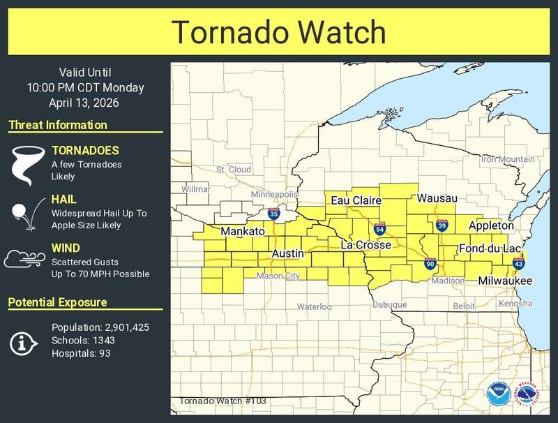
The Fox Valley is under a tornado watch Monday night as thunderstorms make their way to the area.
The tornado watch went into effect at 3:10 p.m. April 13 and runs until 10 p.m. in 31 counties including Outagamie County. The highest threat of tornadoes tonight is near Oshkosh and western parts of the region, said Scott Berschback, a meteorologist with the National Weather Service in Green Bay.

The forecast shows a 2% to 5% chance of tornadoes in Appleton, which is “pretty significant for the area,” Berschback said. In Oshkosh, the chance stands at 10%.
“Once we get up towards that 5 or 10%, that’s a pretty high percentage for tornadoes obviously since those are in nature pretty rare to begin with,” Berschback said.
Severe storms are on the move across Wisconsin. They start in western and southern Wisconsin near Black River Falls and Baraboo and are expected to reach the Fox Valley around 5 or 6 p.m. Heavy rain, large hail and damaging winds are in the storm’s forecast. Another round of storms will touch the Appleton area close to midnight, but Berschback said less chance exists for tornadoes then.
Because of the rain, Appleton is also part of a flood watch from the NWS until 7 a.m. April 14, following the weekend rainfall.
“The ground is quite saturated already from recent repeat thunderstorms,” Berschback said.
The Wolf River faces high water levels from recent rainfall so an elevated flood warning is in effect for the river at New London and near Shiocton during Monday night’s storms. Berschback said the river is going to hover around its current water level Monday night and with the levels rising over the next three to five days.
What is the difference between a tornado watch and a tornado warning?
A tornado warning is issued when a tornado is either sighted or indicated on radar, meaning there is imminent danger to life and property.
If you are in the area of a tornado warning, take cover immediately in the lowest floor of a sturdy building. If you are outdoors, in a vehicle or a mobile home, move to the closest sturdy shelter and take cover.
A tornado watch is issued when the environment is capable of producing tornadoes. If you are located in the area of a tornado watch, the NWS recommends having a plan in place in the event a tornado forms. Be ready to act quickly if a tornado warning is issued.
Contact Benita Mathew at bmathew@usatodayco.com.
This article originally appeared on Appleton Post-Crescent: Prepare for possible tornadoes in the Fox Valley Monday night, NWS says
Reporting by Benita Mathew, Green Bay Press-Gazette / Appleton Post-Crescent
USA TODAY Network via Reuters Connect