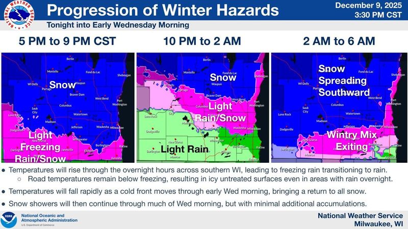
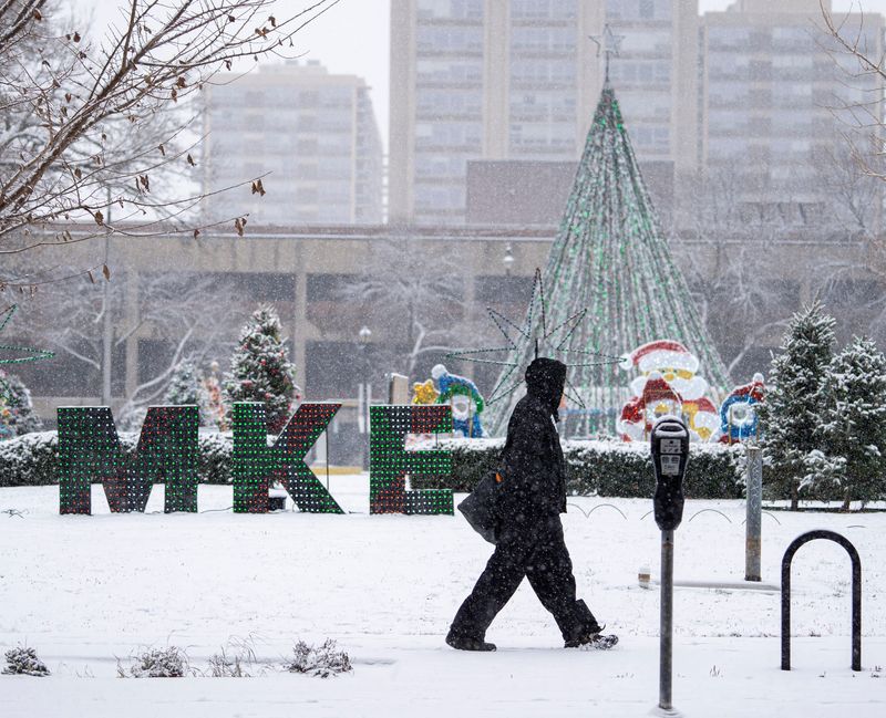
Southern Wisconsin, including the Milwaukee area, received more snow than rain overnight from Dec. 9 into Dec. 10, according to weather reports.
Aidan Kuroski, a meteorologist with the National Weather Service in Milwaukee/Sullivan, said around 6:30 a.m. that the Milwaukee area received at least a half inch of snowfall overnight, but totals won’t be in until later in the morning.

At most, he said, some areas of southeastern Wisconsin may get another 1.5 inches over the course of the morning if there is lake effect enhancement.
The National Weather Service predicted 1 to 2 inches of snow overnight in Milwaukee and another half inch during the morning commute.
A winter weather advisory is in effect for Milwaukee, Ozaukee, Sheboygan, Washington and Waukesha counties until 9 a.m.
“This event had impacts for the snow, but in addition, some ice as well. Overnight, we got some freezing drizzle, so people might see a glaze of ice on their cars,” Kuroski said.
He said driving may be hazardous throughout the day Dec. 10 due to wet snow and freezing.
“The slushy accumulations can actually be more dangerous particularly for driving, because your car doesn’t quite reach the ground all the time,” Kuroski said.
Additionally, Kuroski said gusty winds throughout the morning Dec. 10 may reach up to 30 or 40 mph, and a drop in temperatures later in the day could freeze areas of roads, causing them to become slick.
The city of Milwaukee said in a statement that crews have been out overnight treating roads.
“We encourage drivers to use caution during the morning commute. Snow may linger into the late morning, but it is expected to move out of the area by this afternoon. Crews will remain active throughout the event and will continue operations afterward for clean-up,” the city’s statement says.
There may be flurries in the afternoon on Dec. 10, but the next chance for accumulating snow is Dec. 11. Across Wisconsin, more than 20 counties were under a winter storm warning overnight as several inches were expected in some places.
After the snowfall, the primary hazard this upcoming weekend will be bitter cold temperatures, Kuroski said.
On Saturday Dec. 13, temperatures across southern Wisconsin are expected to reach as low as -3 to -4 degrees, with a “real feel” of -15 to -25 degrees. Sunday, Dec. 14 is expected to be even colder, as low as -5 degrees with a “real feel” of -25 to -30 degrees.
More: Stay up to date on Wisconsin’s winter weather with USA TODAY Network text message updates
See the weather radar for Wisconsin
What to do in a winter storm
During a winter storm, NWS advises staying inside, stocking up on food and water, and charging essential devices in case of power outages.
If you are without shelter, you can visit the 211 Wisconsin website or call 211 to locate nearby warming services.
Wisconsin road conditions
NWS advises against driving during a storm, as snow, sleet or ice can create dangerous driving conditions. For live updates on winter road conditions and accidents in Wisconsin, check out the 511 Wisconsin map.
If you must drive, here are some guidelines for navigating icy roads, according to the Wisconsin Department of Transportation:
What is a winter storm warning?
A winter storm warning is more severe than a watch or advisory. Here are what the different alerts mean, according to NWS:
See the latest weather alerts and forecasts here.
This story was updated to add information.
This article originally appeared on Milwaukee Journal Sentinel: Mix of overnight snow, rain in Milwaukee making for messy morning commute
Reporting by Drake Bentley, Milwaukee Journal Sentinel / Milwaukee Journal Sentinel
USA TODAY Network via Reuters Connect