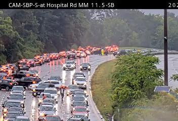
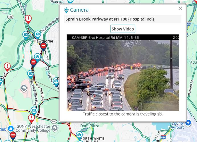
Sections of the Bronx River Parkway, Taconic State Parkway and Sprain Brook Parkway were closed in areas of Westchester Monday, July 14, after flash flooding accumulated in the area.
Westchester County Police Department warned that more closures could be anticipated as rains continued to fall in the region.

“Please do not drive tonight if you can avoid it,” the department said in a Facebook post. “Severe thunderstorms, high winds and flash flooding remain in the forecast. … Stay s
Read on for the latest updates on flash flooding in the Lower Hudson Valley.
Flash flood warning in effect for Rockland and central Westchester
A flash flood warning is in effect for Rockland County and central Westchester, with multiple roads in areas of Westchester Monday, July 14, after multiple inches of rain have accumulated over a short period of time.
“Move to higher ground now! This is a dangerous and life-threatening situation,” the warning from the National Weather Service reads. “Do not attempt to travel unless you are fleeing an area subject to flooding or under an evacuation order. Turn around, don`t drown when encountering flooded roads. Most flood deaths occur in vehicles.”
At 6 p.m., “emergency management reported thunderstorms producing heavy rain across the warned area. Between 2 and 2.5 inches of rain have fallen,” the NWS said. “Additional rainfall amounts of 1 to 2 inches are possible in the warned area.”
“Flash flooding is already occurring” in the areas of Pleasantville, Armonk, Thornwood and Hawthorne. Stamford and New Canaan in Connecticut were also impacted.
By 6:30 p.m., the NWS expanded the warning to include New City, Ossining, Monsey, Nanuet, Ramsey, Tarrytown, Suffern, Nyack, Tappan, Pearl River, Hawthorne, Orangeburg, Upper Nyack, Spring Valley, Valley Cottage, Park Ridge, Airmont, Congers, Upper Saddle River and Chestnut Ridge.
Roads close in Westchester due to flash flooding
New York State Police urged motorists to seek an alternate route of transportation Monday after announcing that stretches of the Taconic State Parkway and Sprain Brook Parkway in the town of Mount Pleasant were closed due to flooding.
“Please seek alternate routes and use caution when traveling in the area,” the post reads.
According to various sources, including the New York State Department of Transportation’s 511NY website, New York State Police and Westchester County Police Department, the following roads are closed due to flooding as of 8:12 p.m.:
Other roads experiencing impacts from flash flooding as of 6:20 p.m. were the Saw Mill River Parkway northbound south of Exit 25 – NY 9A near mile marker 14 in Mount Pleasant.
See a map of current impacts, closures, traffic cameras and more at 511ny.org.
Flood watch in effect for southern Westchester until midnight, July 15
According to the National Weather Service, a flood watch remained in effect for southern Westchester, expiring at midnight Tuesday.
“Excessive runoff may result in flooding of urban, low lying, and flood prone locations, as well as along rivers, creeks, and streams,” the NWS watch reads. “Numerous showers and thunderstorms with heavy rain are expected late this afternoon and this evening.”
Rainfall of up to 2 inches, with localized rainfall totals of up to 3 inches, are possible Monday, which much of the precipitation falling in 3 to 4 hours, “causing isolated to scattered instances of flash flooding.”
What to do in case of a flood
According to the Westchester County Department of Emergency Services, in the event of flooding, people should:
What to do after a flood impacts your area
After a storm and/or flooding, government agencies advise people to:
(This story was updated with new information.)
This article originally appeared on Rockland/Westchester Journal News: Westchester flash flooding: Several roads close near Mount Pleasant July 14
Reporting by Ashley Catherine Fontones and Michael P. McKinney, Rockland/Westchester Journal News / Rockland/Westchester Journal News
USA TODAY Network via Reuters Connect