
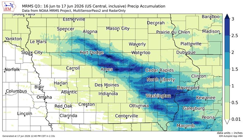
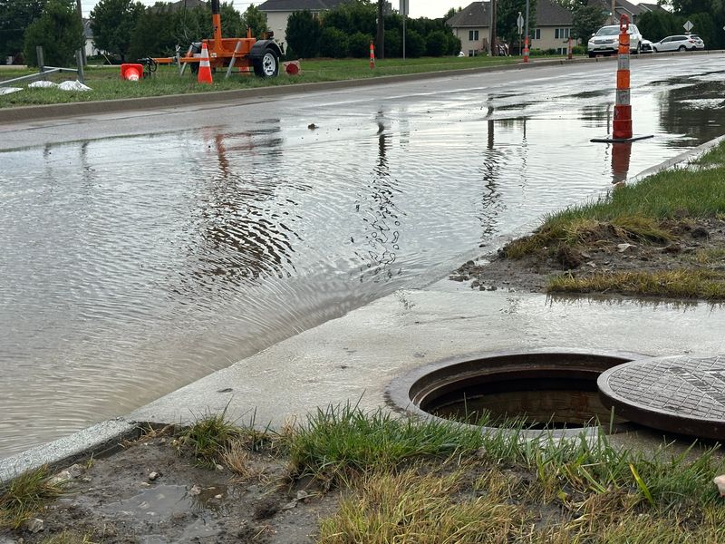
Severe thunderstorms in Iowa early on Wednesday, June 17, brought heavy rainfall to some parts of the state.
The heaviest rainfall fell across central and eastern Iowa. Here’s a look at where the highest totals were reported.

How much rain did we get? See the highest Iowa rainfall totals
Here are the areas that saw the most rainfall over a 12-hour period as of June 17 at noon:
How much rain did Des Moines get?
Des Moines recorded 0.03 inches of rain during the same period. Iowa’s capital city has received 3.37 inches so far in June, about 0.48 inches more than it typically gets by this point in the month, according to the National Weather Service.
Recent storms have improved dry conditions in Iowa. The latest Drought Monitor report, released on June 11, showed that about 63% of Iowa was experiencing some form of drought, a 12-percentage-point improvement from the previous week.
What is the forecast for the rest of the week?
The forecast for Des Moines the rest of Wednesday calls for sunny skies and a high of 81 degrees with southwest winds gusting to 20 mph, according to the NWS. Skies will remain mostly clear at night, with a low around 60 degrees and wind gusts up to 36 mph.
Thursday, June 18, should be sunny again with a high of 78 degrees and northwest winds of 8 mph. Thursday night will be mostly clear, with a low around 57 degrees.
The next chance of rain in Des Moines comes early Saturday morning, June 20, with a 20% chance of showers and thunderstorms after 1 a.m. The likelihood of rain increases Saturday night and Sunday, June 21
Cooper Worth is a service/trending reporter for the Des Moines Register. Reach him at cworth@gannett.com or follow him on X @CooperAWorth.
This article originally appeared on Des Moines Register: Iowa storms drop 2+ inches of rain in some areas. See rainfall totals.
Reporting by Cooper Worth, Des Moines Register / Des Moines Register
USA TODAY Network via Reuters Connect
By Cooper Worth, Des Moines Register | USA TODAY Network