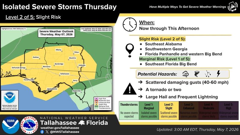
A parched Tallahassee could see severe weather and another round of beneficial rainfall as a cold front creeps across the area.
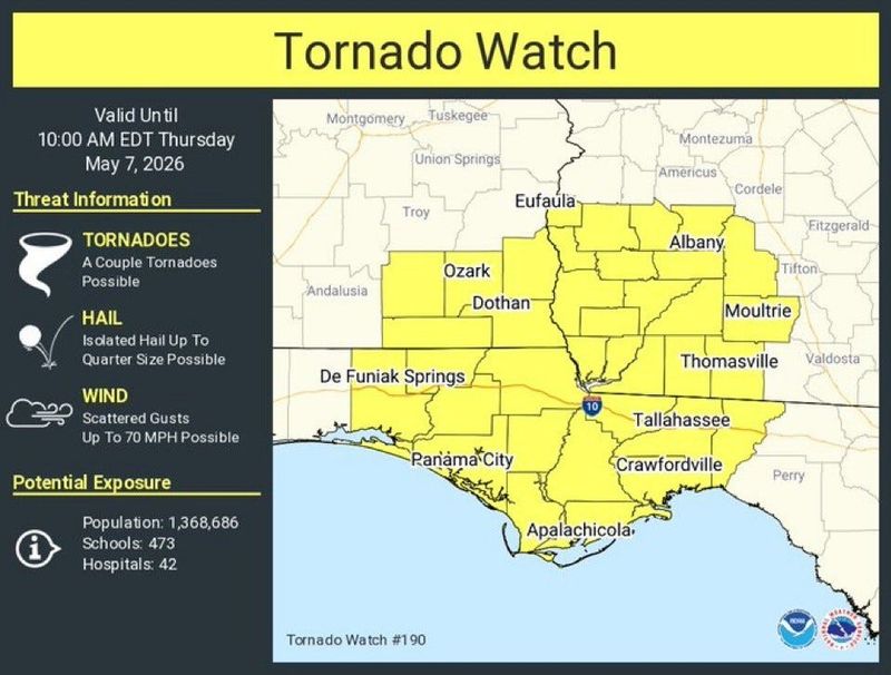
Portions of the Big Bend, including Leon County, the Panhandle, South Georgia and southeast Alabama are under a tornado watch through 10 a.m. Thursday, May 7. The National Weather Service in Tallahassee said a couple of tornadoes are possible with the storm system.

Molly Merrifield, senior meteorologist at the Weather Service, said the storms, which were moving to the east just north of Tallahassee, will make their way eventually to the capital city.
“We are expecting the storms to very slowly work their way southward through the day,” she said. “The Tallahassee area will probably see activity moreso later this afternoon.”
She said strong damaging winds between 60 and 70 mph are the biggest threat, with tornadoes, small hail and locally heavy downpours also on the table.
Merrifield added that the front is expected to stall around the Interstate 10 corridor later today into tonight.
“And while today has the best severe threat, we do expect some ran and maybe a few storms kind of off and on through the weekend as that front just kind of hangs out over that area,” she said.
And while Tallahassee remains in an exceptional and historic drought, Merrifield said the area could see 1 to 2 inches of rain through the weekend.
Contact Jeff Burlew at jburlew@tallahassee.com or 850-599-2180.
This article originally appeared on Tallahassee Democrat: Tornado watch: Tallahassee could see severe storms, rain
Reporting by Jeff Burlew, Tallahassee Democrat / Tallahassee Democrat
USA TODAY Network via Reuters Connect