
Sarasota residents are reporting feeling a magnitude 6.1 earthquake that struck near Cuba on Monday, June 8, with tremors reaching parts of Florida.
The United States Geological Survey reported receiving more than 100 reports related to the earthquake from the Sarasota-Manatee area.

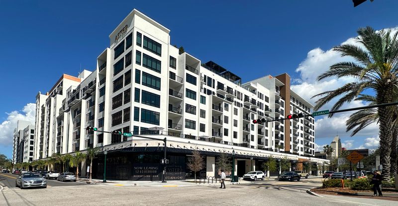
Multiple Reddit users also reported feeling the earthquake, including one who identified themselves as a resident of Aster & Links, the downtown Sarasota luxury apartment community on Main Street featuring twin 10-story towers.
“We have received a small number of reports regarding minor shaking experienced on some of the higher floors within the community this afternoon,” an email sent by Aster & Links management to residents at about 3:35 p.m. Monday states.
6.1 earthquake shakes Cuba
The earthquake struck northwest of Cuba in the early afternoon, according to data from the U.S. Geological Survey. While earthquakes are common along fault systems near Cuba, it is far less common for shaking to be felt hundreds of miles away in Florida. Residents across central and western Florida quickly took to social media to ask whether they had just experienced an earthquake.
Originally, the U.S. Geological Survey estimated the earthquake at magnitude 6.4 before revising it to 6.1. While lower, a magnitude 6.1 earthquake is still considered strong and is capable of causing significant damage near its epicenter.
The Cuba earthquake comes on the heels of a series of earthquakes today in the Philippines, including a magnitude 7.8 quake that killed at least 35 people after triggering building collapses and a small tsunami.
What causes earthquakes?
The Earth has four layers: the inner core, outer core, mantle, and crust. The crust and top of the mantle make up another area called the “lithosphere,” which acts like a skin surrounding the Earth’s surface.
The lithosphere, however, is not in one piece and exists like a puzzle or series of fragments, according to the USGS. These parts of the lithosphere are not stationary and move slowly. These are called “tectonic plates.”
As the tectonic plates move and shift past one another, they occasionally bump or collide. This places stress on the plates’ edges. When the stress becomes too great, it creates cracks called “faults.” The point where these faults move against each other is called the “fault line.”
When there is too much friction between the fault lines, energy is released suddenly, triggering seismic waves which lead to an earthquake.
Does Florida get earthquakes?
Yes, but very rarely. Florida is not located near any tectonic plate boundaries.
Florida ties North Dakota as the state with the fewest earthquakes per year. Between 1975 and 1995 the state was one of only four that recorded no earthquakes at all. (The others were Iowa, Wisconsin, and North Dakota.)
The closest fault line to Florida runs through the Caribbean Sea, just north of Puerto Rico and the Dominican Republic, and south of Cuba toward Guatemala.
The state does get shaken, though, often from earthquakes strong enough to affect us even if they’re not close by. In September 2020, Santa Rosa residents were rattled by a 3.8 magnitude earthquake on the Florida/Alabama line just northwest of Mount Carmel. People in Jay, East Milton, and even Navarre reported feeling the ground shake.
“I was on my couch asleep, and it was (shaking) so hard it woke me up,” said Jay resident Candace Black. “My TV shook on the stand, and the pictures on my wall also shook. It lasted about two to three minutes. I was very scared, I didn’t know what was going on.”
According to the USGS, nine earthquakes struck near that area the year before, between March 7 and April 14, 2019, ranging in intensity from a magnitude 1.9 to a magnitude 3.1. Before that, the area hadn’t seen an earthquake in 20 years.
How likely is an earthquake in Florida?
It’s not a high percentage of risk in Florida, but in the USGS’ National Seismic Hazard Model map, it’s not zero.
In the update, based on a “massive collaborative effort” from more than 50 scientists and engineers and federal, state, and local governments, most of Florida has a 5% chance or lower of experiencing a damaging earthquake in the next 100 years. But the Panhandle and an area of North Florida down to a line stretching from Jacksonville southwest to south of Cape Coral has a 5-25% chance, the agency said.
“Earthquakes are difficult to forecast, but we’ve made great strides with this new model,” said Mark Petersen, USGS geophysicist and lead author of the study. “The update includes more faults, better-characterized land surfaces, and computational advancements in modeling that provide the most detailed view ever of the earthquake risks we face.”
But don’t start pulling your breakables off shelves yet. The new model shows greater chances of more damaging earthquakes along the central and northeastern Atlantic Coast corridor, but the Sunshine State is still at the low end of the threat spectrum.
In the detailed USGS report, “Florida” is not mentioned once.
Could an earthquake in the Atlantic basin or Gulf cause a tsunami to hit Florida?
It is possible, but not likely, that an earthquake in the Atlantic basin would generate a tsunami that hits Florida.
Not every underwater earthquake produces a tsunami, and they typically require significant seafloor displacement. Even some earthquakes above magnitude 6 do not generate dangerous waves.
Florida’s tsunami risk is generally considered low compared with the Pacific Coast. However, scientists and emergency managers say the state is not entirely immune. Research indicates that underwater landslides or certain Caribbean seismic events could, under the right conditions, generate waves capable of reaching Florida’s shoreline.
For Monday’s earthquake near Cuba, no tsunami warning, watch, or advisory was issued. Residents who felt shaking in Florida experienced seismic waves from the earthquake itself, not tsunami activity.
What was Florida’s largest earthquake?
In 1879, the largest recorded earthquake in Florida measured at a 4.4 magnitude, possibly centered in the Palatka area on the border of Putnam and Marion County in North Central Florida. The tremors were felt as far away as Tallahassee and Cedar Key. “Plaster was shaken down, and articles were thrown from shelves at St. Augustine and, to the south, at Daytona Beach,” according to USGS records.
The largest earthquake to affect Florida was in 2006, a 5.9 earthquake in the Gulf of Mexico that rocked Southwest Florida and reportedly shook some buildings in Cape Coral, but caused no serious damage.
Can earthquakes be predicted?
Earthquakes are not predicted. Neither the U.S. Geological Survey nor scientists have predicted a major earthquake, and there’s no expectation for that to change in the near future.
Are earthquakes increasing?
While it might seem like earthquakes are happening more often, especially with real-time alerts and widespread media coverage, the overall rate of earthquakes has remained relatively stable over time.
According to the U.S. Geological Survey, any year may appear more active due to improvements in technology that allow scientists to detect more small quakes than in the past, not because there are actually more earthquakes occurring.
Long-term global records dating back to 1900 show that the Earth averages about 16 major earthquakes (magnitude 7.0 or greater) each year — typically 15 in the 7.0 range and one magnitude 8.0 or higher. In 2024, there were 10 earthquakes of magnitude 7.0 or greater, the strongest being a 7.5 in Japan.
However, the risk of being affected by an earthquake is growing because of increasing human and economic exposure and the number of assets being built in high earthquake hazard areas, the Federal Emergency Management Agency said in a report in 2023.
What to do during an earthquake
What does magnitude mean in an earthquake?
Magnitude is a measurement of the strength of an earthquake. Officially, it’s called the Moment Magnitude Scale. It’s a logarithmic scale, meaning each number is ten times as strong as the one before it. So a 5.2 earthquake is moderate while a 6.2 is strong.
Source: Michigan Technological University.
Previously, people referred to the Richter Scale to describe earthquakes, but that is no longer commonly used as it was only valid in certain circumstances.
Florida weather watches and warnings
Stay informed. Get weather alerts via text
Brandi D. Addison covers weather across the United States as the Weather Connect Reporter for the USA TODAY Network. She can be reached at baddison@gannett.com. Find her on Facebook here.
C. A. Bridges is a journalist for the USA TODAY Network-Florida’s service journalism Connect team. You can get all of Florida’s best content directly in your inbox each weekday day by signing up for the free newsletter, Florida TODAY.
Wade Tatangelo is the executive editor of the Sarasota Herald-Tribune and Florida dining and entertainment editor for the USA TODAY Network. Follow him on Facebook, Instagram, and X. He can be reached by email at wade.tatangelo@heraldtribune.com. Support local journalism by subscribing.
This article originally appeared on Sarasota Herald-Tribune: Sarasota residents report feeling strong Cuba earthquake
Reporting by Wade Tatangelo, Brandi D. Addison and C. A. Bridges, Sarasota Herald-Tribune / Sarasota Herald-Tribune
USA TODAY Network via Reuters Connect
By Wade Tatangelo, Brandi D. Addison and C. A. Bridges, Sarasota Herald-Tribune | USA TODAY Network