Flurries fell on Florida.
While the official forecast of the National Weather Service in Tallahassee said there was “a chance of flurries after 4 p.m.” on Saturday afternoon, the flakes arrived in the capital city early with folks jumping on social media at about 1:30 p.m. to share sightings.

It came as one weather watcher pointed to a “renegade snow band” that was overperforming and bringing a bit of wintry precipitation to South Alabama and Georgia. The band had been moving southeast and ultimately closed in on the capital city.
Soon after, Tallahassee-based WeatherTiger founder and meteorologist Ryan Truchelut reported seeing 12 snowflakes in Southwood as radar showed bits of snow or snow pellets falling in Leon County.
By about 2 p.m., reports were coming in from around Leon County. Some were counting solitary snowflakes flit by while others enjoyed more steady but small bursts of flurries that hit the ground and instantly melted.
At Trader Joes, patrons exclaimed in joy as they checked out a frenzy of flurries fall on the parking lot outside. Snow sightings were reported in the Southwood neighborhood, around Lake Jackson, on the Florida State University campus and as far south as the Wakulla River. Mother Nature was also flaking out in neighboring Gadsden and Jefferson County.
“Snow in Tallahassee! Getting some pretty flurries in this band about to move through the rest of Tallahassee,” NWS meteorologist Wright Dobbs wrote on X. “None is sticking or will cause any concerns but it’s pretty to look at!”
By 4 p.m., the sun was shining and the wind was gusting ahead of what may be a record-breaking Florida cool-down that will reach all the way into south Florida.
“With that, the Great Tallahassee Blizzard of 2026 ends,” one resident wrote on Facebook.
If you get a snow sighting on photo or video, email us at news@tallahassee.com. Please include your name and where the photo and video are from.
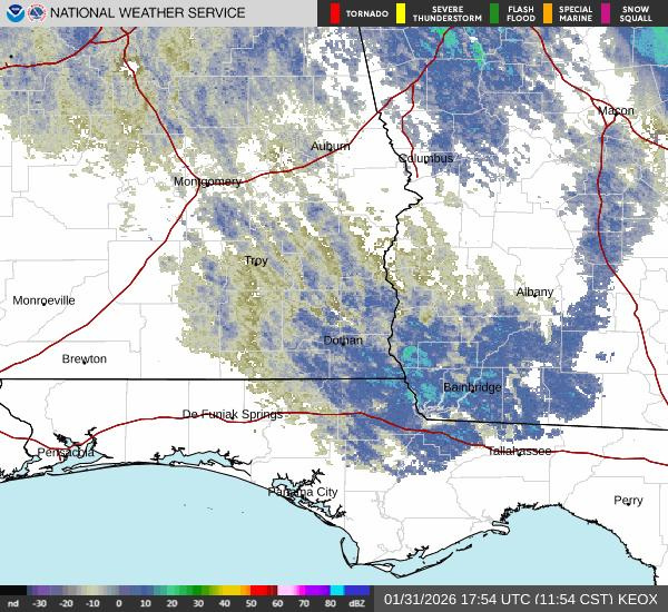
The latest Tallahassee radar shows system with snow flurries
The flakes before the Florida freeze? Meteorologists say look out for hypothermia
The flurries are a fun prelude to a blast of winter weather that National Weather forecasters in Tallahassee warn will bring “dangerously cold temperatures and wind chills” to the Big Bend.
“January 2026 will be ending on an incredibly COLD note,” forecasters wrote in a morning update. “Brace for a very impactful Arctic outbreak arriving today. The coldest period will be tonight into Sunday morning. Take this event seriously.”
After a day of 20 to 40 mph wind gusts. temperatures will crash and it will become “bitterly cold” with feels-like temps in the single digits, ranging from 3 to 7 degrees, meteorologists say.
“Hypothermia onset will be quick as cold air and strong winds efficiently pull heat from all living things that are outside,” forecasters wrote in their afternoon discussion. “Sheltering and minimal exposure will be incredibly important Saturday afternoon through Sunday morning. Due to these extremely cold wind chills, an Extreme Cold Warning is in effect to warn all living things about the dangerously cold temperatures and to be sure to find adequate shelter.”
A brief history of recent Florida snow with more on the way?
The freezing temperatures could not only break record lows around the state, but snow flurries attributed to “Gulf-effect rain and snow” might appear as far south as Tampa, according to AccuWeather and the National Weather Service Tampa Bay.
“Snow flurries in Tampa Bay are exceptionally rare, with only one confirmed measurable snowfall and just a handful of reports of flurries over the past century,” according to Brandon Buckingham, AccuWeather meteorologist.
The best chance to see snow flurries in Florida over the weekend was expected to be in Pinellas County, near St. Petersburg or Clearwater, according to the National Weather Service Tampa Bay, and during a very small window Saturday night into Sunday morning, Feb. 1.
But Tallahassee may have stolen the show.
The flurries are the second bout of winter precipitation in north Florida this year. A couple weeks back, a more steady but still small snowfall hit the ground from Pensacola to Marianna in Jackson County, briefly dusting the ground.
Saturday’s flirtation with wintry weather comes near the one year anniversary of Florida’s 2025 winter storm, which dumped more than 7 inches of snow on Pensacola and brought measurable accumulation to parts of North Florida for the first time in decades.
This flight of flurries was far less dramatic, but still exhilarating for a state more accustomed to dealing with hurricane landfalls than snowfall.
This article originally appeared on Tallahassee Democrat: Florida flurries fall in prelude to a blast of ‘dangerous’ cold
Reporting by William L. Hatfield, Tallahassee Democrat / Tallahassee Democrat
USA TODAY Network via Reuters Connect