PANAMA CITY — Bay County is now in a severe drought.
An Oct. 16 update to the U.S. drought monitor placed a swath of the Florida Panhandle, including Bay County, in severe drought conditions. Meanwhile, extreme drought is lingering in the Panhandle’s northern counties, including parts of Washington County.

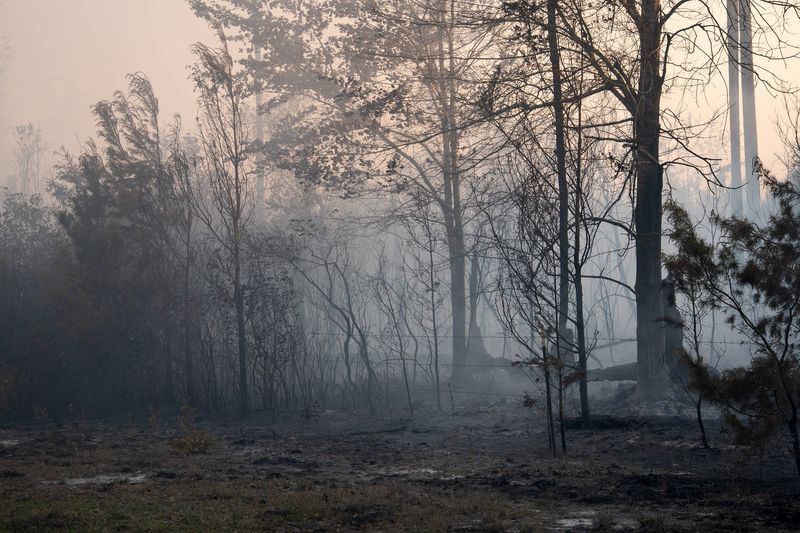
The Florida Forest Service only ranked the fire danger as moderate for this area. High relative humidity and slow winds are keeping fire potential at bay. Despite this, Bay County has a Keetch–Byram drought index value of 638, which is fairly high.
Current KBDI measurements indicate that the ground is very dry, and any potential fires would burn deep. It would take a deep, saturating rainfall to resolve the dry conditions.
“Given the warm daytime temperatures, the low humidity, and the lack of rainfall for the last couple months, drought conditions continue to worsen,” wrote the National Weather Service Tallahassee forecasting office in a Facebook post.
There is a chance of rain on Oct. 19, although NWS forecasters are not optimistic that it will be much. There are no other probabilities for rain in the near-term forecast.
“The dry conditions and decreasing humidity next week will result in elevated fire concerns continuing,” wrote an NWS meteorologist in the area’s forecast discussion. “Exercise caution if dealing with flames.”
Currently, the only significant fire burning in this area is in neighboring Gulf County. The Iron Gate fire reached 200 acres and was 100% contained as of Oct. 16.
The Climate Prediction Center anticipates drought conditions to persist throughout the season for northwest Florida. They also anticipate below-average rainfall to continue over the next six to 10 days.
Outside of drought conditions, temperatures are expected to cool off starting Oct. 20, with a cold front expected to alleviate what has been a warm October. Temperatures this month have been above the historical average, according to the weather tracking site WeatherSpark.
Lows in the mid to upper 50s are expected behind the cold front, with highs falling into the low 80s.
Meanwhile, the National Hurricane Center is tracking two disturbances in the Atlantic Ocean. One system appears it will be another fish storm if it develops with no anticipated U.S. landfall. Another disturbance that may be of interest to Gulf Coast residents is forecast to enter the Caribbean Sea. This system has a 30% chance of cyclone development over the next seven days.
According to the CPC, a 40% chance of cyclone formation is anticipated in the Caribbean Sea between Oct. 22 and Oct. 28. Hurricane season ends on Nov. 30.
This article originally appeared on The News Herald: Bay County is in a severe drought; meteorologists warn of increasing fire danger
Reporting by Dylan Gentile, Panama City News Herald / The News Herald
USA TODAY Network via Reuters Connect