
Tropical Storm Amanda continues its path away from the United States in the Pacific as Florida residents continue to keep a close eye on what’s happening in the Atlantic basin.
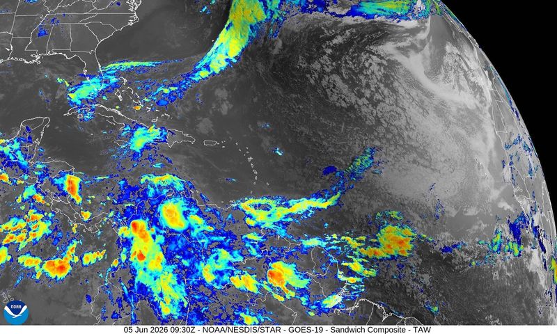
Conditions continue to remain quiet, with the National Hurricane Center’s tropical outlook early June 5 showing nothing in the Atlantic basin to be concerned about for the next two to seven days.

➤ Weather alerts via text: Sign up to get updates about current storms and weather events by location
AccuWeather forecasters said they are keeping an eye on several areas, especially near the north-central Gulf Coast, where an area of low pressure could bring heavy downpours from southeastern Louisiana to the western Florida Panhandle.
“Tropical development chances remain low at this time, but the Gulf, western Caribbean and southwestern Atlantic will need to be monitored during the first two weeks of June,” AccuWeather Lead Hurricane Expert Alex DaSilva said.
Now is the time to prepare for hurricanes and tropical storms. While predictions are for a “below-normal” season, that doesn’t mean Florida won’t feel any impacts. The state leads the U.S. when it comes to impacts from storms.
“It only takes one” is a repeated refrain from officials who urge residents in hurricane-prone areas — which is all of Florida — to prepare now, no matter what predictions are and well before a storm is on the horizon.
➤ Track all active storms
Florida residents shouldn’t be concerned about the four tropical waves out there.
“The first waves that come off Africa are usually too far south, and there’s often too much dry air and wind shear for them to develop,” DaSilva said via email. “There’s no real concern with these early-season tropical waves.”
2026 Atlantic hurricane season has begun
The Atlantic hurricane season runs from June 1 through Nov. 30.
Hurricane season in the eastern Pacific started May 15.
Ninety-seven percent of tropical cyclone activity occurs during this time period, NOAA said.
➤ 2026 Atlantic hurricane season begins today. What can Florida expect?
The Atlantic basin includes the northern Atlantic Ocean, Caribbean Sea and Gulf of America, as the Gulf of Mexico is now known in the U.S. per an order from President Trump. NOAA and the National Hurricane Center are now using Gulf of America on its maps and in its advisories.
Countdown to end of 2026 Atlantic hurricane season
Could Florida face tropical threat in early June?
A smattering of model data hint there may eventually be something to monitor over the course of June. Hurricane history suggests that any such system would most likely be a sloppy rainmaker,” said Dr. Ryan Truchelut, chief meteorologist at WeatherTiger, who works with the USA TODAY Network.
➤ June hurricane season forecast from WeatherTiger: A time for wet and weak storms
The most common locations for June storms to develop are the northwestern Caribbean, eastern Gulf, and off the Southeastern U.S. coast, Truchelut said.
AccuWeather meteorologists said they are monitoring several areas for possible tropical development in the coming days, particularly because they are relatively close to land.
Forecasters are watching a weak area of low pressure near the north-central Gulf Coast.
“Regardless of whether tropical development occurs — it’s close proximity to land limits time to organize — the system’s greatest impact is expected to be heavy downpours and gusty thunderstorms from southeastern Louisiana to the western Florida Panhandle from Friday night into Saturday (June 6),” according to AccuWeather.
National Hurricane Center tracking Tropical Storm Amanda, 2 other disturbances in eastern Pacific
The National Hurricane Center is tracking three systems in the eastern Pacific, including Tropical Storm Amanda.
Little change in strength is expected from Tropical Storm Amanda June 5. The storm is expected to gradually weaken later tonight and through the weekend.
➤ Track Tropical Storm Amanda
Also highlighted on the National Hurricane Center’s tropical outlook map are:
Tropical Storm Amanda spaghetti models
National Hurricane Center tracking no disturbances in Atlantic basin June 5
There were no disturbances listed by the National Hurricane Center on its tropical outlook map as of 2 a.m. June 5.
➤ Hurricane Center testing new cone: What’s changing this season?
There are four tropical waves being watched by forecasters:
What is a disturbance?
The National Hurricane Center’s tropical outlook map highlights “disturbances” in the Atlantic basin.
These are clusters of storms with some organization, but which don’t have a defined circulation typical of tropical cyclones.
➤ Ready or not, National Hurricane Center resumes daily tropical outlooks
If shown on the tropical outlook map in orange or red, forecasters are predicting the potential of those disturbances into developing as medium or high, respectively.
Disturbances shown on the map with a gray x have little to no chance for development. This is a change from prior years which indicated such disturbances in yellow.
What is a tropical wave?
“Tropical waves are clusters of showers and thunderstorms that act as the seedlings for many tropical storms throughout the Atlantic season,” DaSilva said.
➤ Explanation of hurricane terms we hope not to hear in Florida this year
“There are about 60 tropical waves that move across the Atlantic each year, and roughly 10 percent to 15 percent of them develop into a tropical system. That’s about one in seven.
“Tropical waves are important because they contribute to about 80 percent of all major hurricanes.”
What are National Hurricane Center’s tropical outlooks?
Tropical outlooks provide a quick look at what’s happening in the tropics, including any disturbances out there showing potential for development and tropical waves that may be present in the Atlantic basin.
The National Hurricane Center started issuing daily tropical outlooks May 15. The outlooks are updated every six hours until the season ends Nov. 30.
Times are 2 a.m., 8 a.m., 2 p.m. and 8 p.m.
➤ Want to really dive in? See NHC’s user’s guide to hurricane products
An outlook could be issued before or beyond those dates if something showing potential for development appears.
What are predictions for 2026 hurricane season?
Here are some of the predictions released for this year’s hurricane season.
➤ El Niño odds rise again, which could mean fewer hurricanes for Florida
A major hurricane is a storm that is a Category 3 or stronger, with maximum sustained winds of at least 111 mph.
How many tropical storms, hurricanes are in a typical season?
The 30-year average, from 1991 to 2020, is for 14 named storms, seven hurricanes and three major hurricanes.
Could Florida be hit by a hurricane in 2026? See which counties have highest chance
What are names for 2026 Atlantic hurricane season?
Names for the 2026 Atlantic hurricane season, and how to pronounce them, are:
Florida weather radar for June 5, 2026
Weather watches and warnings issued in Florida
When is the peak of Atlantic hurricane season?
The peak of the Atlantic hurricane season is Sept. 10, with the most activity happening between mid-August and mid-October, according to the Hurricane Center.
Why does NHC say ‘tropical cyclone’ on its maps instead of hurricane or tropical storm?
Tropical cyclone is the generic term used by the National Weather Service, NOAA and the National Hurricane Center for any tropical system, even if it’s in the tropical Atlantic basin.
To be more precise, a tropical cyclone is a “rotating, organized system of clouds and thunderstorms that originates over tropical or subtropical waters and has closed, low-level circulation,” NOAA said.
Once maximum sustained winds reach 74 mph, what it is called is determined by where it originated:
Interactive map: See how many hurricanes, tropical storms have passed near your home
Stay informed. Get weather alerts via text
What’s next?
We will update our tropical weather coverage regularly to bring you the most current information you need to protect your home and family.
Cheryl McCloud is a journalist for the USA TODAY Network-Florida’s service journalism Connect team. You can get all of Florida’s best content directly in your inbox each weekday day by signing up for the free newsletter, Florida TODAY, at https://naplesnews.com/newsletters.
This article originally appeared on Naples Daily News: Are tropical downpours ahead for parts of Florida? Here’s the forecast
Reporting by Cheryl McCloud, USA TODAY NETWORK – Florida / Naples Daily News
USA TODAY Network via Reuters Connect
By Cheryl McCloud, USA TODAY NETWORK – Florida | USA TODAY Network