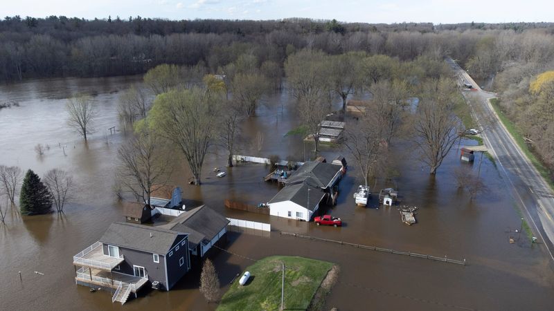
For much of April, showers and melting snow has swamped Michigan, flooding homes, businesses, cottages, roadways; threatening and destroying infrastructure, including dams, and forcing what is likely hundreds of Michiganders to evacuate.
The unusual weather put the entire state under a flood watch.

It’s not over.
To help, the state’s Emergency Operations Center — which was activated on April 10, along with the governor’s state of emergency declaration — created a digital map identifying shelters and damaged areas.
There also is a livestream of the Cheboygan Lock and Dam Complex.
As of Monday morning, the water level at the dam had dropped slightly, and was less than 8 inches below the top, which is still a threat to both the community in the event of a spillover — or structural failure.
The map, which the emergency center is calling a dashboard, shows warming and cooling centers and where people can get food. It tracks where the tornadoes touched down, and the roadways that are under water, were eroded away and are completely washed out.
The emergency center also is providing more information on its website on how to ask for help, what state and federal assistance might be available, and how to get emergency email alerts from the State Police.
Contact Frank Witsil: 313-222-5022 or fwitsil@freepress.com
This article originally appeared on Detroit Free Press: Severe weather map, livestream shows Michigan areas ravaged by floods
Reporting by Frank Witsil, Detroit Free Press / Detroit Free Press
USA TODAY Network via Reuters Connect