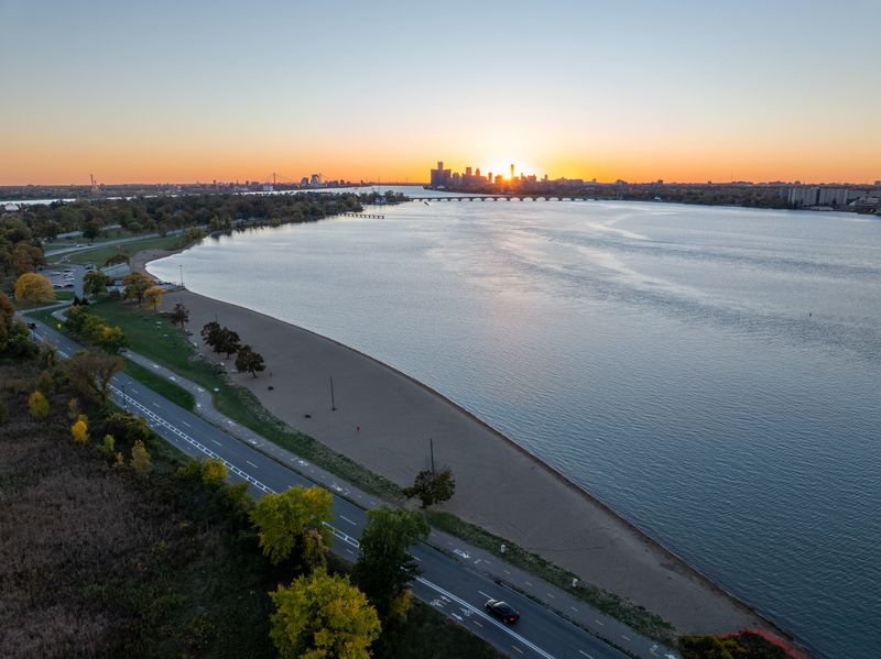
Dust blowing from the Sahara Desert is making it all the way to Michigan through Tuesday, June 30, creating opportunity for a vivid sunset tonight.
The giant plume of dust from the Sahara Desert is making its annual journey across the Atlantic and reached the United States over weekend, with the first hazy skies developing over South Florida and then spreading farther west and north.

Also known as the Saharan Air Layer, the annual weather phenomenon forms over the Sahara Desert during the late spring, summer and early fall and is a mass of dry, dusty air that can travel thousands of miles, according to the National Oceanic and Atmospheric Administration.
The dust is not expected to impact air quality in Michigan and most people won’t see visible “dust” falling from the sky, put the plume will create a milky or filtered look in the sky, enhanced reds and oranges and sunrise and sunset.
Most of the dust, which is thought to be about 2,000 miles wide from west to east and 750 miles long from north to south, will remain high in the atmosphere and have little effect on air quality and health for most people, according to AccuWeather.
People with respiratory conditions are most likely to notice irritation. Most healthy individuals experience little to no impact.
Why does Saharan dust travel so far?
Each summer, intense surface heating over North Africa combined with frequent thunderstorms across the Sahara lifts vast amounts of dust high into the atmosphere, according to NOAA. Once elevated, the particles become embedded within the Saharan Air Layer — a fast-moving, hot and very dry air mass that forms above the cooler, more humid air near the ocean surface.
This elevated layer is then carried westward by strong easterly trade winds across the Atlantic. Because it sits above the marine boundary layer, the dust can remain relatively intact over long distances, traveling thousands of miles before gradually weakening and mixing out. The strength of the trade winds, the depth of the dry air layer, and surrounding weather patterns all determine how far and how concentrated the plume remains.
During peak months in June and July, these outbreaks are most frequent and most organized, allowing dust plumes to routinely reach the Caribbean, Gulf of Mexico and parts of the southeastern United States.
What is the Saharan Air Layer?
The dust is part of a phenomenon known as the Saharan Air Layer, a very dry, dusty mass of air that forms over the Sahara Desert during late spring, summer and early fall, according to the Atlantic Oceanographic and Meteorological Laboratory, part of the National Oceanic and Atmospheric Administration. The dust clouds move over the Atlantic Ocean every few days and can reach as far west as Texas.
What will you notice in Michigan?
Most people won’t see visible “dust” falling from the sky. Instead, the change will show up overhead.
The plume typically creates a milky or filtered look to the sky during the day while enhancing reds and oranges at sunrise and sunset. When concentrations are higher, visibility can be reduced, and fine particles may temporarily degrade air quality.
Jalen Williams is a trending reporter at the Detroit Free Press. Contact him at jawilliams1@freepress.com.
This article originally appeared on Detroit Free Press: Michigan could see vivid sunset, thanks to African dust. What to expect
Reporting by Jalen Williams and Brandi D. Addison, USA TODAY NETWORK / Detroit Free Press
USA TODAY Network via Reuters Connect
By Jalen Williams and Brandi D. Addison, USA TODAY NETWORK | USA TODAY Network