The National Oceanic and Atmospheric Administration confirmed the development of El Niño in Pacific waters last month. Within that confirmation came the likelihood of a “very strong” El Niño this year.
Through the summer months, forecasters predict a 63% chance of sea surface temperatures exceeding 35.6 degrees. If that’s the case, the world must prepare for a rare “super” El Niño.

What is El Niño?
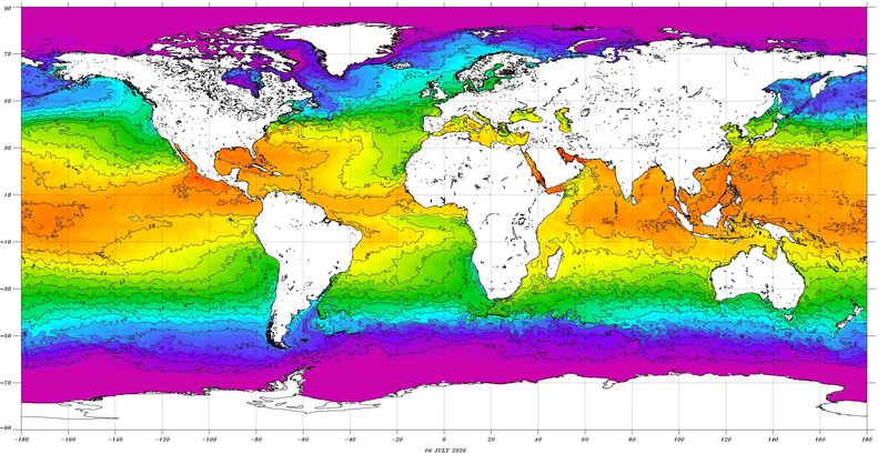
El Niño is the sudden warming of the tropical Pacific Ocean off the coast of Peru. This phenomenon occurs roughly every three to seven years,
It is strongest during the winter months, and its global impacts are typically most significant in the northern hemisphere winter.
El Niño vs. La Niña
La Niña is the inverse climate pattern that occurs when sea surface temperatures in the central and eastern Pacific Ocean are cooler than average, according to the National Weather Service. This cooling shifts atmospheric circulation, influencing weather around the globe. La Niña can also affect the jet stream, sometimes contributing to polar vortex disruptions that push Arctic air farther south.
El Niño vs super El Niño?
The difference between El Niño and a super El Niño isn’t as daunting as it sounds.
The difference is in the “magnitude to which the water is warmed,” said Raelene Campbell of the National Weather Service in Cleveland. “When we say super El Niño, we’re just looking at a magnitude greater in terms of temperatures on the surface of the water.”
How does El Niño affect Ohio?
Ohioans won’t feel the effects of El Niño until the winter due to the large temperature change, Campbell said.
“It’s going to be drier and warmer (in Ohio this winter)” she said. “Overall snowfall may be decreased, but when I say that, that’s not accounting for lake effect.”
According to a NOAA study, the average precipitation deficit in the Ohio Valley and lower Great Lakes regions was 1.82 inches during an El Niño, but was not as pronounced in the areas near lakes. But “strong El Niño events are most likely to affect the climate of the Ohio Valley and lower Great Lakes,” the study said.
Did El Niño cause the heat wave?
The heat wave that struck Ohio last week was not part of El Niño. The extreme heat, which also broke high temperature records in Cleveland and Toledo, was due to a “blocking pattern.”
A blocking pattern is a stagnant high-pressure system that stalls the west-to-east movement of the jet stream. When the region gets stuck between this pattern, there are prolonged days of above normal temperature. This is typical during the summertime and Ohio sees this event once or twice a year.
How does El Niño affect the U.S.?
What forecasters are looking at this El Niño:
Includes reporting by USA TODAY staff writer Brandi D. Addison.
This article originally appeared on The Repository: El Niño vs. super El Niño. What’s the difference?
Reporting by Aaron Hughes, Canton Repository / The Repository
USA TODAY Network via Reuters Connect
By Aaron Hughes, Canton Repository | USA TODAY Network