Strong storms are in the forecast June 18 in the Appleton area, with more rain to come the following days, according to the National Weather Service Green Bay.
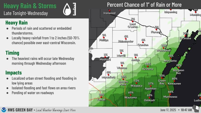
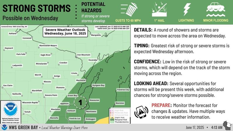
Rain will move during the overnight hours of June 18 through the afternoon, with the heaviest rains starting late in the morning. The Appleton area is currently under a marginal risk for strong storms, though they are still possible.

The National Weather Service Green Bay says the Appleton area has a 57% chance of getting at least an inch of rain or more June 18.
If the storms develop, wind gusts, hail, minor flooding and lightning are all possible. Gusts of 60 mph are also possible.
More rain to follow
The forecast shows a chance of thunderstorms June 19-20, with a chance of showers June 21. There’s a 40% chance of showers June 19, while June 20 has a 30% chance of rain.
“Wednesday looks like more of a steadier rain, while Thursday and Friday is gonna be more scattered periods of rain,” Mike Cellitti, meteorologist for the National Weather Service Green Bay, told the Appleton Post-Crescent. “In addition to Wednesday, we have thunderstorm chances Thursday afternoon and evening at times. And then Friday, there could be multiple rounds of thunderstorms.”
What’s the temperature for the Appleton area?
High temperatures are in the forecast alongside the severe weather on June 18. The sun is expected to shine June 19 prior to the chances of thunderstorms. Here’s the forecast:
Appleton weather radar
Rashad Alexander can be contacted at ralexander@gannett.com and 920-431-8214.
This article originally appeared on Appleton Post-Crescent: Appleton area could see severe weather June 18, with more storms to follow, forecast says
Reporting by Rashad Alexander, Appleton Post-Crescent / Appleton Post-Crescent
USA TODAY Network via Reuters Connect