Waves of scattered storms will sweep across North Texas starting Wednesday and lasting through Friday, bringing the potential for large hail, some as big as golf balls, according to the National Weather Service. While many areas will avoid severe weather and instead receive much-needed rain, a few locations may experience significant hail and strong winds.
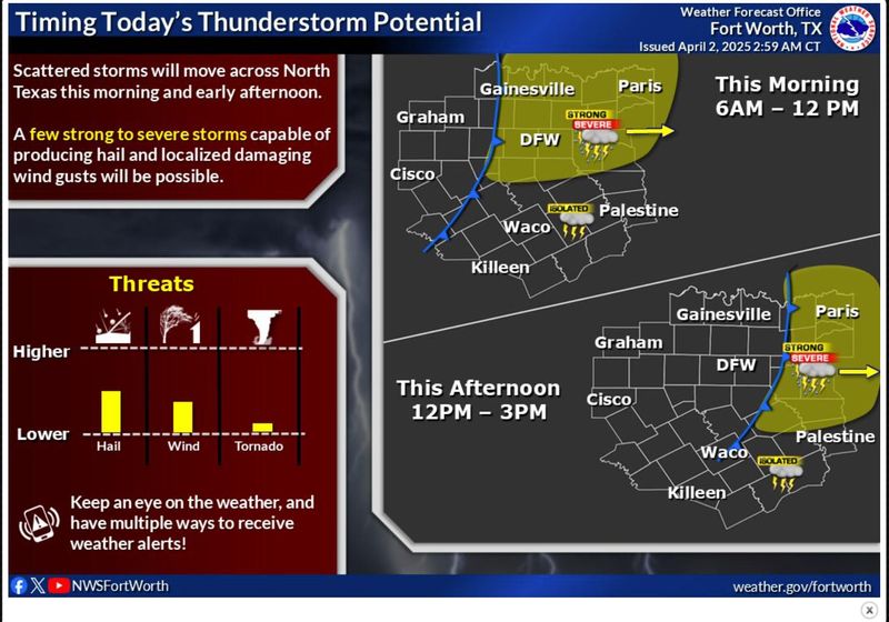
As per the NWS, a severe thunderstorm could happen in the Dallas-Fort Worth area Wednesday morning through noon before moving further east.

Here is a look at what the storms could be like.
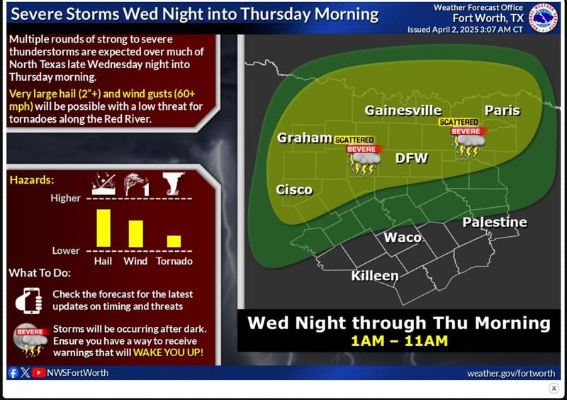
North Texas thunderstorm potential on Wednesday into Thursday morning
According to NWS, North Texans can expect golf ball-sized hail (2 inches) and wild gusts of up to 60 mph with a low threat for tornadoes along the Red River on Wednesday night into Thursday morning. Another round of severe thunderstorms are possible Thursday night, with increasing threat for large hail and damaging winds.
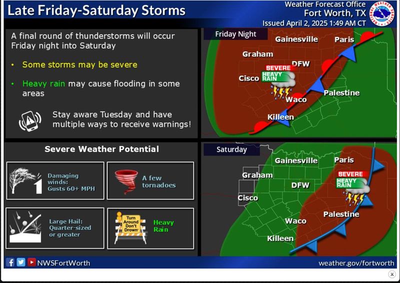
The final round of thunderstorms is expected on Friday night with heavy rain possible, as well as damaging winds, quarter-sized hail and potential for a few tornadoes, the NWS forecasts.
North Texas weather watches and warnings
This article originally appeared on Austin American-Statesman: North Texas thunderstorms are expected to start today. See weather maps, timeline
Reporting by Marley Malenfant, USA TODAY NETWORK / Austin American-Statesman
USA TODAY Network via Reuters Connect