Local temperatures hit the 20’s on Sunday, Feb. 2 for the first time since Jan. 23 when the high, as measured at Griffiss International Airport in Rome, was 24 degrees, according to National Oceanic and Atmospheric Administration online data.
And the National Weather Service has forecast temperatures in the 20s through Friday, Feb. 6 with lows in the single digits, but above 0, until Friday night. Before this week, the low temperature in Rome hadn’t stayed above 0 since Jan. 22.

But the warmer weather won’t last. The forecast calls for single digit highs over the weekend with lows falling below 0, according to the National Weather Service.
And weekend windchills will likely be somewhere around 20 degrees below zero, said Kaitlyn Lardeo, a meteorologist with the NWS’ Binghamton office.
The temperature, in fact, hasn’t hit freezing since Jan. 22 when the high was 32 degrees at Griffiss, according to NOAA. And the predicted low for overnight on Monday, Feb. 3 is 7 degrees at Griffiss, which, if the forecast proves accurate, will be the first time the low temperature has remained above 0 since Jan. 23.
Why has it been so cold?
So what’s going on? It’s all been part of the same, stagnant weather pattern, Lardeo said.
The jet stream normally moves from west to east, but it can shift, she said. In this case, a southward shift created a deep trough pattern. Troughs bring weather on the “stormier side of things” and generally colder temperatures in winter because it pulls in cold air from Canada, she said.
That deep trough pattern has held on since temperatures dropped after Jan. 22 and continues through the weekend at least, Lardeo said. The last two days have been a little warmer because a little movement allowed a little warm air into the area, “not too much because it’s still pretty cold,” she said.
This weekend, a cold front in Canada will get pulled southward, across the Great Lakes and into this area, causing temperatures to chill again, Lardeo said.
When will it warm up?
The National Weather Service forecast only goes out seven days so it’s hard to predict when temperatures might warm up again, she said.
It’s too soon to pin anything down, but it looks like the temperature might make it into the upper teens again on Monday, Feb. 9, she said. But residents will have to keep watching the forecasts as next week gets closer to get a better idea how much it will or won’t warm up, she said.
“We don’t have all the answers all the time, unfortunately,” Lardeo said.
The National Weather Service forecast for Rome, as of the afternoon of Feb. 3, put highs in the 20s on Feb. 4, 5 and 6 with the warmest day on Feb. 6 when the forecast high is 26 degrees. The lows are forecast in the single digits for Feb. 3, 4 and 5, falling to -6 degrees overnight on Friday, Feb. 6.
The NWS weekend forecast calls for highs of 5 on Saturday, Feb. 7 and 8 on Sunday, Feb. 8 with overnight lows of -9 and -7, respectively.
Between Jan. 24 and Feb. 1, the high recorded temperatures at Griffiss ranged from 7 degrees on Jan. 24 and 25 to 17 degrees on Jan. 29. Low recorded temperatures ranged from 0 degrees overnight on Jan. 26 to -15 overnight on Jan. 24 and Jan. 30.
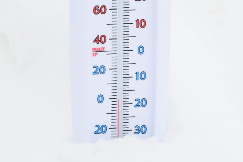
On Sunday, Feb. 2, the temperature rose to a nearly balmy high of 23 degrees, but it fell overnight to -17 degrees, the lowest of this cold snap.
A freezing January
For the entire month of January, the average high was 26.7 degrees and the average low 12.7 degrees with an average temperature of 19.7 degrees, according to NOAA.
That’s chillier than the average January with an average high of 30.1 degrees, an average low of 12.9 degrees and an average temperature of 21.5 degrees.
In fact, from Jan. 23 to Feb. 7, each day’s average temperature was somewhere between 13 degrees and 24.6 degrees below the normal average temperature for that date.
In an average February, the average temperature is 20.6 degrees with an average high of 29.6 degrees and an average low of 11.6 degrees. It’s too soon to tell how this February will stack up, but so far, it’s looking chilly.
This article originally appeared on Observer-Dispatch: Temperatures will drop this weekend; why has it been so darn cold?
Reporting by Amy Neff Roth, Utica Observer Dispatch / Observer-Dispatch
USA TODAY Network via Reuters Connect