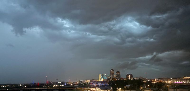
A severe weather front rolled across Iowa early Saturday morning.
The system brought heavy rainfall, lightning and thunder to parts of the state as well as a few tornado warnings.

A radar indicated tornado warning was issued for Story County, specifically Ames and Huxley, at 5:52 a.m. while another was issued for parts of Polk County, including Des Moines, at 6:22 a.m. Sirens went off in Ames around 6 a.m. and near the Drake neighborhood in Des Moines around 6:30 a.m. No tornadoes were confimred to have actually touched down, although the National Weather Service in Des Moines is investigating reports of possible weak tornadoes in Gilbert and northeast of Polk City.
Strong wind gusts downed tree limbs in the Nevada and Pilot Mound areas but there are no reports of significant damage, according to the National Weather Service. Pea sized hail was reported in Madrid, according to Boone County Emergency Management.
How much rain fell in central Iowa?
Des Moines saw 0.66 inches of rain Saturday morning, according to reports from the National Weather Service. significantly higher rainfall, with Bode topping the charts. The cities with the most rain were:
Bode: 4.85 inches
Garner: 2.86 inches
Pilot Mound: 2.5 inches
Swaledale: 2.12 inches
Eagle Grove: 2.07 inches
Ames: 1.64 inches
Boxholm: 1.5 inches
Is more severe weather headed for Des Moines?
Lingering storms are expected to dissipate by midday Saturday, with the possibility of a return in the evening.
A severe weather outlook from the National Weather Service predicts a slight risk for severe weather in central and southeastern parts of the state. The NWS warns residents to be on the lookout for “damaging winds,” and notes that “brief” tornadoes are possible. Excessive rain is expected as well.
Thunderstorms are expected to bring heavy rainfall across the state throughout the weekend. Three to five inches of rainfall could be expected into Sunday. The NWS forecasts at least a half inch to an inch of rain, “especially south of U.S. 20.”
Flash flood watch issued for Polk County, several central Iowa counties
A flood watch was issued for Polk County and nine other central Iowa counties at 2:52 p.m. on Saturday. Strong thunderstorms are expected to drop heavy rainfall, according to the National Weather Service, increasing the likelihood of flash flooding. The watch extends across portions of central, northeast, south central, southeast, southwest and west central Iowa. The flood watch goes into effect at 7 p.m. and will remain active until 10 a.m. on Sunday, July 20.
The National Weather Service said rain is supposed to sweep through central Iowa starting at 7 p.m. with a chance for strong storms developing after 10 p.m. Damaging winds, up to 70 mph, are likely along with a chance for large hail. The storm will move southeast across the state at 25 mph.
The National Weather Service predicts rainfall up to two to five inches, with the potential to exceed five inches in some areas. The NWS said a tornado or two is possible. The highest chances for flash flooding is for communities between U.S. Highway 20 and U.S. Highway 34.
More storms expected Sunday
The threat of severe weather continues through Sunday, July 20 across much of Iowa. The National Weather Service expects scattered severe storms to develop in the early morning hours, producing damaging winds and heavy rain. More storms are expected to roll through in the late afternoon and early evening. The storms will move across the state to the east at 30 mph.
(This story was updated to add new information, a video and a photo gallery.)
Norah Judson is a reporter for the Register. Reach her at njudson@gannett.com.
This article originally appeared on Des Moines Register: Tornado warnings issued in Des Moines, Ames Saturday morning. Are more storms on the way?
Reporting by Norah Judson, Des Moines Register / Des Moines Register
USA TODAY Network via Reuters Connect