Temperatures have gradually cooled across the Midwest as October winds down to Halloween. With lows this week in Central Indiana hovering in the upper 30s, some Hoosiers might be wondering when it will snow.
The first flakes of measurable snowfall could blanket Indianapolis in as little as a month, according to historical records kept by the National Weather Service.

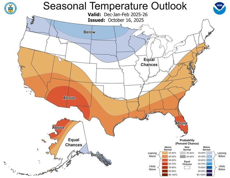
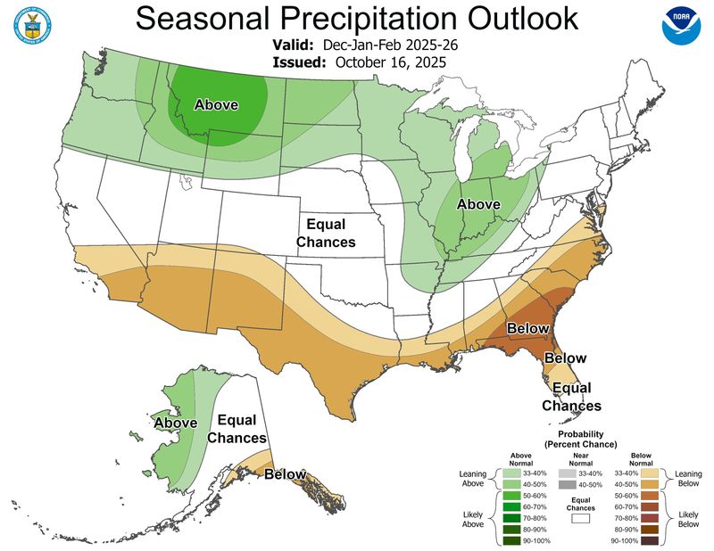
As of Oct. 16, federal meteorologists suggest Indiana is in for a wetter winter than normal but has equal chances seeing above or below normal temperatures.
Here are first frost and snowfall dates Hoosiers should keep in mind either to bring in plants or to have a snow shovel at the ready, just in case.
When can Indiana expect frost?
Records kept by NWS show Indianapolis residents can expect the average first freeze of the year (when temperatures drop below 32 degrees) by Oct. 28. The first hard freeze usually hits around Nov. 5.
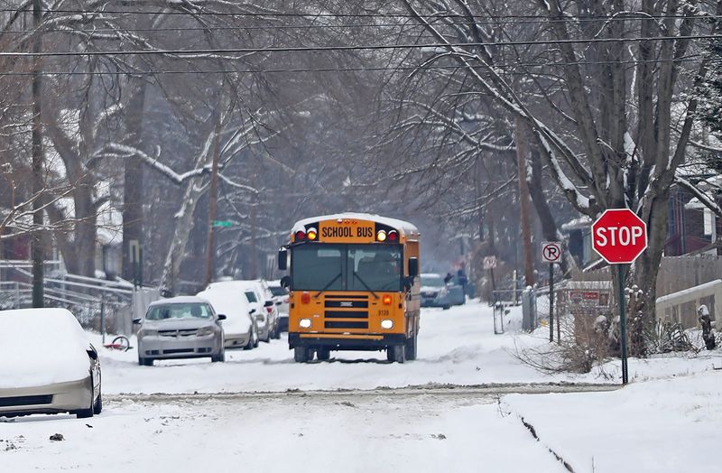
Story continues after photo gallery.
What date last year was the first frost in Indiana?
In 2024, temperatures dipped below 32 degrees on these dates, according to NWS and AccuWeather, for the following Indiana cities:
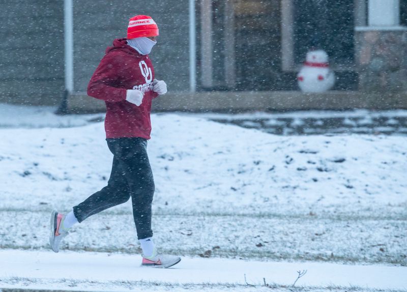
What month does it start to snow in Indiana?
Snow can fall in Indiana as early as October but it usually holds off until late November.
The first measurable snowfall in Indianapolis normally happens on Nov. 24, according to NWS. The earliest date was on Oct. 18, 1989.
What’s the average winter temperature like in Indianapolis, Indiana?
Last winter, average temperatures in Indianapolis were as follows:
Historically, Indy’s snowiest month is January.
Indianapolis saw the most amount of snowfall in a single month, 30.6 inches, in January 1978, according to NWS. Indy usually sees its greatest average snow depth on Jan. 31 with 1.7 inches of snow on the ground.
How much snow normally falls in Indianapolis?
Records kept by NWS from 1991 to 2020 show Indianapolis gets the following average snowfall:
Some years, of course, are snowier than others.
On Jan. 5, a snowstorm moving across the Midwest buried some Indiana cities in nearly 12″ of heavy snow. It’s too early to tell if such an event will repeat in January 2026. The latest forecast models from NWS show the Hoosier State could veer colder or warmer this winter.
What NOAA’s Climate Prediction Center says about winter 2025-26
A seasonal temperature outlook map issued Oct. 16 by the National Oceanic and Atmospheric Administration shows Indiana and its neighboring states are leaning toward “equal chances” for above and below normal temperatures.
Federal forecasters predict a “brief period of weak La Niña conditions” is expected in the late fall and early winter, which could bring cooler and wetter temperatures to Indiana.
The latest seasonal precipitation outlook predicts the Hoosier State might see above average precipitation (40-50% probability) from December through February, according to NOAA.
John Tufts covers trending news for IndyStar and Midwest Connect. Send him a news tip at JTufts@Gannett.com. Find him on BlueSky at JohnWritesStuff.
This article originally appeared on Indianapolis Star: When could Indianapolis see its first snow in 2025? Meteorologists keep track of this date
Reporting by John Tufts, Indianapolis Star / Indianapolis Star
USA TODAY Network via Reuters Connect