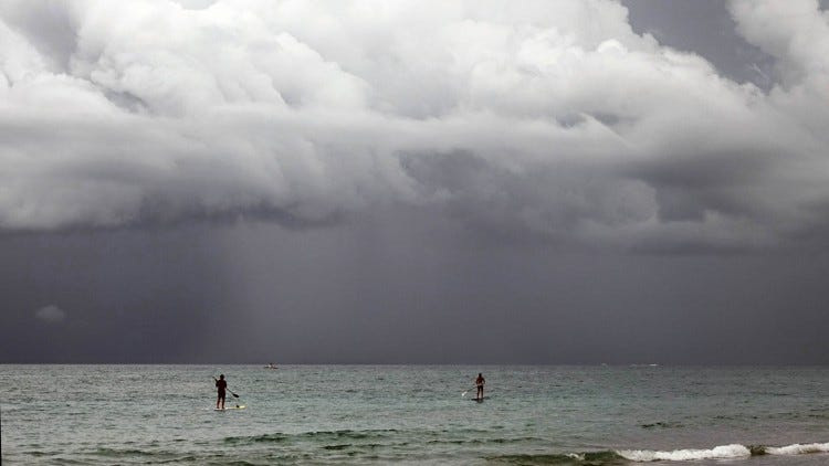
A soggy injection of tropical air is promising days of showers in Florida and Palm Beach County with several inches of drought dimming rain possible into early June.
Southeast Florida, including Palm Beach, Broward and Miami-Dade counties, could get 2 inches per day, with a maximum of 7 inches, through early next week.

Areas of the western Panhandle have already experienced a taste of the moisture gushing north from the Gulf with 1.02 inches of rain falling in Pensacola on Memorial Day. The Weather Prediction Center is warning of the potential for excessive rainfall in areas from Apalachicola west through Friday.
The remainder of the Panhandle and Peninsula should experience a pattern shift beginning Thursday, May 28, as high pressure spinning east of the state shimmies away, allowing for a tropical dousing.
National Weather Service meteorologist George Rizzuto said the extended wet weather is a little unusual for this time of year.
Although the rainy season has likely launched, the soaker over the coming days is linked partly to the Central American Gyre — an area of low pressure in the western Caribbean that can bookend hurricane season but is less active in summer months.
Through June 3, rainfall amounts from Jacksonville through Miami and over the Everglades could be as high as 4 to 6 inches.
Southeast Florida, including Palm Beach, Broward and Miami-Dade counties, could get 2 inches per day, with a maximum of 7 inches, through early next week.
“When the high-pressure retreats, it will allow for the moisture to come up,” Rizzuto said. “It’s usually more contained in the lower latitudes but sometimes it heads north.”
Another feature that is fueling wonky weather nationally is something called the Omega block. That’s where high-pressure forms in the center of the country with areas of low pressure stalled on either side.
It’s the reason why the high temperature in Bismarck, North Dakota was 21 degrees warmer on May 26 than Albuquerque, New Mexico, according to Caitlin Kaiser, a Weather.com meteorologist.
“The two things we typically watch out for during this pattern are potential flooding and an upside-down temperature pattern,” Kaiser wrote in a column for Weather.com. “By the end of the week, some spots in the southeast could see up to 5 inches of rain.”
Kaiser singled out Tallahassee as an area that “should be on alert.”
NWS meteorologists in Tallahassee noted that showers and thunderstorms are expected each day through the next week with the biggest threats being gusty winds, torrential downpours, and frequent lighting.
Rizzuto said whatever rain Florida gets through early June will help with the drought but won’t erase it completely. The U.S. Drought Monitor report released May 19 showed about 75% of the state in severe or extreme drought, the two highest levels on the drought intensity scale.
The worst of the drought is from the Big Bend region of the state through Bay County in the Panhandle.
A new drought monitor report will be released May 28.
“I don’t think even 5 to 7 inches will help significantly,” Rizzuto said. “It will take more than that to knock this back because it’s been a pretty long drought.”
Hurricane season begins June 1 in Florida but nothing is brewing, yet
With hurricane season officially beginning June 1, AccuWeather is already watching the southwest Atlantic and eastern Gulf of Mexico for possible tropical development. The Gulf is now referred to as the Gulf of America by the U.S. government,
Alex DaSilva, lead hurricane forecaster for AccuWeather, said the same gyre that is pumping moisture into Florida could be a spot for a tropical system to develop in the first two weeks of June.
The Madden-Julian Oscillation—a globe-circling pulse of showers and storms that can instigate tropical systems—will be in a favorable position for something to develop, DaSilva said.
“We don’t have anything explicitly highlighted for development yet,” DaSilva said. “The waters are warm enough to support a tropical cyclone but there’s a lot of wind shear typically in the Gulf this time of year.”
The National Hurricane Center, which began issuing forecasts May 15, had no areas marked for potential tropical development as of Wednesday.
Kimberly Miller is a journalist for the USA TODAY NETWORK FLORIDA. She covers weather, the environment and critters as the Embracing Florida reporter. If you have news tips, please send them to kmiller@pbpost.com. You can get all of Florida’s best content directly in your inbox each weekday by signing up for the free newsletter, Florida TODAY, at palmbeachpost.com/newsletters.
This article originally appeared on Palm Beach Post: When will rain stop in Palm Beach County? Here’s the soggy forecast
Reporting by Kimberly Miller, Palm Beach Post / Palm Beach Post
USA TODAY Network via Reuters Connect