

At least 10 Florida cities set or tied high temperature records Aug. 18 including two that sent the mercury soaring into the triple digits.
Tallahassee and Miami both made it to 100 degrees. For Tallahassee, it was the second consecutive day of 100.

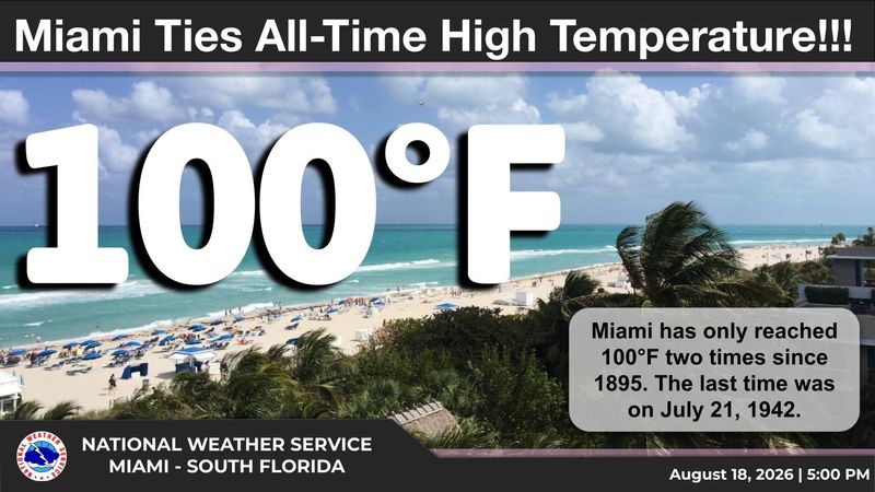
For Miami, it was only the second time in 131 years that the Magic City would see the century mark on the outdoor thermometer. The first time was in 1942.
And if forecasts for continued abnormal heat hold true, there could be a third time this week, with a 10% chance Wednesday that the Miami International Airport could reach 100 degrees.
“You’d think we’ve become Tucson or something,” said Miami based National Weather Service Warning Coordination Meteorologist Robert Garcia. “The current forecast is 97 or 98 but the chance is not zero that it could surpass that.”
According to the Southeast Regional Climate Center, other high temperature records broken or tied Aug. 18 include 98 degrees in Fort Lauderdale and Jacksonville; 97 degrees in Melbourne and Gainesville; and the 96 degrees reached in West Palm Beach, Fort Pierce and Vero Beach.
Garcia said meteorologists weren’t overly surprised by the 100-degree watching it tick up from the upper 90s and a delay in the cooling afternoon sea breeze. It reached 100 degrees at 3:45 p.m.
“It’s not unheard of to be that late,” Garcia said. “It was just one of those things where it could go for the gold.”
Tucson, which is in the Sonoran Desert of Southern Arizona, was 105 degrees on Aug. 18.
How often does it reach 100 degrees in Florida?
Andy Haner, a meteorologist with the NWS in Miami, said having a few 100-degree days in the summer is normal for Tallahassee International Airport. The one recorded Aug. 18, tied a 100-degree reading on the same day in 1993.
Monday’s triple digit high broke a 1957 record for Aug. 17 of 97 degrees.
On July 29, Tallahassee hit 101 degrees, topping a 2015 record for that day of 100.
“I would say getting three 100-degree days during summer is pretty on target,” said Haner, noting that for Tallahassee the worst heat may be in the rearview mirror. “For an individual day 100 is above normal but for the summer as a whole, not as much.”
A nagging area of high pressure over the Southeast U.S. is partly to blame for the high temperatures as sinking air is warmer and tends to evaporate any clouds that try to form, allowing for more sunshine to reach the surface. Also, no clouds means no rain.
Temperatures for Aug. 19 were forecast to be in the low 90s in the Florida Keys into the upper 90s through the Panhandle.
Haner said the high pressure is expected to slowly push west, moving the heat dome that has menaced Florida into the southwestern states. That could mean a return of higher rain chances to cool off spicy afternoons.
Still, temperatures through the weekend are still forecast statewide to be in the low to mid 90s.
“People say, ‘Oh, it’s just summertime in South Florida,’ but the heat can cause serious injury,” said Garcia. “And we’re not done with the heat this week.”
Kimberly Miller is a journalist for the USA TODAY NETWORK FLORIDA. She covers weather, the environment and critters as the Embracing Florida reporter. If you have news tips, please send them to kmiller@pbpost.com. You can get all of Florida’s best content directly in your inbox each weekday by signing up for the free newsletter, Florida TODAY, at palmbeachpost.com/newsletters.
This article originally appeared on Palm Beach Post: Florida heat shatters records as Miami hits 100 for only second time
Reporting by Kimberly Miller, USA TODAY NETWORK – Florida / Palm Beach Post
USA TODAY Network via Reuters Connect
By Kimberly Miller, USA TODAY NETWORK – Florida | USA TODAY Network
