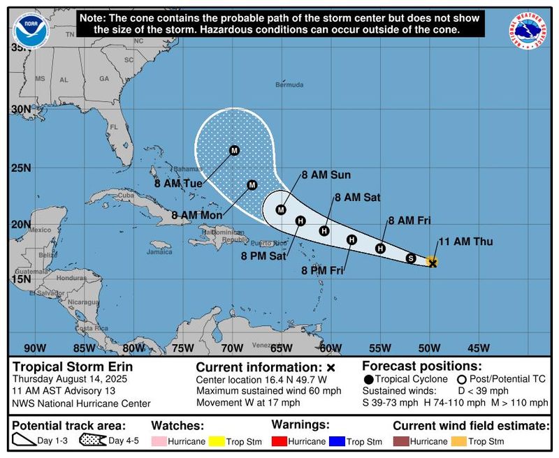
Special note on the NHC cone: The forecast track shows the most likely path of the center of the storm. It does not illustrate the full width of the storm or its impacts, and the center of the storm is likely to travel outside the cone up to 33% of the time.

Tropical Storm Erin is quickly moving westward across the Atlantic and is expected to become a hurricane in the morning of Aug. 15 and possibly a major hurricane northeast of Puerto Rico by early Sunday, according to the latest advisory from the National Hurricane Center.
A major hurricane is listed as a Category 3 or higher, with maximum sustained winds of at least 111 mph.
Swells generated by Erin will begin affecting portions of the northern Leeward Islands, the Virgin Islands and Puerto Rico by this weekend.
“These swells are likely to cause life-threatening surf and rip current conditions,” the National Hurricane Center said.
The system is then forecasted to turn northwest and by late Tuesday night/Wednesday morning, Erin will likely be positioned approximately 600 to 750 miles east of Jacksonville. Erin will remain well offshore of the Southeast Georgia and Northeast Florida coasts through Tuesday and Wednesday of next week.
“Forecast confidence in this track remains high at this time,” they said.
➤ Excessive rainfall forecast
Will it affect St. Johns County?
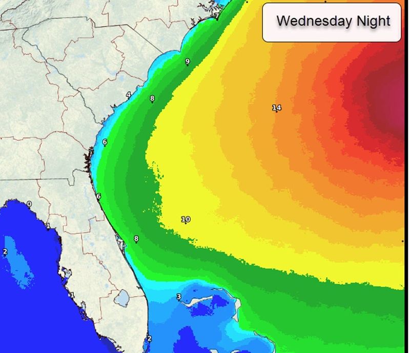
Ben Nelson, senior meteorologist at the National Weather Service in Jacksonville, told the St. Augustine Record that while Erin does not currently pose a direct threat to coastal St. Johns County in terms of winds, rainfall, storm surge, and tornadoes, beaches will be impacted.
“Next week will be dangerous due to indirect impacts from what will likely be Major Hurricane Erin,” he said. “Large ocean swells will create deadly rip currents beginning on Monday.”
Nelson said that because of the Aug. 23 new moon phase, wave heights will likely reach Small Craft Advisory criteria (7 feet) 20-plus nautical miles from the shoreline on Aug. 19.
“Visitors to the beaches should make sure that they enter the surf at locations served by lifeguards next week,” Nelson said. “Conditions may become very dangerous Tuesday through Friday as Erin turns northward and parallels the U.S. eastern seaboard, remaining well offshore. “
Daily Briefing | Newsletters | St. Augustine Record (staugustine.com)
Potential impacts
The National Weather Service in Jacksonville said the area could see the following impacts.
Surf Zone
Marine
➤ Track all active storms
➤ Weather alerts via text: Sign up to get updates about current storms and weather events by location.
Hurricane News: Get the latest hurricane updates and how communities are preparing, responding, and recovering.
What’s next?
We will update our tropical weather coverage daily.
Download your local site’s app to ensure you’re always connected to the news. And look for our special subscription offers here.
This article originally appeared on St. Augustine Record: Erin could become a hurricane Aug. 15: What impact will it have in St. Johns County?
Reporting by Lucia Viti, St. Augustine Record / St. Augustine Record
USA TODAY Network via Reuters Connect