PANAMA CITY — Tropical Storm Bertha is meandering just off the coast of Bay County and the area is still feeling its impacts.
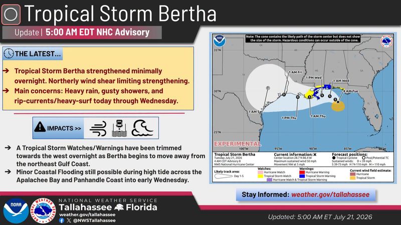
Tropical Depression Two was upgraded to Tropical Storm Bertha as expected on July 20 and is moving at a snail’s pace of 5 mph to the northwest. Bay County, along with many of the western Panhandle counties, is under a tropical storm watch.

The National Weather Service’s Tallahassee forecasting office says that the main concerns are heavy rain, gusty showers, rip currents, and heavy surf. The agency projects these concerns to last through at least July 22.
Coastal flooding is also possible during high tide through 1 p.m. on July 22, expected to impact low-lying parks and roads near waterfronts.
NWS also projects a marginal 5-14% flooding rain risk with forecast additional rainfall amounts between one and two inches and isolated high-end totals up to four inches. This could lead to isolated flash flooding, particularly in areas that are already well-saturated from recent rains.
Gusty winds between 35 and 45 mph are forecast across the coastal Panhandle. NWS Tallahassee says spotty power outages are possible, loose objects should be secured, and high-profile vehicles such as vans and trucks may have difficulty driving.
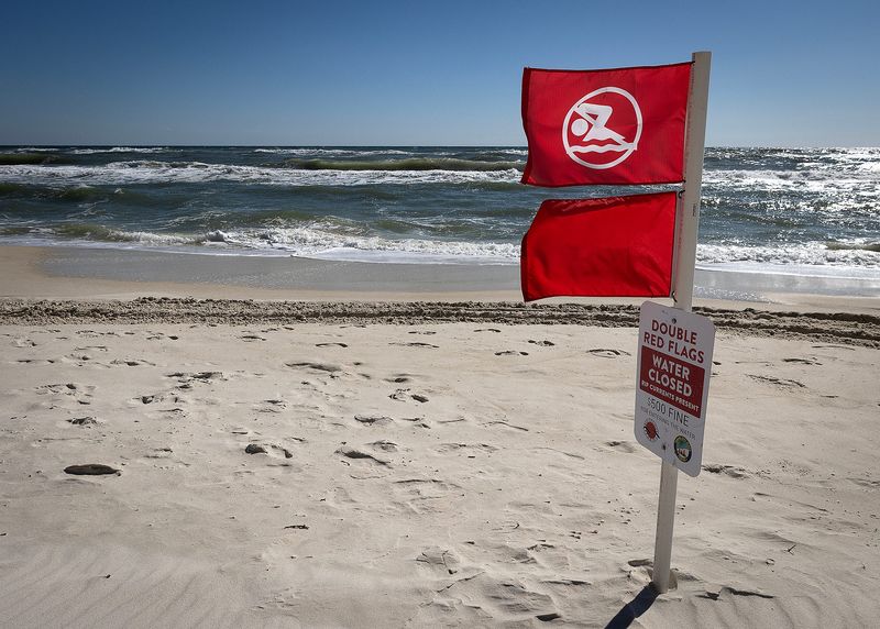
Small-craft mariners and beachgoers may want to stay out of the water until the storm passes. Double-red flags are flying over Panama City Beach on July 21 as dangerous surf up to 9 feet is forecasted. Numerous dangerous rip currents that can pull even the strongest swimmers out into the Gulf are anticipated.
NWS experts themselves say that inexperienced mariners should avoid navigating these conditions. The agency also notes in the area forecast discussion that these conditions are anticipated to last for most of the week.
“Tropical Storm Bertha will continue to send periodic bands of rain through our area through Wednesday,” reads the forecast discussion. “Very heavy rain and gusty winds can be expected as these outer rain bands move ashore and inland the next couple of days.”
As Bertha moves out of the area on July 22, it is expected to leave behind ample moisture that will fuel afternoon showers and thunderstorms through July 27.
A Florida landfall is unlikely, with most models showing a coastal Louisiana or Texas impact.
Stay informed. Get weather alerts via text
What’s next?
We will continue to update our tropical weather coverage to bring you the most current information you need to protect your home and family.
(This story was updated to add a video)
This article originally appeared on The News Herald: Dangerous surf, flooding possible as Bertha lingers near Bay County
Reporting by Dylan Gentile, Panama City News Herald / The News Herald
USA TODAY Network via Reuters Connect
By Dylan Gentile, Panama City News Herald | USA TODAY Network