Most evacuation warnings tied to the Volcano Fire near Murrieta were lifted by Wednesday, July 8, though one evacuation order remained in place around the perimeter of the fire.
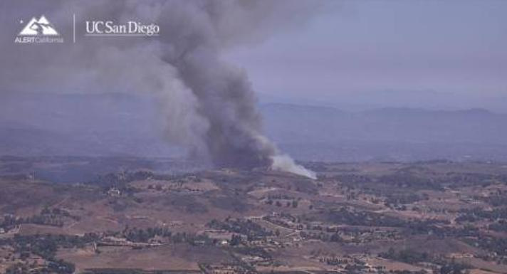
The wildfire, burning near Via Volcano and Tenaja Road in an unincorporated area, had scorched 137 acres and was 45% contained, according to Cal Fire’s Riverside County Unit in an update about 1:30 p.m. Wednesday.

The Volcano Fire was initially reported around 2:52 p.m. Tuesday, July 7. After working through the night around the perimeter of the Volcano Fire, crews spent Wednesday strengthening containment lines and putting out hot spots and dense pockets of vegetation.
Rising temperatures Wednesday added to the challenge as crews from across Southern California arrived to help fight the fire, Cal Fire said.
A heat advisory for the Inland Empire issued by the National Weather Service was in effect through 8 p.m. Friday, July 10, with highs expected to reach the mid-90s to 105. Murrieta was forecast to reach 95 on Thursday and 93 on Friday, with wind gusts up to 20 mph both days.
Cal Fire said 209 personnel had been assigned to the fire, along with 29 engines, one water tender, nine crews and six other resources.
Other agencies assisting include the Murrieta Fire Department, Riverside County Emergency Management Department, Riverside County Sheriff’s Department, Cal Fire San Diego and the Cleveland National Forest.
The cause of the fire was under investigation.
Volcano Fire evacuations
An evacuation order remained in place Wednesday afternoon for the 117-Volcano Fire Perimeter.
Zone RVC-2146 was downgraded to an evacuation warning, with its boundaries north of Tenaja Road; south of Avenida La Cresta and Valle Vista; east of Sierra Maria Road and Avenida La Cresta; and west of Clinton Keith Road.
To see if you are located within an evacuation or warning zone, a map is available online at protect.genasys.com or on the Genasys Protect app, which provides real-time emergency alerts.
A temporary evacuation point remains at Chaparral High School, 27-215 Nicolas Road in Temecula, where pets are allowed. A large animal evacuation site is also located at Murrieta Equestrian Center at 42-646 Juniper St. in Murrieta.
Volcano Fire road closures
Road closures had been reported Tuesday on Teneja Road between Avocado Mesa Road and Avenida La Cresta, as well as Los Gatos Drive and Carancho Road. By Wednesday, Cal Fire was no longer listing those roads as hard closures.
Jennifer Cortez covers education and breaking news in the Coachella Valley. Reach her at jennifer.cortez@desertsun.com.
This article originally appeared on Palm Springs Desert Sun: Volcano Fire 45% contained, most evacuation warnings lifted
Reporting by Jennifer Cortez, Palm Springs Desert Sun / Palm Springs Desert Sun
USA TODAY Network via Reuters Connect
By Jennifer Cortez, Palm Springs Desert Sun | USA TODAY Network