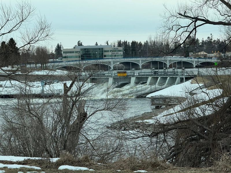
The Cheboygan Dam, located in Michigan’s Lower Peninsula, is closely watched because the Cheboygan River, Mullet Lake and Black River have risen and water is nearly at the top of the structure.
“At this hour, crews continue to monitor water levels at the Cheboygan Dam. In the last 24 hours, water levels on the Cheboygan River have remained at 21 inches below the top of the dam. If water reaches 12 inches below the top, an emergency action plan is in place to safeguard public safety,” the Michigan Department of Natural Resources said the at noon Thursday, April 9, in an update on social media.

The Cheboygan Dam — located south of downtown Cheboygan in the northern region of the Lower Peninsula — holds back water from the Cheboygan River that connects to Mullett Lake and Black Lake and Indian River. Increased water levels on both water bodies, combined with snowmelt, have caused the reservoir to be fuller than usual.
“We are experiencing very high water levels. All the dam gates are open, and we are passing as much water through the dam gates as we can,” Rich Hill, DNR Gaylord District supervisor, said on April 7.
The Cheboygan River empties into Lake Huron.
DNR officials said workers were placing 1,500 sandbags at the Cheboygan Lock and Dam and urged locals to steer clear of the area, and to sign up for real-time local alerts via MIREADY, according to the DNR release.
DNR officials did not immediately respond to requests for an update on the dam conditions on Friday, April 10.
This week, Michigan has seen several flooded rivers, prompting warnings by the National Weather Service. Snowmelt and heavy early-April rain showers have caused water levels to rise.
A hazardous weather outlook for Cheboygan County says the area could see thunderstorms and locally heavy rainfall at times Sunday through Tuesday, which could make the situation worse.
As of Friday morning, April 10, flood warnings and advisories remained in place for rivers in Kalamazoo, Ottawa, Kent, Clinton, Barry, Newaygo, Saginaw, Bay and Iron counties, according to the NWS. Much of the Upper Peninsula is under a flood watch.
In addition, officials have issued a flood watch for the entire Upper Peninsula from Saturday, April 11, through Wednesday morning, April 15.
Here’s more on the Cheboygan Dam:
Where is the Cheboygan Dam? How large is the dam?
The Cheboygan Lock and Dam Complex is comprised of the Cheboygan Lock and Dam, as well as a privately owned hydroelectric facility, the DNR noted. The complex is regulated by the Federal Energy Regulatory Commission.
Here are some key details on the Cheboygan Dam, according to Dams of the World:
Is there a flood warning near me? Current warnings in Michigan
To view the details of a warning, watch or advisory in Michigan click on any shaded region shown on the map.
The bright green lines indicate flood warnings.
Contact Sarah Moore @ smoore@lsj.com
This article originally appeared on Lansing State Journal: Officials sandbag Cheboygan Dam as high water nears top of structure
Reporting by Sarah Moore, Lansing State Journal / Lansing State Journal
USA TODAY Network via Reuters Connect