
Another slug of Saharan air filters into Florida this week, dampening rain chances in the burning southern reaches of the state and contributing to a tropical cyclone hibernation that may last well past the July 4 holiday.
Weather Trader meteorologist Ryan Maue said the Atlantic basin was heading into a “slumber” after the short-lived but soggy Tropical Storm Arthur doused the Gulf Coast, while Colorado State University hurricane researcher Phil Klotzbach suggested now would be a good time to go on holiday.

“There is just a massive wall of wind shear and lots of dust, so, everybody go on vacation,” Klotzbach joked. “It looks really quiet after that junk in the Gulf. Arthur looks to be it for a while.”
National Weather Service meteorologists in Key West forecast rain chances near “nil” at least through Wednesday as the pocket of Saharan air drifts west from the Bahamas, eventually moving into the Gulf.
Does Saharan dust increase Florida temperatures?
And Miami-area meteorologists said “heat will remain a problem,” as Saharan dust is introduced into the mix and heat index or “feels like” temperatures climb into the 105 to 110 degree range. Dry air evaporates clouds, increasing sunshine, limiting rainfall and leading to higher temperatures.
West Palm Beach reached an ambient temperature of 96 degrees on Sunday, that’s 7 degrees warmer than normal and tied the record daytime high set in 2009 for that day. At the same time, rain chances are at just 10% at least through mid-week as three wildfires continue to burn in Miami-Dade County consuming 22,000 acres.
“We do balloon launches twice a day and the dust is already oozing in here,” said NWS meteorologist Bryce Tyner, who is based in Key West. “We start getting these plumes June through July and it should limit hurricane activity for quite some time.”
WPLG Channel 10 in Miami hurricane expert Michael Lowry said there will be “tropical tumbleweeds for the foreseeable future.”
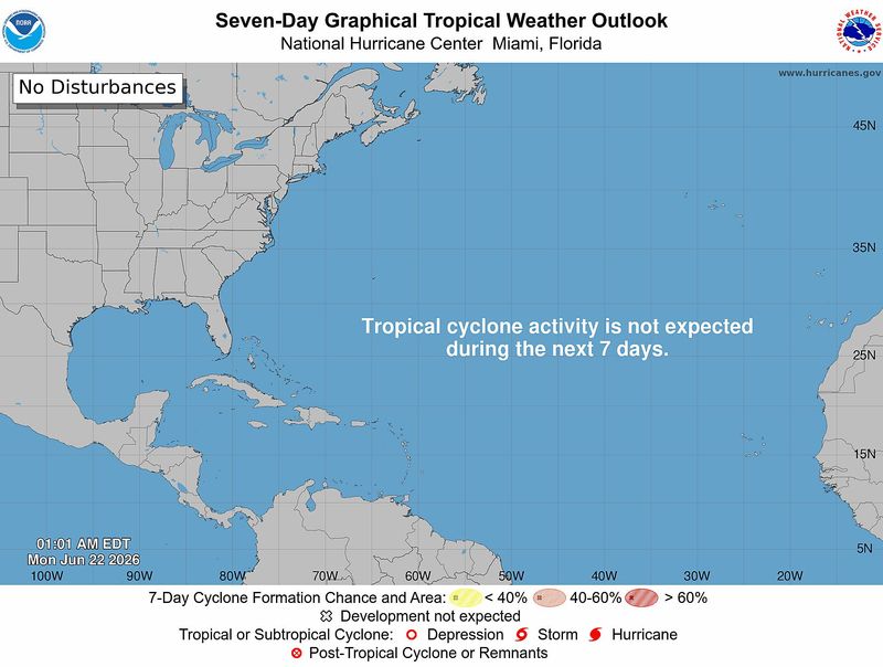
The National Hurricane Center has no tropical development in the forecast for the next seven days but that could stretch past the Fourth of July and into the middle of next month, said AccuWeather long-range forecaster Chad Merril.
In addition to the dry Saharan air and storm-throttling wind shear in the runway between Africa and the Caribbean, a globe trotting pulse of energy called the Madden Julian Oscillation, or MJO, is moving into the western Pacific away from any stirrings in the Atlantic.
The MJO can instigate storm formation by causing air to rise. Two potential areas of tropical cyclone development have been highlighted by the NHC in the Pacific.
“Everything is going to be pretty quiet for the next couple of weeks in the Atlantic,” Merril agreed.
The first-named tropical cyclone of the 2026 hurricane season lived less than a day but contributed to slopping up to 20 inches of rain in an area of eastern Louisiana between June 16 and June 19. About 3.4 inches fell in parts of the western Florida Panhandle during the same time.
Arthur’s messy structure was indicative of an El Niño afflicted storm, forming at a higher latitude above the strongest wind shear, Klotzbach said.
Still, wind shear was strong enough that it knocked askew what should be a chimney-like funnel atop Arthur. At one point Arthur was considered a “naked swirl”, where the center of the storm has no thunderstorms above it and most of the rain was east of the center.
The Climate Prediction Center officially declared El Niño present on June 11, a day after Colorado State reduced its official hurricane forecast down from 13 named storms to 11.
Klotzbach called the reduction “fairly aggressive.” An average hurricane season has 14 named storms.
“This is a very different conversation than we’ve been having for quite a while,” Klotzbach said. “Of the past 10 years, nine were above normal or hyperactive. The last below average season was 2015.”
El Niño is forecast to deepen and has a 63% chance of becoming a very strong El Niño in the fall through November.
The Climate Prediction Center says it could rank among the strongest in the historical record dating back to 1950.
The strength of El Niño correlates with its impact on hurricane season, with a stronger pattern creating more hurricane-shredding wind shear. An exception to that happened in 2023 when superheated ocean temperatures overcame wind shear, allowing an impressive 20 named storms to form.
Still, only Idalia and Tropical Storm Harold made U.S. landfalls that year with many storms curving out to sea.
Kimberly Miller is a journalist for the USA TODAY NETWORK FLORIDA. She covers weather, the environment and critters as the Embracing Florida reporter. If you have news tips, please send them to kmiller@pbpost.com. You can get all of Florida’s best content directly in your inbox each weekday by signing up for the free newsletter, Florida TODAY, at palmbeachpost.com/newsletters.
This article originally appeared on Palm Beach Post: Hurricane season slumbers as dust, shear quiet Atlantic turbulence
Reporting by Kimberly Miller, USA TODAY NETWORK – Florida / Palm Beach Post
USA TODAY Network via Reuters Connect

By Kimberly Miller, USA TODAY NETWORK – Florida | USA TODAY Network