Stark County’s weekend weather forecast calls for a warm and wet Saturday followed by a much cooler Sunday, when there will be a slight chance of rain showers mixing with snow at night.
The National Weather Service predicts that today’s high temperature will be near 74 degrees, and stay in the same range on Saturday, when the high is expected to be near 77.

But the bottom will drop out Sunday, when the forecast high is near 50 degrees. Expect a nighttime low temperature of 31 degrees and widespread frost after 5 a.m. The chance of precipitation will be 40% during the day and 20% at night. Winds could gust up to 28 mph during the day.
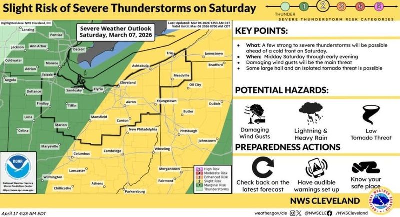
Showers and thunderstorms are expected Saturday
Showers and thunderstorms are expected to develop ahead of a cold front on Saturday afternoon. Some storms may be strong to severe, with threats of damaging wind gusts, large hail, or a tornado.
The chance of precipitation is 90% during the day on Saturday and 80% on Saturday night. Winds could gust as high as 32 mph during the day and 25 mph at night.
On Monday, expect widespread frost before 9 a.m., sunny skies and a high near 46 leading into a nighttime low around 31.
Tuesday is expected to be mostly sunny during the day with a high near 66. At night, it will be mostly cloudy with a low around 51.
Wednesday’s high will be near 69, and the nighttime low, around 48.
Thursday’s high is expected to be near 74.
This article originally appeared on The Repository: Expect warm weather in the Canton area before storms, cool air roll in
Reporting by Nancy Molnar, Canton Repository / The Repository
USA TODAY Network via Reuters Connect