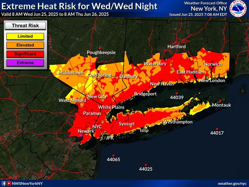
A heat advisory and air quality alert are in effect for the Lower Hudson Valley on Wednesday, June 25, as the region continues to experience its first major heat wave of the year.
The National Weather Service has issued an extreme heat warning for portions of southern Connecticut, northeast New Jersey and downstate New York, in effect until 7 p.m. Wednesday, June 25. An air quality alert has also been issued from 11 a.m. to 11 p.m. Wednesday.

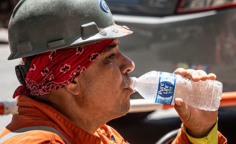
“Extreme heat and humidity will significantly increase the potential for heat-related illnesses, particularly for those working or participating in outdoor activities,” the agency said in the warning. “The highest heat index values will take place each day during the afternoon.”
Heat index in Lower Hudson Valley passes 100 degrees for third day
The National Weather Service said a heat advisory is issued when the heat index, the combination of heat and humidity as it feels to the human body, is predicted to feel like “95 to 99 degrees for two or more consecutive days or 100 to 104 degrees for any length of time.”
Temperatures are expected to reach 96 degrees Wednesday, but the heat index could make temperatures feel like 101 degrees or higher.
The change in index is a welcome change from Monday and Tuesday, where index values reached a record-breaking 107 degrees, but the National Weather Service still warns of an unforgiving heat throughout the day Wednesday.
“Take extra precautions if you work or spend time outside, NWS said. “When possible, reschedule strenuous activities to early morning or evening.”
Chance of thunderstorms could spell relief for New Yorkers
A 30% chance of showers and thunderstorms after 5 p.m. could help cool temperatures a bit. Evening temperatures are predicted to be around 70 degrees Wednesday with an additional 50% chance of showers and thunderstorms.
Temperatures should cool down in the Lower Hudson Valley by Thursday, as some more showers and thunderstorms could occur throughout the week until Sunday.
The National Weather Service says Thursday is looking mostly cloudy with a high of 77 degrees and a 40% chance of showers and thunderstorms throughout the day. In the evening, temperatures could average around 62 degrees as the chance of rain could continue.
Lower Hudson Valley air quality alert Wednesday, June 25
The New York State Department of Environmental Conservation said ground level ozone pollutants in the air due to the heat could exceed safe air quality index levels over 100.
As of 8 a.m., airnow.gov measured the Lower Hudson Valley’s Air Quality Index as “Good,” with an AQI score of 55 and an Ozone level of 50.
The air in the early morning hours is not yet dangerous for at-risk groups, but as the sun continues to rise and heat things up, the NYSDEC says that risk will increase.
At-risk populations for poor air quality include “the very young, and those with preexisting respiratory problems such as asthma or heart disease,” said NWS in the alert.
NYSDEC said those at risk should stay inside and limit physical activity.
Tips for staying safe in a heat wave
Here are some tips from the National Weather Service to stay safe during a heat wave:
Keep cool with these tips
(This story may update.)
This article originally appeared on Rockland/Westchester Journal News: Third day of NY heat wave: Heat index could reach 101 degrees, cool down with evening rain
Reporting by Alexandra Rivera, Rockland/Westchester Journal News / Rockland/Westchester Journal News
USA TODAY Network via Reuters Connect