
Soak in the sun now before possible severe weather rolls through the Fox Valley later this week.
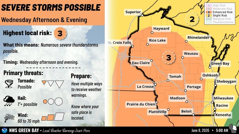
Rebecca Kruk, a meteorologist at the National Weather Service Green Bay, said the greatest risk of severe weather this week is June 10. The strongest risk is in central Wisconsin, but all severe weather hazards are possible in the Fox Valley, including damaging winds, large hail and tornadoes.

The storms will fall under two time frames June 10, with the first round of thunderstorms beginning early in the morning and then stronger storms arriving in the late afternoon and evening, Kruk said.
“It’s not that every single person would receive the same amount,” Kruk said. “It would be very scattered in terms of precipitation amounts. Some places could receive half an inch and some places could even receive an inch.”
It will also be a hot and humid day, with the high reaching 91 degrees in the Appleton area.
There is less of a chance of showers June 11 but more rain could arrive in the afternoon.
Appleton weather radar
Contact Benita Mathew at bmathew@usatodayco.com.
This article originally appeared on Appleton Post-Crescent: Damaging winds, hail, tornadoes possible in Fox Valley later this week
Reporting by Benita Mathew, Green Bay Press-Gazette / Appleton Post-Crescent
USA TODAY Network via Reuters Connect
By Benita Mathew, Green Bay Press-Gazette | USA TODAY Network