After a hot weekend capped off by severe thunderstorms, rain and thunderstorms could return to West Texas skies as soon as Tuesday.
The National Weather Service in Lubbock expects at least a chance for rain and thunderstorms Tuesday through the weekend, with slightly cooler temperatures also in store starting Wednesday.

What’s the forecast for rain, thunderstorms in Lubbock this week?
Expect highs in the low to mid 90s on Monday around Lubbock, with no significant chance for precipitation after the South Plains saw widespread storms Sunday evening.
A cool front will drop daytime highs into the upper 70s and 80s around the South Plains Wednesday through Saturday.
In Lubbock, there’s a 70 percent chance for thunderstorms Tuesday night, increasing to 80 percent Wednesday and 70 percent Wednesday night and Thursday. Precipitation chances drop back to 60 percent on Friday.
This week’s storm chances could help Lubbock and the South Plains make up for the dry start to the year and lingering drought conditions, which have eased slightly in recent weeks thanks to some timely May rains.
How much rain has Lubbock seen so far in 2026?
Still, Lubbock is well behind its average precipitation total for the year.
Storms in late May were helpful, bringing the month’s total to more than 2 inches – still behind the average 2.49 inches for the month, according to National Weather Service data.
For the year to date, Lubbock has seen about 4 inches of precipitation compared to a year-to-date average just above 6.2 inches.
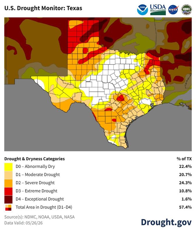
The latest Texas Drought monitor map released May 28, but using data collected before storms on May 26, showed slight improvement in the region’s overall drought conditions, although most of the South Plains remained in severe-to-extreme drought condition status.
This article originally appeared on Lubbock Avalanche-Journal: Rain, thunderstorms, cooler temps are in Lubbock’s forecast this week
Reporting by Adam D. Young, Lubbock Avalanche-Journal / Lubbock Avalanche-Journal
USA TODAY Network via Reuters Connect