A major heatwave is headed toward Greater Akron.
But first it will be a bit stormy.

The National Weather Service says rain and rumbles of thunder are expected across northern Ohio on Tuesday.
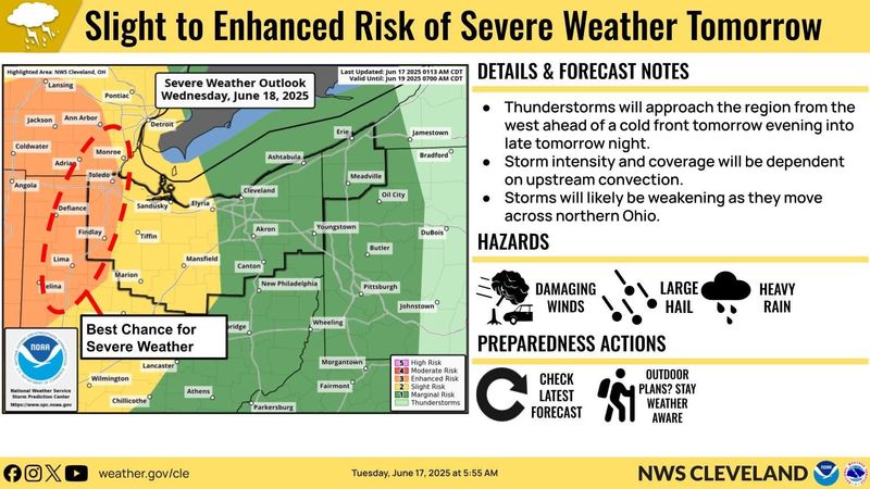
Some of the storms possible on Wednesday could be strong to severe, according to the Storm Prediction Center.
The biggest threat, forecasters say, with Wednesday’s expected outbreak of severe storms will be damaging winds.
Large hail and heavy rain are also possible with the storms.
When will the heat wave arrive in Akron?
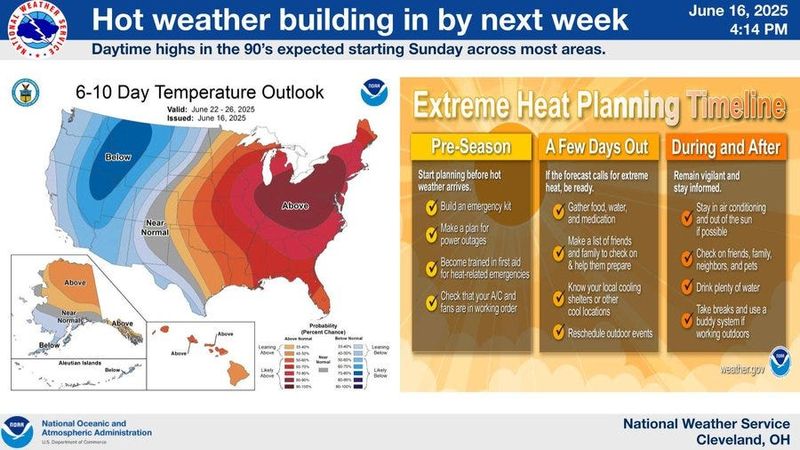
Highs this week are expected in the 80s before soaring over the weekend.
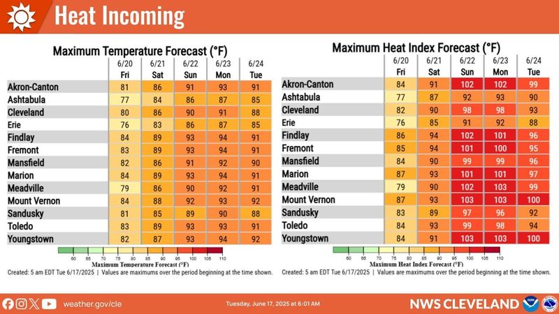
The National Weather Service says the warmest temperatures of the summer season will arrive starting Saturday with a high in the upper 80s expected.
The real heat arrives by Sunday with a high in the low 90s expected.
And little relief is in sight with highs in 90s expected on Monday and Tuesday.
The weather service says the Heat Index or so-called real feel temperature will be around 100 degrees Sunday through Tuesday.
The normal highs for this time of year are in the lower to mid 80s.
Akron weather radar
What’s the Greater Akron weather forecast?
Tuesday: A chance of showers and thunderstorms, then showers likely and possibly a thunderstorm after noon. Mostly cloudy, with a high near 82. Southwest wind 3 to 7 mph. Chance of precipitation is 70%. New rainfall amounts between a quarter and half of an inch possible.
Tuesday night: A chance of showers and thunderstorms, mainly after 2 a.m. Mostly cloudy, with a low around 68. Southwest wind around 6 mph. Chance of precipitation is 40%. New rainfall amounts of less than a tenth of an inch, except higher amounts possible in thunderstorms.
Wednesday: A chance of showers, with thunderstorms also possible after 11 a.m. Partly sunny, with a high near 85. Southwest wind 6 to 9 mph. Chance of precipitation is 50%. New rainfall amounts between a tenth and quarter of an inch, except higher amounts possible in thunderstorms.
Wednesday night: Showers likely and possibly a thunderstorm. Mostly cloudy, with a low around 69. Southwest wind 10 to 13 mph. Chance of precipitation is 60%. New rainfall amounts between a tenth and quarter of an inch, except higher amounts possible in thunderstorms.
Juneteenth: A chance of showers, with thunderstorms also possible after 11 a.m. Partly sunny, with a high near 77. West wind 9 to 13 mph. Chance of precipitation is 50%. New rainfall amounts of less than a tenth of an inch, except higher amounts possible in thunderstorms.
Thursday night: Mostly clear, with a low around 61.
Friday: Mostly sunny, with a high near 83.
Friday night: Partly cloudy, with a low around 67.
Saturday: Partly sunny, with a high near 88.
Saturday night: Partly cloudy, with a low around 72.
Sunday: Mostly sunny, with a high near 93.
Sunday night: Mostly clear, with a low around 74.
Monday: Sunny, with a high near 94.
Akron weather hourly
Need to know weather conditions by the hour? Make sure to check out our weather page here.
This article originally appeared on Akron Beacon Journal: Temperatures about to soar in Greater Akron. When will it hit 90-plus degrees?
Reporting by Craig Webb, Akron Beacon Journal / Akron Beacon Journal
USA TODAY Network via Reuters Connect