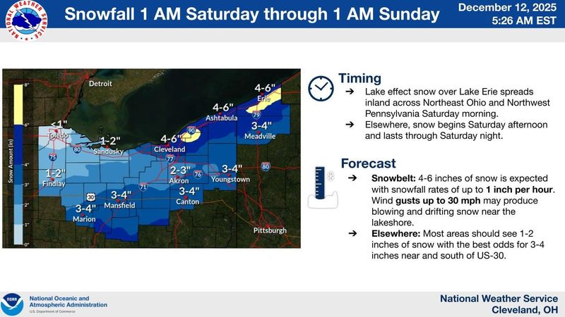
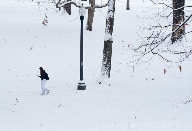
Travel could be “difficult” this weekend across northern Ohio.
The National Weather Service warns that “gusty winds, poor visibility and subzero wind chills possible” as bands of snow move across the region.

The hardest hit areas will likely be along the Lake Erie shoreline in the traditional snowbelt.
But some snow is expected throughout Greater Akron.
The weather service says widespread snow is expected Saturday afternoon through the evening.
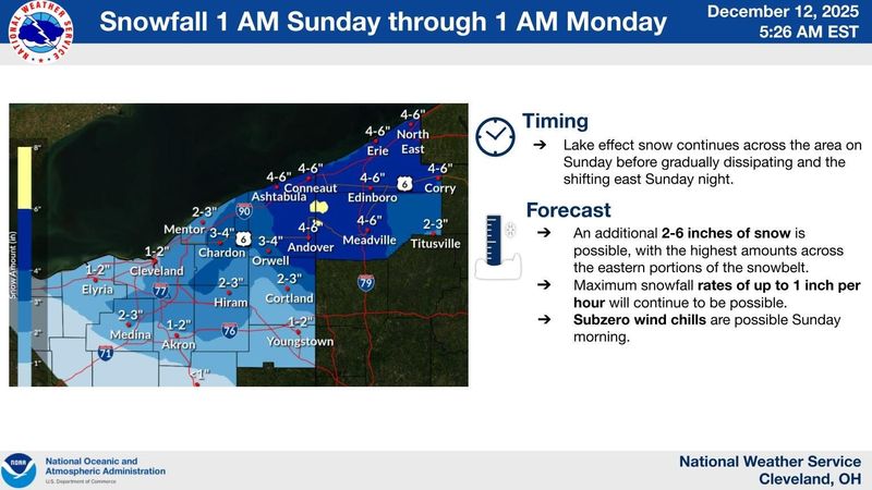
Another round of snow is expected on Sunday.
As many as four more inches of snow or more is possible in Greater Akron if “persistent” snow squalls settle Saturday through Sunday.
Windchills of 5 degrees to 10 degrees below zero are expected early Sunday and Monday mornings.
The city of Akron has activated its warming centers.
The Summit Lake Community Center at 380 W. Crosier St. will be open from 8 a.m. to 10 p.m. Sunday, Dec. 14, and Monday, Dec. 15.
The Emergency Overnight Shelter at 111 East Voris St. will be open from 7 p.m. to 8 a.m. Friday, Saturday, Sunday and Monday.
The deep chill is expected to come to an end next week.
The high on Wednesday will be in the 40s and reach nearly 50 degrees by Thursday.
Greater Akron weather radar
Greater Akron weather forecast
Friday: Mostly sunny, with a high near 31. Light southwest wind.
Friday night: Increasing clouds, with a low around 20. Calm wind becoming southwest 5 to 9 mph in the evening.
Saturday: Snow, mainly after 1 p.m. High near 29. West wind 10 to 13 mph, with gusts as high as 23 mph. Chance of precipitation is 80%. New snow accumulation of 1 to 2 inches possible.
Saturday night: Snow, mainly before 1 a.m. Low around 10. Wind chill values as low as -2. West wind 8 to 10 mph, with gusts as high as 21 mph. Chance of precipitation is 80%. New snow accumulation of 1 to 3 inches possible.
Sunday: Snow likely, mainly before 1 p.m. Mostly cloudy, with a high near 21. West wind 10 to 15 mph, with gusts as high as 28 mph. Chance of precipitation is 60%. New snow accumulation of 1 to 2 inches possible.
Sunday night: A slight chance of snow before 1 a.m. Mostly cloudy, with a low around 12. Chance of precipitation is 20%.
Monday: Mostly cloudy, with a high near 22.
Monday night: Partly cloudy, with a low around 13.
Tuesday: Partly sunny, with a high near 32.
Tuesday night: Mostly cloudy, with a low around 26.
Wednesday: Mostly cloudy, with a high near 42.
Wednesday night: A chance of rain. Mostly cloudy, with a low around 35. Chance of precipitation is 40%.
Thursday: Rain likely. Mostly cloudy, with a high near 50. Chance of precipitation is 70%.
Akron weather hourly
Need to know weather conditions by the hour? Make sure to check out our weather page here.
This article originally appeared on Akron Beacon Journal: Snow and wind could make travel ‘difficult’ in Akron this weekend
Reporting by Craig Webb, Akron Beacon Journal / Akron Beacon Journal
USA TODAY Network via Reuters Connect