This story has been updated with new information.
Cancellations and snow emergency declarations went into effect as snow started to fall Saturday evening across Greater Cincinnati.

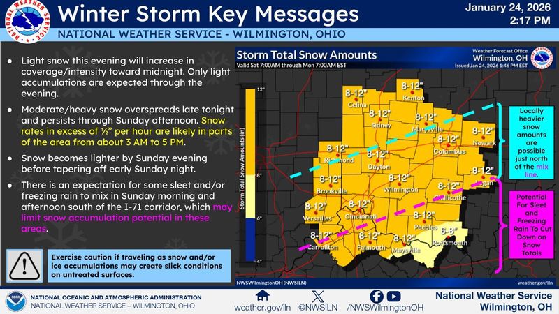
Accumulations of 2 to 5 inches of dry, fluffy snow are likely overnight Saturday, Jan. 24, according to the National Weather Service in Wilmington.
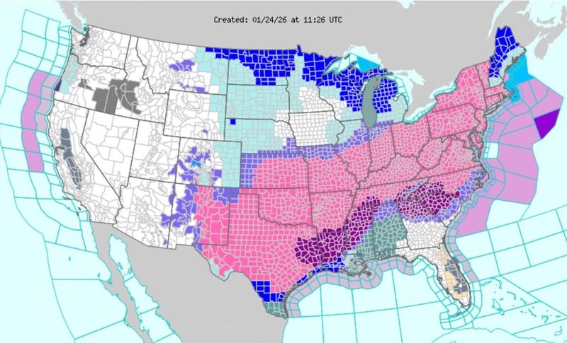
A winter storm warning began for most of Ohio, Indiana and all of Kentucky ahead of the storm as up to a foot of snow is possible. The warning will continue until noon Jan. 26.
Total snow accumulations of 9 to 12 inches are possible, according to the National Weather Service in Wilmington. The chance for mixed frozen precipitation has increased for southern Ohio and northeastern Kentucky. Sleet is possible as far north as Cincinnati.
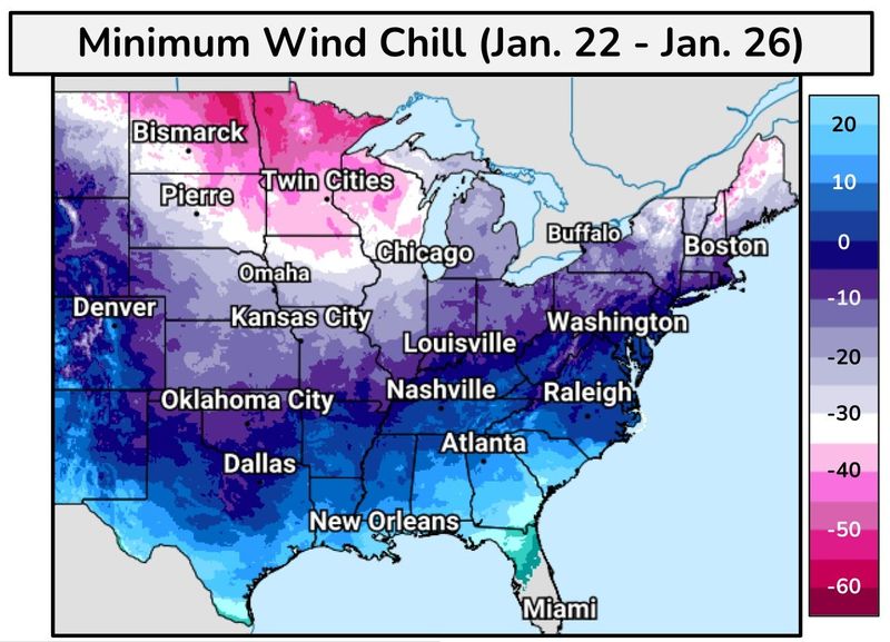
Additionally, a cold weather advisory and an extreme cold watch are set to take effect Jan. 26 as wind chill values as low as between negative 15 and 25 degrees are possible.
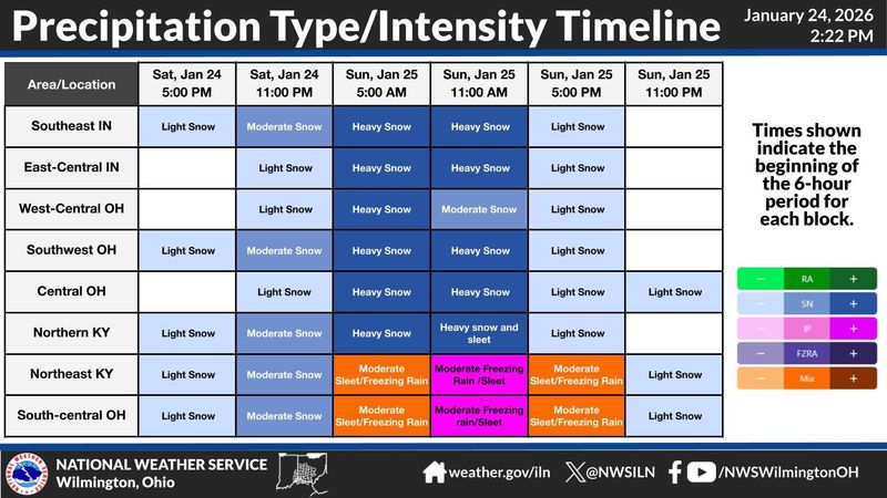
How much will it snow in Cincinnati and when? See timeline
The initial round of snowfall Saturday afternoon and evening will not be significant, according to forecasters, with only an inch or 2 predicted for most locations before there is a lull in snowfall. The majority of the snowfall will happen on Sunday, Jan. 25.
“We have pretty high confidence that Cincinnati will see 9 inches of snow through the entirety of the event,” meteorologist Kristen Cassady told The Enquirer.
Breaking down the snow timing:
Moderate to heavy snow arrives about daybreak Sunday, according to the weather service. Snowfall rates of 1/2 inch an hour or more are likely in parts of the region from 7 a.m. to 5 p.m. Sunday, according to forecasters.
Snow becomes light on Sunday evening, ending by Monday morning.
After the winter storm passes, snow will possibly return to the area Wednesday into Thursday but amounts are expected to be minimal.
Dozens of CVG flights canceled, delayed
Dozens of flights to and from Cincinnati/Northern Kentucky International Airport have either been canceled or delayed late Saturday afternoon, Jan. 24, as the winter storm moves in.
The airport, locally known as CVG, posted a brief notice on its website, saying travelers should check flight status before heading to the airport and to monitor traffic conditions.
Arrivals: 57 flights are shown as canceled, 13 are delated and 52 flights are shown as scheduled to depart through 4:43 p.m. Sunday.
Departures: 77 flights are shown as canceled, one is delayed and 32 still scheduled to leave, through 5:55 p.m. Sunday.
Travelers can check their status of their departing or arriving flights via CVG’s tracker on its website.
What is the snow emergency level?
Several counties and cities across Greater Cincinnati have announced snow emergencies ahead of the winter storm.
Hamilton County in Ohio declared a level 1 snow emergency around 7:15 p.m. on Jan. 24, according to statement from the sheriff’s office. Boone, Kenton and Campbell counties in Northern Kentucky have each declared a level 1 snow emergency. All took effect at noon Saturday, Jan. 24.
Under level 1, no roads are closed but unnecessary travel is discouraged.
In Indiana, Dearborn County is under a “yellow” travel advisory, signifying that routine travel or activities may be restricted in areas because of a hazardous situation, and individuals should use caution or avoid those areas.
In addition, Kentucky Gov. Andy Beshear declared a state of emergency ahead of the storm, which allows for the activation of state resources, including Kentucky Emergency Management and the Kentucky National Guard. Ohio Gov. Mike DeWine declared one on Saturday afternoon.
To see a list of snow emergencies across Greater Cincinnati, visit here.
What’s closed Sunday?
Many churches and some business will be closed Sunday, Jan. 25, due to the winter storm.
Goodwill announced that 20 Cincinnati-area locations will be closed and the Aronoff Center for the Arts canceled two Jan. 25 showings of an Alicia Keys musical.
To see a full list of closures, visit here.
Extreme cold temperatures and wind chills
Dangerously cold temperatures with wind chills below zero are possible over the next few days.
A cold weather advisory is in place until noon Saturday. Wind chills below zero are expected on Monday and Tuesday mornings, and temperatures expected to remain below freezing through the entire week, according to the weather service.
What is a winter storm warning?
A winter storm warning is issued when there is an 80% or greater chance of a winter storm and conditions pose a threat to life or property. Travel will be difficult or impossible.
The following conditions merit a winter storm warning:
Weather forecast for Cincinnati
Saturday night: Snow. Low around 13. Northeast wind around 6 mph. Chance of precipitation is 90%. New snow accumulation of 2 to 4 inches possible.
Sunday: Snow. The snow could be heavy at times. High near 23. Northeast wind 6 to 9 mph. Chance of precipitation is 100%. New snow accumulation of 4 to 8 inches possible.
Saturday night: Snow, mainly after 10 p.m. The snow could be heavy at times. Low around 15. East wind around 6 mph. Chance of precipitation is 100%. Total nighttime snow accumulation of 3 to 5 inches possible.
Sunday: Snow before 1 p.m., then snow, possibly mixed with sleet between 1 p.m. and 3 p.m., then snow after 3 p.m. The snow could be heavy at times. High near 24. North wind 6 to 9 mph. Chance of precipitation is 100%. New snow and sleet accumulation of 4 to 8 inches possible.
Sunday night: A chance of snow, mainly before 1 am. Mostly cloudy, with a low around 6. Northwest wind 6 to 9 mph. Chance of precipitation is 50%. New snow accumulation of less than one inch possible.
Monday: A chance of flurries. Mostly sunny, with a high near 14. Wind chill values as low as negative 5. West wind 6 to 10 mph, with gusts as high as 21 mph.
Monday night: Mostly clear, with a low around negative 2. Southwest wind around 7 mph.
Tuesday: Mostly sunny, with a high near 22.
Tuesday night: Mostly cloudy, with a low around 1.
Wednesday: Partly sunny, with a high near 18.
Wednesday night: A chance of snow before 1 a.m. Mostly cloudy, with a low around 4. Chance of precipitation is 30%.
Thursday: Partly sunny, with a high near 19.
Thursday night: Partly cloudy, with a low around minus 1.
Friday: Partly sunny, with a high near 19.
Source: National Weather Service in Wilmington
We’ve made this story available for free to all users in the interest of public safety. Please consider supporting local journalists covering the community through a subscription.
This article originally appeared on Cincinnati Enquirer: Timing and impact as winter storm hits Ohio, Kentucky. See forecast updates
Reporting by Cheryl Vari, Gillian Stawiszynski and Matthew Cupelli, Cincinnati Enquirer / Cincinnati Enquirer
USA TODAY Network via Reuters Connect