Stark County will continue to see the potential for rain today, along with winds that could gust up to 35 mph. Skies will be mostly cloudy.
The National Weather Service forecast also says much cooler temperatures will arrive mid-week and persist through the weekend. The potential for frost and freezing returns Thursday through Saturday nights.

Nighttime low temperatures are expected to be in the upper 30s on Wednesday and Thursday, and mid 30s on Friday and Saturday. The forecast low on Sunday night is in the lower 40s.
Today’s high will be in the lower 70s, and the nighttime low, in the lower 50s. The chance of rain is 50% during the day and 30% at night.
Wednesday will bring a slight chance of thunderstorms. Expect showers with a high in the upper 50s. The chance of rain is 90% during the day and 70% at night.
Highs are expected to be in the mid 50s on Thursday, lower 50s on Friday and Saturday and upper 50s on Sunday. The high temperature is expected to be in the lower 60s on Monday.
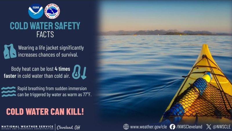
Cold water safety tips
The National Weather Service is observing Lake Erie Cold Water Safety Week, and provides these facts about cold water safety:
The weather service advises that people should treat any water temperature below 70 degrees with caution.
This article originally appeared on The Repository: Frost may return this week in Canton region, National Weather Service says
Reporting by Canton Repository / The Repository
USA TODAY Network via Reuters Connect