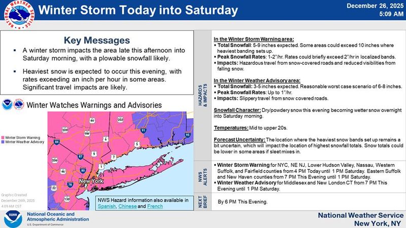
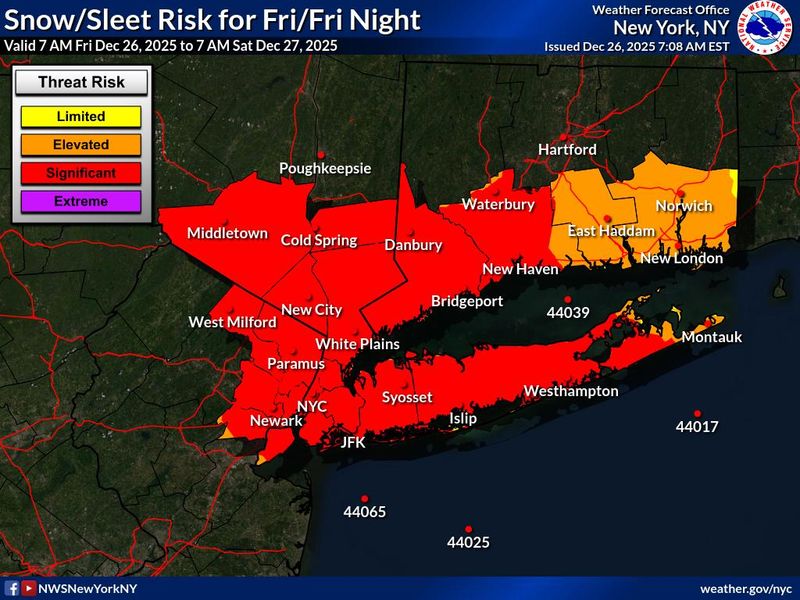
Winter weather is on the way for the Lower Hudson Valley Friday, Dec. 26, and the National Weather Service says some areas of the region could see up to 9 inches of snow.
The NWS also issued a winter storm warning for the region, starting at 4 p.m. Friday.

The warning, which is set to last until 1 p.m. Saturday, calls for total snow accumulations between 5 and 9 inches in portions of southern Connecticut, northeast New Jersey and southeast New York.
“Travel could be very difficult. The hazardous conditions could impact the Friday evening commute,” the warning reads. “If you must travel, keep an extra flashlight, food, and water in your vehicle in case of an emergency. Check local Department of Transportation information services for the latest road conditions.”
What does the Dec. 26 forecast say?
The NWS says there’s 60% chance of snow in the region, with the snow likely to start after 5 p.m. In Rockland and Westchester, expect high temperatures near 29 degrees, with wind chill values between 10 and 20. It’ll be colder in Putnam County, with highs near 26 and wind chill values between 5 and 15.
How much snow will we get in Lower Hudson Valley?
We may only see around an inch of snow during the day on Friday, but the real heavy stuff will start at night.
With 100% chance of precipitation come nightfall, the entire region could see between 5 and 9 inches of snow Friday night.
The white stuff could continue falling the next day, as there’s a 30-40% chance of snow Saturday morning.
According to an AccuWeather forecast, Friday’s quick-moving Alberta clipper storm will “tap into fresh Arctic air and just enough moisture to bring accumulating snow heavy enough to shovel and plow from central New York state to coastal areas of New York, New Jersey and Connecticut from Friday through early Saturday.”
“This fast-moving storm will pack a punch in the Northeast right after Christmas. Holiday travelers should prepare for major slowdowns on roads and at airports,” AccuWeather Senior Meteorologist Tyler Roys said.
“Travel plans could be delayed or disrupted for millions of people trying to visit loved ones or returning home after Christmas. The busy period for shopping, gift exchanges and returns after Christmas may also be impacted,” Roys said.
This article originally appeared on Rockland/Westchester Journal News: How much snow will we get in Westchester, Rockland? See the forecast
Reporting by Ashley Catherine Fontones, Rockland/Westchester Journal News / Rockland/Westchester Journal News
USA TODAY Network via Reuters Connect