
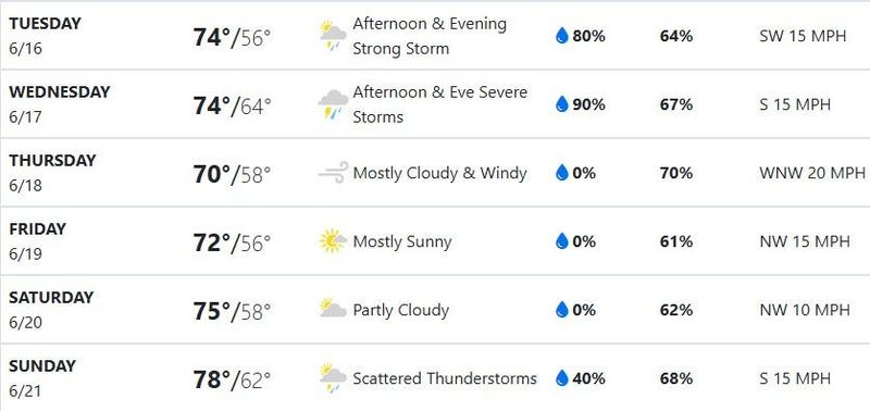
SOUTH BEND — While much of the Midwest braces for another round of storms, it appears the South Bend area may escape the worst of it.
The Tribune’s newsgathering partner WNDU forecasts that a broken line of showers and thunderstorms could move into the area in the early afternoon into early evening, though “the timing should help limit the severe threat due to limited daytime heating.” Severe thunderstorms generally arise in hotter conditions, WNDU said.

Residents should be ready for a stronger potential for storms Wednesday, WNDU forecasts, with the highest potential being late afternoon through the evening.
WNDU stressed that Wednesday’s storms are not predicted to be as severe or damaging as the outbreak of storms last week.
The South Bend area should then see a period of three days with calmer weather and moderate temperatures, WNDU forecasts, before Father’s Day arrives on Sunday, June 21, with slightly warmer temperatures and scattered thunderstorms.
This article originally appeared on South Bend Tribune: Storms possible in coming days, including Father’s Day, but not so bad
Reporting by Cory Havens, South Bend Tribune / South Bend Tribune
USA TODAY Network via Reuters Connect
By Cory Havens, South Bend Tribune | USA TODAY Network