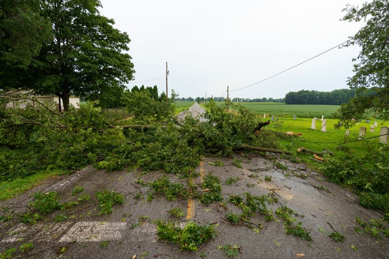
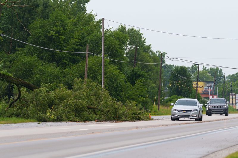
More than a thousand customers across Michiana are still without power on Wednesday, Aug. 12, after the region was hit with severe weather on Tuesday afternoon.
As of noon Wednesday, Indiana Michigan Power’s outage map reports over 1,600 customers without power as far south as North Liberty, as far west as Springfield, Ill., as far north as Berrien Springs and as far east as White Pigeon. In South Bend alone, I&M reports over 270 customer outages as of noon.

At 1 p.m. Wednesday, I&M sent a press release with an update on power restoration. According to the company, crews worked throughout Tuesday night to restore power to customers impacted by the storms, and more than 1,450 workers continue the restoration on Wednesday.
The power company says all affected customers in the Muncie and Fort Wayne regions have been restored, along with most customers in the Michigan and South Bend areas. The company expects to have power restored by 6 p.m. Wednesday for customers whose homes or businesses can safely receive power.
But, I&M says, with additional severe weather possible on Wednesday, and because the ground is already saturated, there is an increased risk of trees uprooting or falling.
“We will remain fully staffed and ready to respond if more storms occur,” I&M says. “Our focus is on restoring power safely and quickly so customers can get back to their daily routines. We thank our customers for their patience and understanding as communities recover from these storms.”
I&M says another update will be released at 6 p.m. Wednesday, with information available on the power company’s website, social media pages and app.
Heavy rainfall, high winds reported
According to the National Weather Service, the South Bend region saw heavy rainfall and high winds, along with a tornado warning, on Tuesday afternoon.
While NWS says that no tornadoes were reported in the Northern Indiana office’s coverage area, one-inch hail and over an inch of rainfall were seen in St. Joseph County on Tuesday. The county also saw winds up to 60 miles per hour; the strongest winds were reported in Marshall County with gusts up to 75 miles per hour.
Jim Andersen, a lead meteorologist at NWS’s Northern Indiana office, told The Tribune that even though no tornadoes were reported, Tuesday’s tornado sirens and warning were out of an abundance of caution. The Chicago area saw winds around 90 miles per hour, he said, and the office was concerned those conditions would head toward Indiana.
“We put the tornado warning out because anytime you get very strong winds like we were seeing, you can also get little spin-ups that maybe don’t appear on the radar very readily,” Andersen said. “And so we wanted to actually make sure we were covering that and protecting everybody from the potential.”
Andersen added that the region did see high winds, but they just weren’t as high as what was possible.
As of around 5 p.m. Tuesday, the Storm Prediction Center has classified the storm as a derecho, defined as a “widespread severe windstorm characterized by a family of destructive downbursts containing multiple 75+ mph gusts.”
More severe weather possible Wednesday
NWS says showers and thunderstorms are likely to hit the South Bend region again Wednesday, mainly before 3 p.m. Conditions Wednesday afternoon will be mostly cloudy, with a high near 82 and wind speeds between five and 10 miles per hour.
Andersen said the South Bend region is currently under a severe thunderstorm warning, with storms seen to the west of the area. But, he added, the storms aren’t expected to be as strong as Tuesday’s.
NWS predicts a 60% chance of precipitation Wednesday afternoon, with less than an inch of rainfall expected, although higher amounts could be seen if thunderstorms hit the area.
Wednesday night has a 10% chance of showers and thunderstorms before 8 p.m., NWS says. Conditions will be mostly cloudy, winds around five miles per hour and patchy fog after 2 a.m.
Email South Bend Tribune staff reporter Rayleigh Deaton at rdeaton@usatodayco.com.
This article originally appeared on South Bend Tribune: Power outage endures in South Bend area; tornado warning precautionary
Reporting by Rayleigh Deaton, South Bend Tribune / South Bend Tribune
USA TODAY Network via Reuters Connect


By Rayleigh Deaton, South Bend Tribune | USA TODAY Network