The flood risk across central Indiana continues on Thursday, March 5, as a flood watch issued by the National Weather Service remains in effect until noon.
Scattered showers and thunderstorms continue to be possible throughout the day, with rainfall amounts between a quarter and half inch possible, according to the NWS forecast.

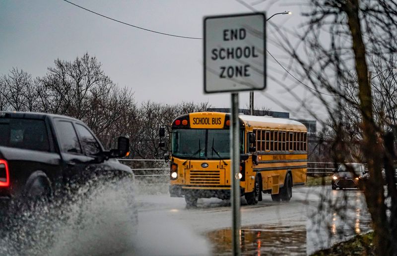
NWS recommends Hoosiers drive with caution as roads may be slick due to the excessive rainfall and keep a close eye on the weather to stay aware in case any flood warnings are issued.
➤ Weather alerts via text: Sign up to get updates about current storms and weather events by location
Are Indiana counties under flood watches or flood warnings?
A flood watch has been issued for the following Indiana counties through noon Thursday, March 5: Bartholomew, Brown, Clay, Daviess, Decatur, Greene, Hancock, Hendricks, Henry, Jackson, Jennings, Johnson, Knox, Lawrence, Marion, Martin, Monroe, Morgan, Owen, Parke, Putnam, Rush, Shelby, Sullivan, Vermillion and Vigo.
Flood warnings have also been issued for the following rivers: Buck Creek at Acton, Sugar Creek near Edinburgh, Clifty Creek at Hartsville and Mill Creek near Cataract.
Find the most relevant information about flood watches and warnings by visiting the Watches, Warnings & Advisories page on the NWS website, weather.forecast.gov.
Driving in Indianapolis? Check road conditions on life traffic map, per Waze
Drivers can use a free live traffic map from Waze to navigate Indianapolis. The navigation app from Waze provides traffic updates, road condition information and offers directions.
Check local travel advisories
Hoosiers can check the Indiana Department of Homeland Security’s travel advisory map to see if their local county has issued an advisory based on the road conditions.
Yellow is the lowest level of advisory and it means routine travel or activities may be restricted in areas because of a hazardous situation, and individuals should use caution or avoid these areas.
Orange is a travel watch which means conditions are threatening to the safety of the public. Only essential travel, such as to and from work or in emergency situations, is recommended, and emergency action plans should be implemented by businesses, schools, government agencies and other organizations.
Red is a travel warning, which is the highest level of travel advisory. Travel may be restricted to emergency management workers only. Under a travel warning Hoosiers should refrain from all travel until conditions are deemed safe.
How to stay safe if there is flooding
Each year, more deaths occur due to flooding than from any other thunderstorm related hazard, according to the NWS.
The Centers for Disease Control and Prevention report that over half of all flood-related drownings occur when a vehicle is driven into hazardous flood water.
If flooding is possible or expected, you should know the difference between a watch, advisory and warning according to NWS.
The most important thing to remember in areas where there is flooding: “Turn around, don’t drown.”
It is crucial that you turn around if you see standing or flowing water. It only takes 12 inches of water to sweep your car away.
NWS advises commuters to never drive around barriers blocking flooded areas and to follow signage that advises you to turn around. It is possible for roads to collapse underwater, making them impossible for drivers to see.
Indianapolis weather radar
Indianapolis weather forecast
Visit forecast.weather.gov for the most up-to-date forecast.
Thursday, March 5: Showers and possibly a thunderstorm, mainly before 10 a.m., then scattered showers and thunderstorms after 10 a.m.. Patchy fog before noon. High near 65. Southwest wind 5 to 10 mph, with gusts as high as 21 mph. Chance of precipitation is 100%. New rainfall amounts between a quarter and half of an inch possible.
Thursday night: Scattered showers, with thunderstorms also possible after 4 a.m. Patchy fog after 11 p.m. Otherwise, cloudy, with a low around 55. West southwest wind around 5 mph becoming calm in the evening. Chance of precipitation is 30%.
Friday, March 6: Scattered showers and thunderstorms before 4 p.m., then isolated showers. Patchy fog before 8am. Otherwise, mostly cloudy, with a high near 76. South southwest wind 6 to 14 mph, with gusts as high as 25 mph. Chance of precipitation is 50%. New rainfall amounts of less than a tenth of an inch, except higher amounts possible in thunderstorms.
Friday night: Scattered showers and thunderstorms after 1 a.m. Mostly cloudy, with a low around 62. South wind 10 to 13 mph, with gusts as high as 24 mph. Chance of precipitation is 50%. New rainfall amounts between a tenth and quarter of an inch, except higher amounts possible in thunderstorms.
Saturday, March 7: Showers and possibly a thunderstorm. High near 68. South southwest wind 14 to 16 mph, with gusts as high as 29 mph. Chance of precipitation is 90%. New precipitation amounts between a quarter and half of an inch possible.
Saturday night: Mostly cloudy, with a low around 41. West wind 5 to 9 mph becoming light northwest after midnight. Winds could gust as high as 20 mph.
Sunday, March 8: Mostly sunny, with a high near 60. Light and variable wind becoming west southwest 5 to 9 mph in the morning.
Sunday night: Mostly clear, with a low around 46. Southwest wind around 6 mph.
Katie Wiseman is a trending news reporter for IndyStar and Midwest Connect. Contact her at klwiseman@usatodayco.com. Follow her on Bluesky @katiewiseman and X, formerly Twitter, at @itskatiewiseman.
This article originally appeared on Indianapolis Star: Flood watch continues for central Indiana on March 5
Reporting by Katie Wiseman, Indianapolis Star / Indianapolis Star
USA TODAY Network via Reuters Connect