Rain in central Indiana will continue during the afternoon and evening hours Tuesday, May 19, according to the National Weather Service, renewing flooding concerns, especially near and south of Interstate 70. Between two to four inches of rain fell on Monday.
“Thunderstorms are likely this afternoon into this evening,” NWS said in the hazardous weather outlook. “Severe storms will be possible, with damaging winds the primary threat. Storms will also be capable of producing heavy rainfall and localized flooding.”

Showers and thunderstorms are most likely after 5 p.m., according to NWS Indianapolis. The forecast for most of Tuesday is expected to be partly sunny, with a high near 84.
How to stay safe if there is flooding
Each year, more deaths occur due to flooding than from any other thunderstorm related hazard, according to the NWS.
The Centers for Disease Control and Prevention report that over half of all flood-related drownings occur when a vehicle is driven into hazardous flood water.
If flooding is possible or expected, you should know the difference between a watch, advisory and warning according to NWS.
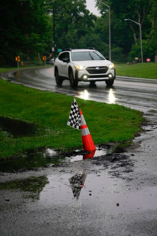
Story continues after photo gallery.
Turn around, don’t drown
The most important thing to remember in areas where there is flooding: “Turn around, don’t drown.”
It is crucial that you turn around if you see standing or flowing water. It only takes 12 inches of water to sweep your car away.
NWS advises commuters to never drive around barriers blocking flooded areas and to follow signage that advises you to turn around. It is possible for roads to collapse underwater, making them impossible for drivers to see.
Indiana weather radar
Weekly forecast
Tuesday, May 19: Showers and thunderstorms likely, mainly after 5 p.m. Partly sunny, with a high near 84. Southwest wind 11 to 17 mph, with gusts as high as 30 mph. Chance of precipitation is 60%. New rainfall amounts between a tenth and quarter of an inch, except higher amounts possible in thunderstorms.
Tuesday night: Showers and thunderstorms before 9 p.m., then showers likely and possibly a thunderstorm between 9 p.m. and 2 a.m., then showers likely after 2 a.m. Low around 59. Southwest wind 6 to 10 mph, with gusts as high as 21 mph. Chance of precipitation is 80%. New rainfall amounts between a half and three quarters of an inch possible.
Wednesday, May 20: A 30% chance of showers, mainly before 9 a.m. Mostly cloudy, with a high near 69. North wind around 10 mph, with gusts as high as 18 mph.
Wednesday night: Mostly cloudy, with a low around 50. North northeast wind around 9 mph.
Thursday, May 21: Mostly sunny, with a high near 67. East northeast wind around 11 mph, with gusts as high as 21 mph.
Thursday night: A 30% chance of showers after 2 a.m. Mostly cloudy, with a low around 53. East northeast wind around 9 mph, with gusts as high as 18 mph.
Friday, May 22: Showers likely, then showers and possibly a thunderstorm after 2 p.m. High near 71. East wind around 9 mph. Chance of precipitation is 90%.
Friday night: Showers and possibly a thunderstorm, mainly before 2 a.m., then a chance of showers and thunderstorms after 2 a.m. Low around 61. East southeast wind 7 to 9 mph becoming south southwest after midnight. Chance of precipitation is 80%.
Saturday, May 23: A chance of showers and thunderstorms before 8 a.m., then a chance of showers between 8 a.m. and 2 p.m., then a chance of showers and thunderstorms after 2 p.m. Mostly cloudy, with a high near 78. West wind around 7 mph. Chance of precipitation is 40%.
Saturday night: A 30% chance of showers and thunderstorms, mainly before 8 p.m. Mostly cloudy, with a low around 62. Northwest wind around 5 mph becoming calm in the evening.
Sunday, May 24 – Indy 500: A 30% chance of showers and thunderstorms. Mostly cloudy, with a high near 81.
Sunday night: A 20% chance of showers and thunderstorms. Mostly cloudy, with a low around 64.
Monday, May 25 – Memorial Day: A 40% chance of showers and thunderstorms. Mostly cloudy, with a high near 83.
Katie Wiseman covers trending news for IndyStar and Midwest Connect. Contact her at klwiseman@indystar.com. Follow her on Bluesky, Twitter and Instagram.
This article originally appeared on Indianapolis Star: Central Indiana has more rain, flooding risk possible May 19
Reporting by Katie Wiseman, Indianapolis Star / Indianapolis Star
USA TODAY Network via Reuters Connect