Leon County may not always be the first place that comes to mind when people think of Florida agriculture – but it should be. The county significantly contributes to Florida’s agriculture through specialized crops, livestock, and horticultural education, with 325 farms covering 20.42% of its land and supporting economic vitality, community identity, and sustainability.
In Leon County, agricultural, silvicultural, and natural resource-based activities within the Rural Zoning District (R) have traditionally been guided and monitored through professional planning and land management offices. However, limited attention has been given to identifying and strategically integrating marginal and underutilized lands in both rural and urban areas, despite their potential to contribute to sustainable land use, food systems, environmental resilience, and community development. That balance matters in a state where urban sprawl often wins.

With its warm climate, long growing season, and reliable access to water, Leon County is uniquely positioned to serve as a winter food supplier, not just for Florida but for the nation.
In 2017, the market value of products sold in Leon County was over $5.5 million, with a strong emphasis on crops (73% of sales). And yet, this potential is quietly slipping away.
Why do marginal lands matter?
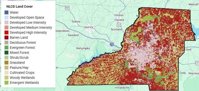
Florida agriculture often overlooks so-called marginal lands, even though their challenging conditions can serve as valuable opportunities for innovation rather than wasted landscapes. In Leon County, this includes cattle pasturelands and vast pine flatwoods that dominate our region. While these lands are poorly suited for intensive farming, they hold strong potential for alternative crops, pollinator habitats, renewable bioenergy feedstocks, and natural buffers that protect soil and water.
Bringing marginal lands into the public conversation can expand our toolkit for sustainable agriculture and strengthen agroecosystem resilience. Instead of forcing these landscapes to fit traditional models of production, the county should invest in approaches that work with their natural conditions.
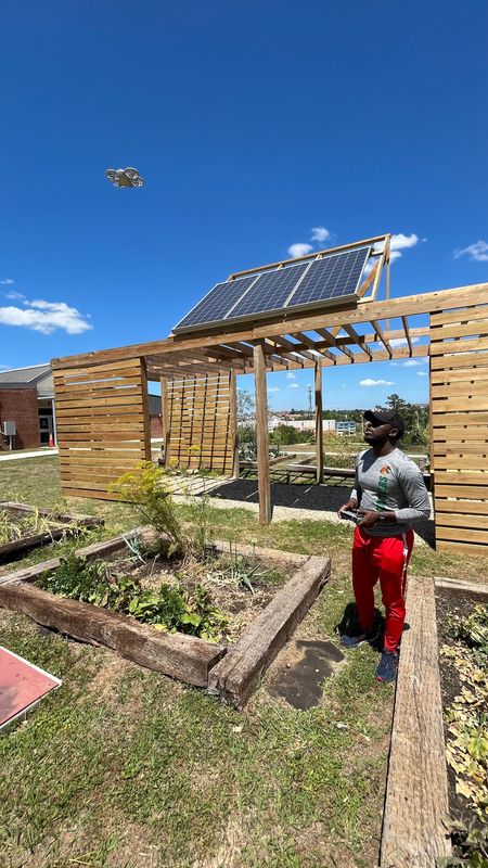
Unlocking the potential of drones
Drone technology is a silver bullet solution to rapidly identify marginal and underutilized lands in Leon County by capturing high-resolution imagery and applying geospatial AI to detect patterns such as poor vegetation health, soil degradation, or irregular land use. For this reason, multispectral drone data can reveal abandoned agricultural fields or nutrient-stressed soils at a small scale. Similarly, combining drone imagery with other satellite data and elevation models can highlight flood-prone or poorly drained areas in Leon County that are unsuitable for conventional farming but may support alternative uses like wetland restoration or climate-smart agriculture.
Understanding the value of land
While in Florida, farm classification is primarily based on use and economic activity rather than size, often aligned with criteria recognized by agencies such as the USDA, so drone data serves as a valuable supplement to records like sales, management, practices, and land registration. Even 2 acres of land or less is sufficient for a productive farm, particularly for market gardening, homesteading, specialty crops, or specialized niche farming, allowing food production or supplemental income.
A drone can give farmers a bird’s-eye view, data that simply can’t be obtained from the ground, and help optimize every square foot. The approach of drone data also strengthens urban farming and local food systems by helping identify productive small plots and monitor crop health in real time.
Relying on spatial reality, not assumptions
Farmers often make decisions based on assumptions, but a more effective approach is to integrate spatial reality through multiple lenses. Drones in agriculture are not only about technology but also about maximizing farm productivity while increasing resource efficiency. The farming is not uniform because the land is inherently variable. Precision agriculture enables farmers to apply inputs optimally, targeting only the specific zones that need attention, such as identifying nutrient-deficient patches in farms or poorly drained sections in row-crop fields, ultimately improving productivity while reducing costs and environmental impact.
Educating the next generation and sustainability
Leon County faces a pivotal opportunity to integrate geospatial and drone technologies into K–12 education while responsibly utilizing marginal lands, empowering the next generation with data-driven and climate-smart skills to transform degraded areas into sustainable, productive systems.
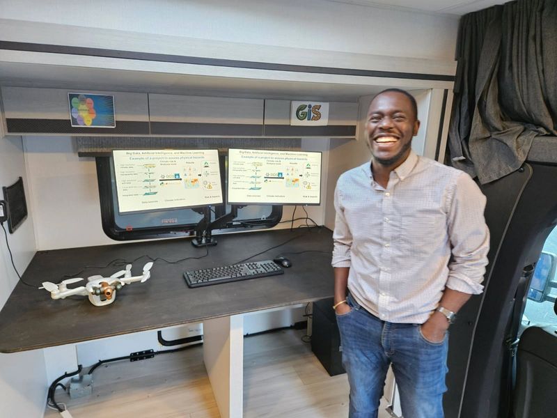
Hubert Hirwa, Ph.D., is assistant director of the Sustainability Institute at Florida Agricultural and Mechanical University.
JOIN THE CONVERSATION
Send letters to the editor (up to 200 words) or Your Turn columns (500-550 words) to letters@tallahassee.com. Please include your address for verification purposes only, and if you send a Your Turn, also include a photo and 1-2 line bio of yourself. You can also submit anonymous Zing!s at Tallahassee.com/Zing.Submissions are published on a space-available basis. All submissions may be edited for content, clarity and length, and may also be published by any part of the USA TODAY NETWORK.
This article originally appeared on Tallahassee Democrat: Unlocking Leon County’s hidden terrain through drone mapping | Opinion
Reporting by Hubert Hirwa, Your Turn / Tallahassee Democrat
USA TODAY Network via Reuters Connect