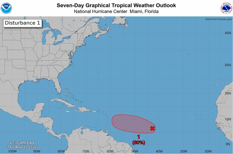
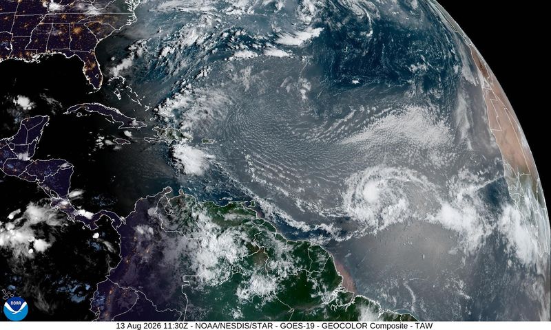
Invest 92L continues to lead a couple of tropical waves headed northwestward, and could join Tropical Depression Cristobal on the growing list of named storms in the Atlantic.
“The tropical wave east of the Caribbean is currently in a zone that is generally favorable for development this week,” AccuWeather Lead Hurricane Expert Alex DaSilva said. “The tropical wave has a high chance of development.”

“The most likely time for development of this tropical wave is from Thursday to Friday,” DaSilva said.
The likelihood that Invest 92L impacts Florida is still unclear, but the general outlook is favorable for the Sunshine State, according to AccuWeather. However, the following tropical wave, Invest 94L, could be one to keep an eye on.
Here’s what to know about the potential tropical storms.
Where is Invest 92L now?
Tropical Invest 92L is located about 1,000 miles east Lesser Antilles, a small island chain on the eastern edge of the Caribbean Sea, and the west coast of Africa, according to the National Hurricane Center.
The NHC believes that the system will likely form a short-lived tropical depression on Thursday or Friday before it moves into a region with strong persistent wind shear.
“Interests in the Lesser Antilles should monitor the progress of this system as gusty winds and areas of heavy rain are possible Friday night and Saturday, regardless of development,” the NHC wrote in its 7 a.m. update.
Where is Invest 94L now?
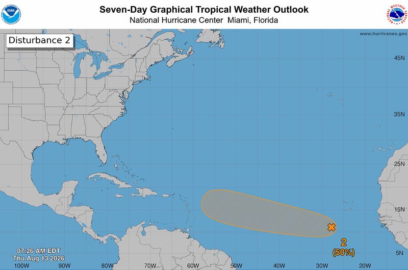
Invest 94L is more than 3,600 miles from Florida’s coast, located just a few hundred miles southwest of the Cabo Verde Islands near west Africa.
It is the third in a chain of tropical waves to move out of the area over the past week, and forecasters have it pegged as the one most likely to see some notable development.
“The first wave we were tracking croaked going into the Lesser Antilles, the second one we have a high risk on, but it doesn’t have spin with it, and the new one, we have a medium risk on because it’s pretty robust,” DaSilva said. “The first one that croaked primed the pump for the second one and the second one primed the pump for the one after.”
Bermuda-Azores High will determine the tropical waves’ paths
AccuWeather forecasters are looking at a weather feature known as the Bermuda-Azores High to help them figure out the paths of Invest 92L and 94L.
The Bermuda-Azores High is a semi-permanent area of high pressure over the North Atlantic that can steer tropical storm paths based on how strong or weak it is.
If the high-pressure area stays strong and elongated to the west, it could drive the two invests west and ultimately toward the United States. If it stays weak, the storms could curve into the North Atlantic.
A westward path doesn’t necessarily spell trouble for Florida, the invests would still need to battle strong wind shear around the Caribbean.
How strong and organized the tropical waves are once they get closer to the Lesser Antilles will be one of the biggest factors driving their path afterward, according to AccuWeather.
Could Florida’s Gulf Coast be impacted?
There are a lot of conditions that would need to be met for one of the invests to make it into the Gulf and impact the Florida Panhandle.
One of the waves would have to be in a generally weak state to take a southern path through the Caribbean, and then that weaker system would have to survive strong wind shear in the area.
“The storm would have to thread the needle to reach the Southeast coast of the United States sometime late next week and seems to be only a remote possibility at this point,” AccuWeather wrote in its forecast.
“The storm would have to stay organized and strong enough to survive extensive wind shear over the Caribbean. But if it gets too strong before reaching U.S mainland waters, it will turn north and track well east of the East Coast.”
Does this mean the Atlantic hurricane season will be more active than we thought?
Tropical activity always ramps up in August. The season typically peaks around Sept. 12, so having more tropical waves with the potential to generate tropical depressions or storms is normal.
A previous tropical wave carved the way for Invests 92L and 94L to follow in its path by disrupting some of the dry air that ultimately robbed the wave’s ability to continue development.
As the two invests move closer to the Lesser Antilles, they will feel more effects from the current El Niño pattern in the form of strong wind shear, but there’s also the chance they’re guided away from that direction altogether.
This article originally appeared on Pensacola News Journal: This weather feature will determine Invest 92L, 94L’s paths
Reporting by Brandon Girod, Pensacola News Journal / Pensacola News Journal
USA TODAY Network via Reuters Connect
By Brandon Girod, Pensacola News Journal | USA TODAY Network