

Saharan dust is back. A plume of dust carried by the wind all the way from the Sahara Desert is traveling thousands of miles through the atmosphere and is expected to skim over South Florida this week.
Every year during the summer and early fall, bursts of dust from the Saharan Desert are picked up by wind and form a big mass of dry, dusty air that sits about a mile up in the atmosphere at its lowest point.

This mass of dry, dusty air is called the Saharan Air Layer (SAL), and its activity ramps up from mid-June through mid-August, when it moves over the tropical North Atlantic Ocean every three to five days.
“During this peak period, it is common for individual SAL outbreaks to reach farther to the west — as far west as Florida, Central America and even Texas — and cover extensive areas of the Atlantic (sometimes as large as the lower 48 United States),” NOAA’s guide to the Saharan Air Layer says.
This layer of dust can help keep the tropics calm during hurricane season and create stunning sunsets, but it can also affect people with allergies or respiratory issues.
Here’s what Saharan dust is, how long the next plume is expected to last in Florida and how it impacts rain and hurricane season.
What is the Saharan dust layer?
The Saharan Air Layer (SAL) is a yearly phenomenon in which plumes of dust from the Sahara Desert are picked up by the wind and “ride” it across the ocean, being carried thousands of miles west.
“SAL outbreaks can form when ripples in the lower-to-middle atmosphere, called tropical waves, track along the southern edge of the Sahara Desert and loft vast amounts of dust into the atmosphere,” NOAA says.
“As the SAL crosses the Atlantic, it usually occupies a 2 to 2.5-mile-thick layer of the atmosphere with its base starting about 1 mile above the surface. The warmth, dryness and strong winds associated with the SAL have been shown to suppress tropical cyclone formation and intensification.”
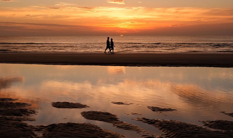
When it’s present in the atmosphere, Saharan dust can make the sky look hazy and bring vibrant sunrises and sunsets.
Is Saharan dust in Florida?
Yes. The first effects of the next plume of Saharan dust are expected to reach South Florida today, Wednesday, July 8, and continue through the end of the week.
It will likely bring hazy skies, suppress thunderstorm activity and create vibrant sunsets across South Florida throughout the rest of the week and into the weekend.
CBS12 News in West Palm Beach and Gulf Coast News in Fort Myers both forecast that the plume will likely peak over the weekend and thin out early next week.
“Hot, dry, and hazy conditions are expected today as a Saharan Air Layer spreads over the region. Heat advisories are in effect for most of South Florida,” the National Weather Service in Miami said in a post on X (formerly Twitter).
What is dirty rain?
When Saharan dust mixes with rain, it makes “dirty rain.”
Like Saharan dust, “dirty rain” isn’t toxic or dangerous, but can irritate you if you have pre-existing respiratory issues. “Dirty rain” is just dust mixed with water and can leave a muddy residue behind on any exposed surfaces it falls on.
What are noticeable impacts of Saharan dust?
Most people won’t see visible “dust” falling from the sky. Instead, the change will show up overhead.
The plume typically creates a milky or filtered look to the sky during the day while enhancing reds and oranges at sunrise and sunset. When concentrations are higher, visibility can be reduced, and fine particles may temporarily degrade air quality.
People with asthma, allergies or other respiratory conditions are most likely to notice irritation, while most healthy individuals experience little to no impact.
How does Saharan dust affect hurricane season?
While the dust can create hazy skies and colorful sunsets, it also carries very dry air that makes it harder for tropical systems to organize.
The Saharan Air Layer can suppress thunderstorm development and increase atmospheric stability across parts of the tropical Atlantic, temporarily reducing the odds that disturbances develop into tropical storms or hurricanes. The effect is usually temporary and does not prevent hurricanes from forming later in the season.
Lianna Norman and Brandi Addison are trending reporters for the USA TODAY NETWORK, covering weather, hurricane season, breaking news and more. You can get all of Florida’s best content directly in your inbox each weekday by signing up for the free newsletter, Florida TODAY, at https://floridatoday.com/newsletters.
This article originally appeared on Palm Beach Post: Saharan dust in Florida will bring dry heat, pretty sunsets, less rain
Reporting by Lianna Norman and Brandi D. Addison, USA TODAY NETWORK – Florida / Palm Beach Post
USA TODAY Network via Reuters Connect
By Lianna Norman and Brandi D. Addison, USA TODAY NETWORK – Florida | USA TODAY Network
