The National Hurricane Center is monitoring Invest 93L, a low pressure system off Florida that could impact Fort Myers and Lee County in the coming days.
Invest 93L is forecast to move west into the Gulf by late Tuesday, July 15. It currently has a 30% chance for tropical development over the next seven days and a 20% chance over the next 48 hours.

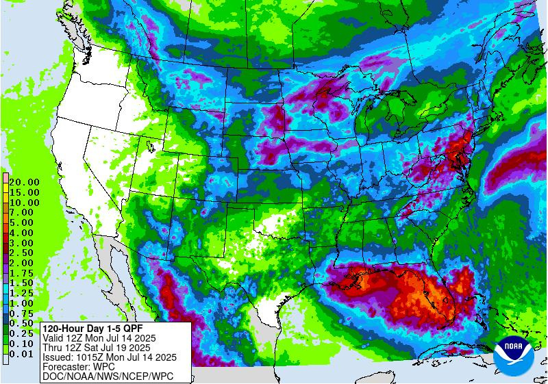
What does that mean for Lee County? Get ready for a wet week; make that a very wet week, with a potential for localized flooding, rough surf and dangerous rip currents.
➤ Track all active storms
➤ Weather alerts via text: Sign up to get updates about current storms and weather events by location
The next named storm of the 2025 Atlantic hurricane season will be Dexter.
Here’s the latest advisory from the National Hurricane Center as of 2 p.m., July 14:
Invest 93L expected to move across Florida
At 2 p.m. July 14, the National Hurricane Center said an area of low pressure located offshore of the east coast of Florida is producing disorganized showers and thunderstorms.
This disturbance is forecast to move westward across Florida during the next day or so, and into the northeastern Gulf by late Tuesday.
Environmental conditions appear favorable and some gradual development of this system is possible while it moves westward to west-northwestward across the northeastern and north-central portions of the Gulf during the middle to latter part of this week.Regardless of development, heavy rainfall could produce localized flash flooding over portions of Florida and the north-central Gulf coast through the middle to latter portion of this week
What do the colored, hatched areas on the NOAA map mean?
The hatched areas on the National Hurricane Center’s tropical outlook map indicate “areas where a tropical cyclone — which could be a tropical depression, tropical storm or hurricane — could develop,” said National Hurricane Center Deputy Director Jamie Rhome.
The colors make it visibly clear how likely a system could develop, with yellow being low, orange medium, and red high.
The National Hurricane Center generally doesn’t issue tropical advisories until there is a named storm, but there is an exception.
“If a system is near land and there is potential for development, the National Hurricane Center won’t wait before it issues advisories, even if the system hasn’t become an actual storm. This gives residents time to prepare,” Rhome said.
Spaghetti models for Invest 93L
Live weather radar for Fort Myers, Cape Coral, Lee County, Florida
Fort Myers, Cape Coral, Lee County, Florida weather forecast for July 14, 2025
Fort Myers, Cape Coral, Lee County weather forecast from the National Weather Service as of July 14, 2025:
Weather watches and warnings issued for Fort Myers, Lee County, Florida
Hurricane names for 2025 season
Here are the names for the 2025 Atlantic hurricane season, along with how to pronounce them:
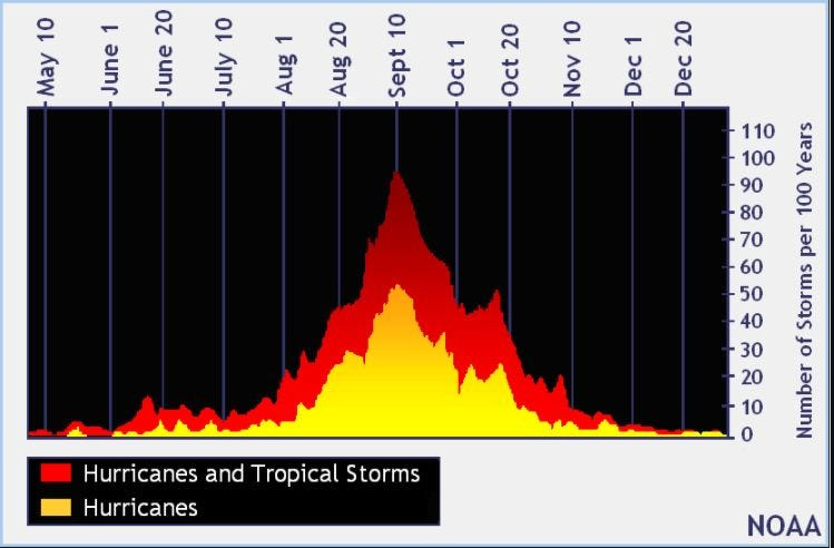
When is the Atlantic hurricane season?
The Atlantic hurricane season runs from June 1 through Nov. 30.
Ninety-seven percent of tropical cyclone activity occurs during this time period, NOAA said.
The Atlantic basin includes the northern Atlantic Ocean, Caribbean Sea and Gulf of America, as the Gulf of Mexico is now known in the U.S. per an order from President Trump. NOAA and the National Hurricane Center are now using Gulf of America on its maps and in its advisories.
When is the peak of hurricane season?
National Hurricane Center map: What forecasters are watching now
Systems currently being monitored by the National Hurricane Center include:
Why does NHC say ‘tropical cyclone’ on its maps instead of hurricane or tropical storm?
Tropical cyclone is the generic term used by the National Weather Service, NOAA and the National Hurricane Center for any tropical system, even if it’s in the tropical Atlantic basin.
To be more precise, a tropical cyclone is a “rotating, organized system of clouds and thunderstorms that originates over tropical or subtropical waters and has closed, low-level circulation,” NOAA sadi.
Once maximum sustained winds reach 74 mph, what it is called is determined by where it originated:
Interactive map: Hurricanes, tropical storms that have passed near your city
Stay informed. Get weather alerts via text
What’s next?
We will update our tropical weather coverage daily.
Download your local site’s app to ensure you’re always connected to the news. And look for our special subscription offers here.
This article originally appeared on Fort Myers News-Press: NHC tracking Invest 93L disturbance off Florida. What can Fort Myers, Lee County expect?
Reporting by Kim Luciani and Cheryl McCloud, USA TODAY NETWORK – Florida / Fort Myers News-Press
USA TODAY Network via Reuters Connect