Unusually volatile fire weather staggered through the Panhandle down into the gut of subtropical Central Florida on Monday, April 20, with rare early morning eruptions in air sucked dry by a rain-barren cold front.
Red flag warnings stretched from Pensacola to Jacksonville and south past smoldering Gainesville, which suffered smoke-choked evacuations over the weekend.

Past the hills of Ocala through Disneyfied Orlando and into Lee County, fire weather watches were raised into Tuesday evening with parched relative humidities and winds gusting to 25 mph.
Alex Booth, a meteorologist with the National Weather Service office in Jacksonville and its fire weather program leader, said he was watching hot spots on satellite imagery Monday morning when typically higher daybreak humidity levels would douse embers.
“That’s a kind of prelude to what we will likely see this afternoon,” Booth said. Because we have higher winds and a very dry air mass, the burn window is opening sooner.”
Where have burn bans been issued in Florida?
Burn bans had been issued in 32 Florida counties as of April 17 and federal forecasters with the Climate Prediction Center don’t see Florida’s drought improving until deep into the rainy season, which begins about mid-May.
Even then, they expect some drought to cling to areas of the Panhandle and southwest coast of the state where a lack of tropical systems during the 2025 hurricane season combined with a winter La Niña has left extreme to exceptional drought — the two highest levels on a four-tier scale.
According to the Southeast Regional Climate Prediction Center, Tallahassee is down 9.6 inches of rain for the year with Pensacola at a deficit of 10.2 inches of rain. Other cities are similarly thirsty including Jacksonville (-5.1), Gainesville (-8.52), Orlando (-5.36), Tampa (-2.92) and Fort Myers (-3).
A cool front that pushed through North Florida on Sunday and is meandering south brought little to no rain with it in the upper reaches of the state. In its wake, it left humidity levels as low as 15 to 20%.
“There’s just very dry fuel and very dry relative humidities and also breezy conditions,” said Molly Merrifield, a meteorologist in the NWS Tallahassee office. “That’s the perfect recipe for fire starting and getting out of control fast.”
Where are the active fires in Florida?
Over the weekend, two brush fires erupted in Gainesville, threatening structures and forcing evacuations. By late Sunday, the City of Gainesville posted on its Facebook page that all evacuation notices had been lifted but “residents are encouraged to remain alert and aware of changing conditions as operations continue.”
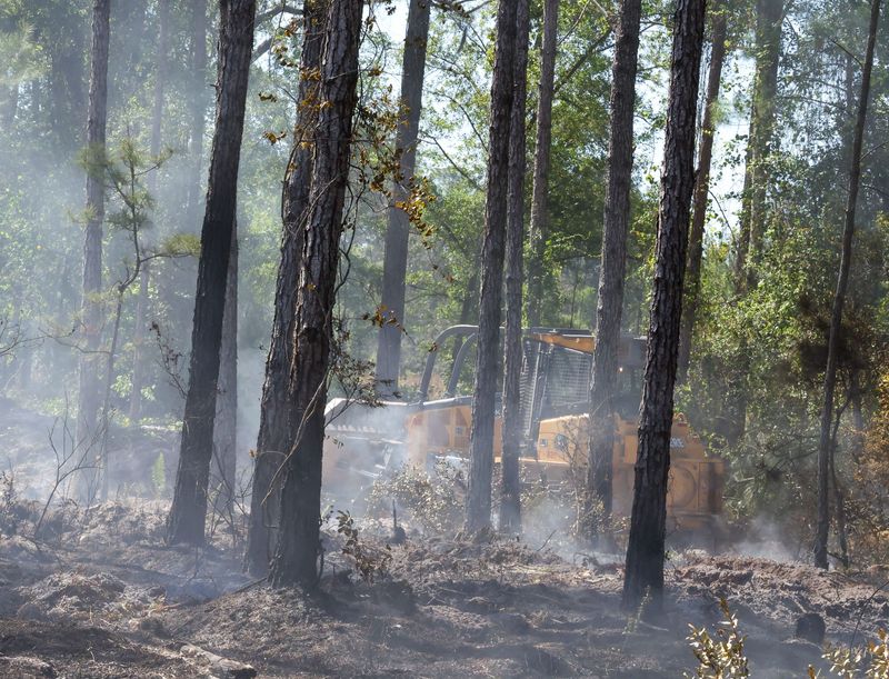
Statewide, 11,940 acres were on fire from 103 wildfires were reported active or contained as of Monday morning.
Nearly 100,000 acres have been blackened by wildfires this year in Florida, not including blazes on federal properties such as the February fire in Big Cypress National Park that swelled to about 25,000 acres.
Florida climatologist David Zierden said the drought gripping Florida is the worst in 24 years, but recent rains along the southeast coast have lessened desperation. The South Florida water Management District lifted water shortage warnings earlier this month in Miami-Dade and Monroe after rains allowed the Biscayne Aquifer to rebound.
On Friday, it rescinded the warning for Glades County and portions of Highlands County citing 4.27 inches of rain in the Indian Prairie Basin.
Booth said people should avoid throwing cigarettes out of car windows and make sure nothing is dragging from their vehicles that could produce sparks that alight dried roadside grasses.
“With the wind, fire can get out of control and become erratic very quickly,” he said. “There may be some rain this weekend that will give firefighters a chance to catch their breath but by no means will it be a meaningful rainfall event.”
Will early-week rain help with Florida’s dry conditions?
In South Florida, the cold front was just reaching the area early Monday with dousing showers following Friday rains that left nearly a half-inch of rain in West Palm Beach.
Meteorologists at the NWS office in Miami warned of the potential for 2 to 4 inches of rain leading to localized and urban flooding with wind gusts up to 35 mph.
West Palm Beach, as measured at Palm Beach International Airport, had gotten 6.9 inches of rain for the month of April through Monday. That’s nearly 5 inches above normal for the month and a boon that other areas such as Fort Lauderdale and Miami didn’t receive. Fort Lauderdale is up just .22 inches for April, with Miami seeing .55 inches more than normal.
The cold front should push as far south as Cuba by Wednesday. Leaving drier air and breezy winds in its wake.
After highs in the upper 80s on Sunday, temperatures high temperatures will dip ito the upper 70s and low 80s on Tuesday. Overnight lows may dip into the upper 50s away from coasts.
Kimberly Miller is a journalist for the USA TODAY NETWORK FLORIDA. She covers weather, the environment and critters as the Embracing Florida reporter. If you have news tips, please send them to kmiller@pbpost.com. You can get all of Florida’s best content directly in your inbox each weekday by signing up for the free newsletter, Florida TODAY, at palmbeachpost.com/newsletters.
This article originally appeared on Pensacola News Journal: Florida is on fire as burn bans and windy conditions sweep the state
Reporting by Kimberly Miller, Pensacola News Journal / Pensacola News Journal
USA TODAY Network via Reuters Connect