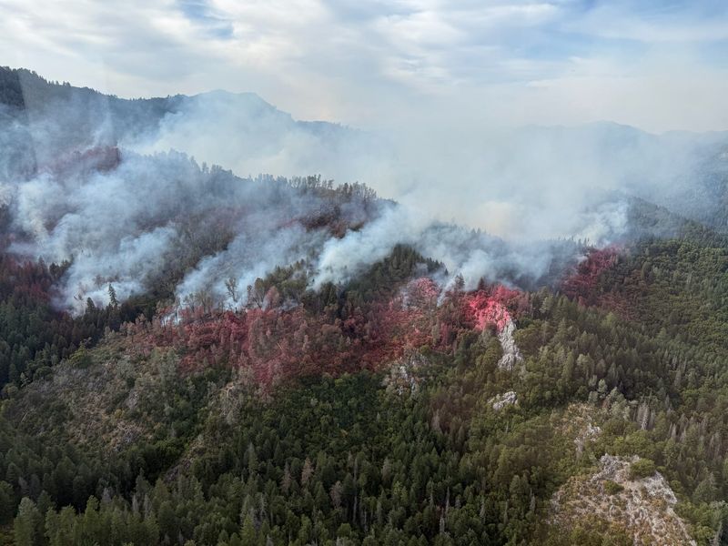
The Green Fire north of Lake Shasta remains at zero containment on Thursday afternoon. It burned 5,037 acres in the Shasta-Trinity National Forest, according to the U.S. Forest Service — up from 4,396 acres Thursday morning.
The fire remains east of Interstate 5 and 8 miles west of Montgomery Creek in Shasta County, the forest service reported in its Thursday.

The agency announced it closed the Hirz Recreation Complex to allow firefighters safe access to the fire. Guest services are working to help people re-book their reservations at the popular summer campgrounds, located north of Lake Shasta Caverns on the McCloud River arm of Lake Shasta. That closure is not included in Wednesday’s 6.5-month closure of trails and campsites in the area around the Green Fire.
Firefighters built containment on the Horse and Helena fires this week in anticipation of hot weather further drying out vegetation and air, conditions that allow fire to spread fast. Temperatures warm to 107 by Friday afternoon, according to the National Weather Service.
People should avoid fire areas and watch for emergency vehicles, Shasta-Trinity National Forest staff cautioned. They should also avoid breathing wildfire smoke, public health cautioned.
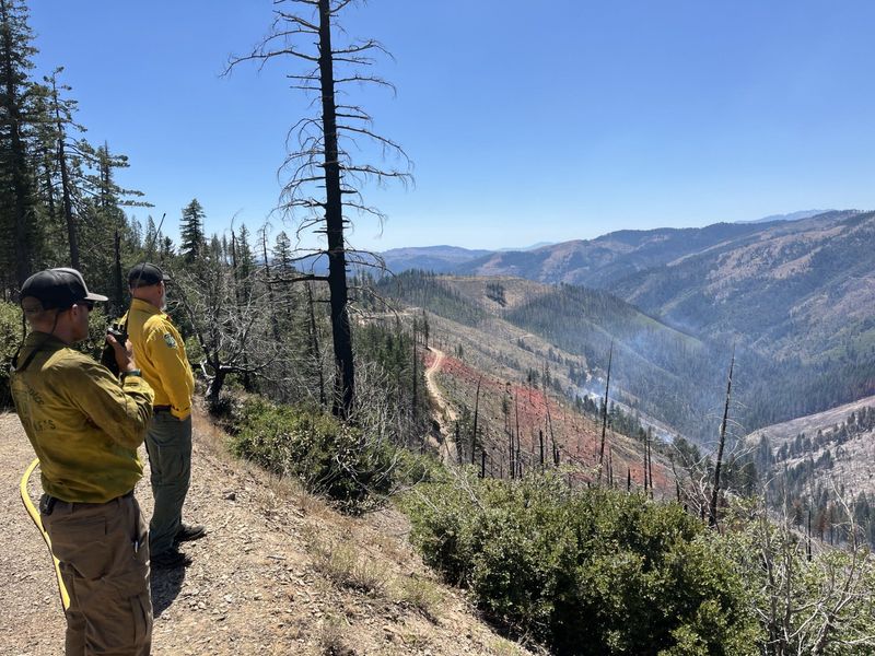
Green Fire grows west of Round Mountain
The Green Fire is burning northeast of Gray Rocks and west of Fenders Ferry Road, according to firefighters.
It’s growing mostly on its north border east of the Chirpchatter Campground, said Operations Section Chief Gino DeGraffenreid this week. Crews are working to keep the fire north of the Pit River, east of Didallas Creek and west of the 27 Road between Fender’s Ferry Bridge and Goose Gap, the forest service reported.
Note to readers: If you appreciate the work we do here at the Redding Record Searchlight, please consider subscribing yourself or giving the gift of a subscription to someone you know.
The blaze prompted an evacuation warning from the Shasta County Sheriff’s Office and campgrounds and trail closures near the fire, northeast of Lake Shasta. People in Zone LKH-1448 — between Montgomery Creek and O’Brian/Interstate 5 — should prepare to evacuate if the county instructs them to do so, the sheriff’s office said. That zone is north of Bully Hill; south of Satin Peak and Bagley Mountain; east of Nosoni, Salt Creek and Minnesota Mountains; and west of Kettle Mountain.
The fire started on July 1 north of the Pit River arm of Lake Shasta, and south of the Chirpchatter Campground, according to the forest service. That area is about 8 miles west of Round Mountain, according to Cal Fire maps.
Horse Fire west of Lakehead
The 390-acre Horse Fire is now fully contained, according to the forest service. It’s burning west of Lakehead and Interstate 5 in Shasta County.
Crews will continue to monitor the fire this week, the forest service reported.
The Horse Fire started on Wednesday, July 2, near Schell Mountain in an area south of the Clear Creek Campground. The area is about 7 miles west of Sugarloaf, according to Cal Fire maps.
Helena Fire in Trinity County
Downgraded to 110 acres on Thursday, the Helena Fire is 90% contained, the forest service reported.
Started on July 2, the Helena Fire is burning west of East Fork Road, north of Helena in Trinity County.
(This story was updated with new information.)
Jessica Skropanic is a features reporter for the Record Searchlight/USA Today Network. She covers science, arts, social issues and news stories. Follow her on Twitter @RS_JSkropanic and on Facebook. Join Jessica in the Get Out! Nor Cal recreation Facebook group. To support and sustain this work, please subscribe today. Thank you.
This article originally appeared on Redding Record Searchlight: Green Fire updates: Blaze grows to more than 5,000 acres. More Lake Shasta campsites close
Reporting by Jessica Skropanic, Redding Record Searchlight / Redding Record Searchlight
USA TODAY Network via Reuters Connect