Pictured Rocks National Lakeshore known for its sandstone cliffs and quiet, sandy beaches, but the Lake Superior park offers a variety of activities for those planning to visit this summer.
The national park is located along the southern shore of Lake Superior in Michigan’s Upper Peninsula, between Munising and Grand Marais.

“The lakeshore includes some 15 miles of cliffs along its 42-mile length. Within the park, nearly 100 miles of trail lead to remote trout streams, hidden bogs, wild Lake Superior beaches, and a system of 22 backcountry campgrounds,” the website says.
In addition to the summer activities, the park is open to visit year-round with opportunities for fall color viewing, winter ice climbing, ice fishing, cross-country skiing and snowshoeing, although most roads in the park close to vehicles during the winter.
In 1966, Congress designated the area as the nation’s first national lakeshore, but the park’s features are more than 10,000 years old.
The indigenous Anishinaabe people were the first to call the area home, the lakeshore website says. In the 1700s and 1800s, Europeans brought trapping, logging, and shipping to the area.
What to know about Pictured Rocks.
Why is the park called Pictured Rocks?
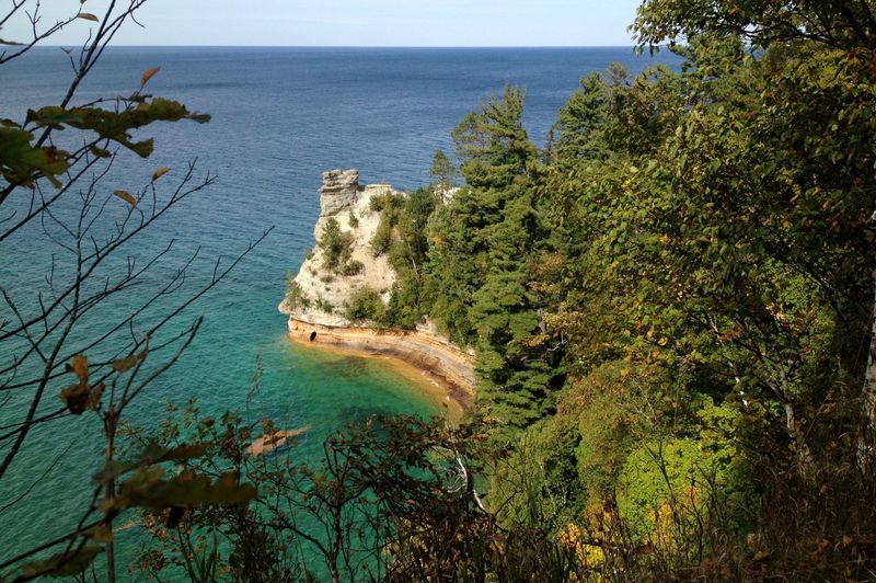
The namesake of the park is the multicolored sandstone cliffs that stretch for 15 miles along Lake Superior’s south shore. The cliffs are streaked with various minerals that leave different colors behind.
The cliffs are best viewed from a boat or kayak while on Lake Superior, although you can see portions while on land from various vantage points.
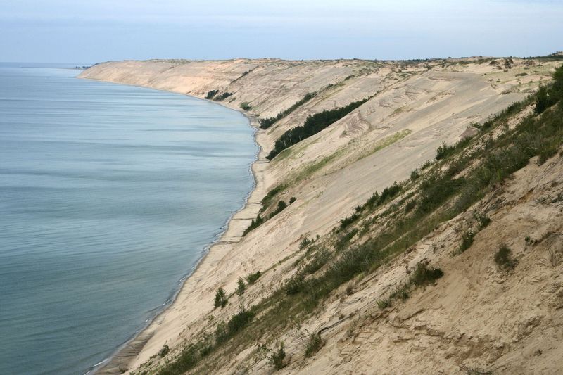
The Grand Sable Banks are a dramatic 4-square-mile, perched dune created 10,000 years ago by the last glaciation. Between these features is a landscape of inland lakes, spectacular waterfalls, and miles of sand-graced strand.
How many visitors does Pictured Rocks see?
Pictured Rocks National Lakeshore saw 910,939 total visitors in 2023, a 1.5% decrease from 2022 and a 30% decrease from 2021, where the park saw its highest visitation of 1.3 million visitors, according to the National Park Service.
Variety of animals and fish offer hunting and fishing opportunities
Pictured Rocks provides habitat for a variety of game animals, including white-tailed deer, grouse, woodcock, bear, and snowshoe hare, according to the park’s website.
Additionally, with a number of streams, inland lakes — and Lake Superior — the park offers opportunities for anglers with common cool-water game fish that include smallmouth bass, northern pike, walleye, yellow perch, whitefish, menominee and smelt, the website says.
All hunting and fishing within the Lakeshore follow the Michigan Department of Natural Resources regulations and special park regulations.
Boating, kayaking on Lake Superior and inland lakes attracts many
Lake Superior’s shoreline offers boaters a chance to experience miles of colorful sandstone cliffs and long stretches of sandy beaches.
Boats and motors of any size are permitted on Lake Superior, the park website says. Motors are limited to 50 hp on Grand Sable Lake.
Water skiing, personal watercraft, canoes and kayaks can also be used on lake waters.
Three operators offer kayaking along the park’s miles of sandstone cliffs. Park officials say only those with sea kayaks should attempt to paddle along the park’s cliffs.
If you’re not up to renting or bringing your own boat or kayak, there are boat tours available that will showcase the cliffs.
Backcountry and drive-in camping
All drive-in campsites require a reservation. There is a $25 fee per site. Campgrounds are open from May 15 through October 15. After October 15th, water systems and toilets are shut down.
Visitors to the park can participate in backcountry camping, meaning you can pitch a tent if you are not near a road or developed area.
Backcountry campers must stay in specific backcountry campgrounds and numbered site as noted on their permit. Most campgrounds are located at 2-5 mile intervals along the North Country Trail. Each campground has a specific capacity; individual campsites within each backcountry campground are identified by a numbered post.
The park has 13 designated backpacking camping areas along their North Country National Scenic Trail, which runs 42 miles through the length of the park.
Additionally, there are eight separate group sites. All of these sites are only accessible to campers by foot and some by boat.
Day hiking in the national lakeshore
Pictured Rocks is home to more than 100 miles of hiking trails that lead to waterfalls, cultural sites and cliff-top views of Lake Superior, the parks website says. Some trails of 1 mile or less include:
Longer trails in the park include:
Pictured rocks and amazing waterfalls
While at the park, visitors can trek to a number of waterfalls, some that are nearby and others that require long hikes or even a boat to see.
Major falls to see include:
Safety tips when visiting national parks, monuments and preserves
The National Park Service offers a list of recommendations and tips to keep you safe when visiting the parks. Those safety tips include:
Jalen Williams is a trending reporter at the Detroit Free Press. Contact him at jawilliams1@freepress.com.
This article originally appeared on Detroit Free Press: Pictured Rocks National Lakeshore renown for colorful cliffs, but there’s more to see, do
Reporting by Jalen Williams, Detroit Free Press / Detroit Free Press
USA TODAY Network via Reuters Connect