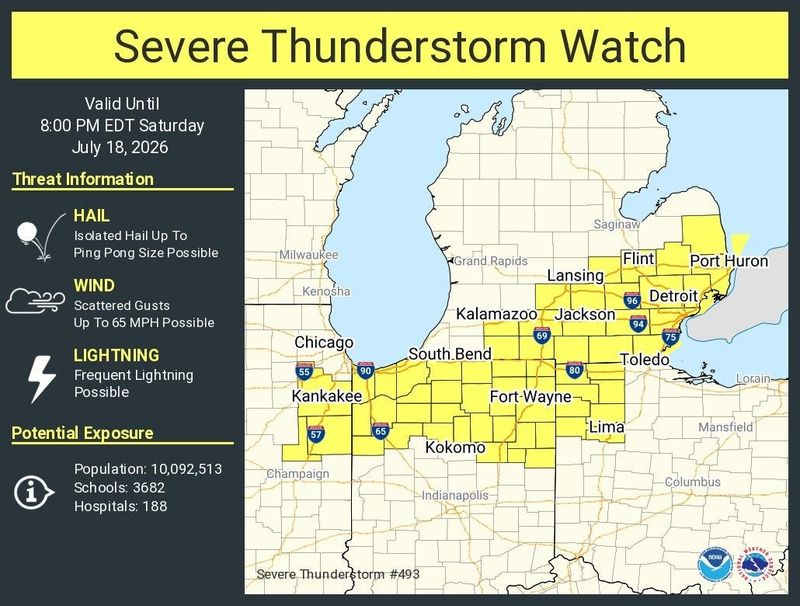
The National Weather Service has issued a severe thunderstorm watch for parts of southeast Michigan until 8 p.m. Saturday.
Winds of up to 65 mph are possible as well as frequent lightning and ping pong ball-sized hail, according to a social media post by the National Weather Service in Grand Rapids.

A cold front moving across southeast Michigan Saturday afternoon brings a chance for strong to severe thunderstorms, the weather service said. Severe weather is more likely east of Interstate 75, the agency said.
The watch was issued at 1:24 p.m. p.m. Saturday for 12 counties in southeast Michigan: Wayne, Macomb, Oakland, St. Clair, Monroe, Washtenaw, Genesee, Lapeer, Lenawee, Livingston, Sanilac and Shiawassee.
Residents can move to an interior room on the lowest floor of a building to protect themselves.
This article originally appeared on The Detroit News: Southeast Michigan under severe thunderstorm watch
Reporting by The Detroit News / The Detroit News
USA TODAY Network via Reuters Connect
By The Detroit News | USA TODAY Network