Michigan’s Upper Peninsula and portions of the northern Lower Peninsula are expected to see thunderstorms on Tuesday, July 7, and additional rounds of rain will develop on Wednesday, July 8, covering more of the Lower Peninsula.
Scattered rain will arrive Tuesday afternoon, July 7, across the U.P. and a sliver of the northern L.P. Storms expected to arrive on Wednesday, July 8, will be more widespread and linger into Thursday, July 9, according to the National Weather Service.

Highs on Tuesday, July 7, will range in the 70s to 80s across Michigan, then rise slightly on Wednesday, July 8, with cities in the Michigan’s central Lower Peninsula reaching 90 degrees with increasing humidity.
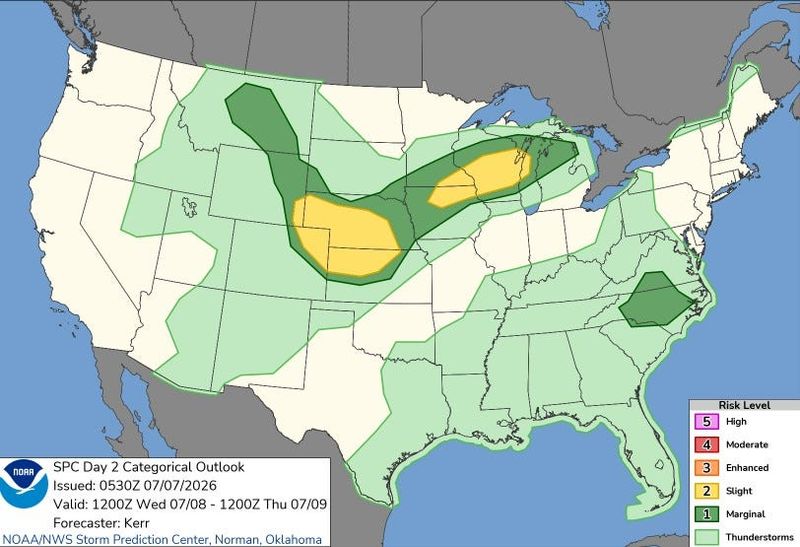
Wednesday’s rain showers are forecast to cover most of the state, with the northern Lower Peninsula facing the highest risk of severe conditions.
“Dry and warm weather today (July 7) gives way to increasing shower and thunderstorm chances Wednesday (July 8) into Thursday morning (July 9). Some of these storms could produce some brief heavy rains, with any repeated storms across the same area resulting in some locally heavy rain totals,” the Gaylord NWS said on X on July 7.
Need a raincoat Shop now
Officials urge Michigan residents to stay updated with forecasts as storms brew this week.
Here’s the Michigan radar and the current warnings, watches and advisories:
Michigan live Doppler radar
Current warnings, watches and advisories in Michigan
Contact Sarah Moore @ smoore@lsj.com
This article originally appeared on Detroit Free Press: Rain, severe weather threat returns along with humidity. What to expect
Reporting by Sarah Moore, USA TODAY NETWORK / Detroit Free Press
USA TODAY Network via Reuters Connect
By Sarah Moore, USA TODAY NETWORK | USA TODAY Network